- Elevation
- 10 m
- above sea level
- Airports
- GWT Westerland Sylt Airport12 km
- EBJ Esbjerg Airport58 km
About Sütterknoll
Sütterknoll is a mountain. Location: List, Kreis Nordfriesland. Elevation: 10 m. The best months to visit are June–August. The nearest airport is Westerland Sylt Airport (12 km). Nearby sights include Mannemorsumtal and Sandberg.
Climate of Sütterknoll
Best months for sightseeingBest months for sightseeing: June–August.
This month · November
A cold month
Day 8° · Night 4° · Rain 94 mm
- Hottest month
- August (day 20°)
- Coldest month
- February (night -1°)
- Wettest month
- October (98 mm)
- Driest month
- April (39 mm)
Bars: average monthly low and high temperature. Below: precipitation. Monthly averages for 1970–2000 at about 18 km resolution, adjusted for elevation. Highlighted months are mild and relatively dry. Source: WorldClim 2.1 (CC BY 4.0).
Show values as a table
| Month | Jan | Feb | Mar | Apr | May | Jun | Jul | Aug | Sep | Oct | Nov | Dec |
|---|---|---|---|---|---|---|---|---|---|---|---|---|
| Average high (°C) | 3° | 3° | 5° | 9° | 15° | 17° | 19° | 20° | 16° | 12° | 8° | 5° |
| Average low (°C) | -1° | -1° | 1° | 4° | 8° | 11° | 13° | 14° | 11° | 8° | 4° | 1° |
| Precipitation (mm) | 63 | 41 | 52 | 39 | 41 | 57 | 61 | 72 | 86 | 98 | 94 | 75 |
How to get to Sütterknoll
The nearest airport is Westerland Sylt Airport (GWT), 12 km to the south as the crow flies. The nearest large city is Odense, 133 km to the east.
Airports
- Westerland Sylt Airport (GWT) Sylt 12 kmsouth
- Esbjerg Airport (EBJ) Esbjerg 58 kmnorth
- Sønderborg Airport (SGD) Sønderborg 88 kmeast
Nearby large cities
- Odense Population: 180.9K 133 kmeast
- Kiel Population: 252.7K 135 kmsoutheast
- Bremerhaven Population: 118.6K 163 kmsouth
- Aarhus Population: 285.3K 170 kmnortheast
- Lübeck Population: 212.2K 195 kmsoutheast
Straight-line distances; road distances are longer. Airport data: OurAirports.
Nearest towns and villages
-
List auf Sylt Village, List1.3 km NE
-
Mellhörn Village, List0.7 km S
-
Süderheidetal Village, List2.6 km SW
-
Westerheide Village, List3 km SW
-
Ellenbogen Village, List4.1 km NE
-
Klappholttal Village, Kampen (Sylt)4.1 km SW
Nearby attractions & nature
Everything nearby-
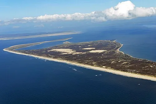 Mannemorsumtal Natural site, Schleswig-Holstein0.5 km NW
-
Sandberg Mountain, Schleswig-Holstein0.8 km N
-
Jensmettenberg Mountain, Schleswig-Holstein1.2 km N
-
Ellenbogental Natural site, List1.1 km NW
-
Blidseltal Natural site, List1.2 km SW
-
Mövenberg Mountain, Schleswig-Holstein2.2 km N
-
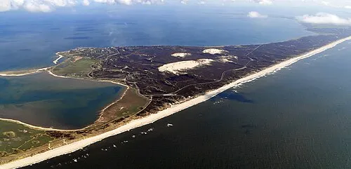 Norderstrandtal Natural site, Schleswig-Holstein2.5 km NW
-
Naturschutzgebiet Nord-Sylt Natural site, List1.9 km W
Sources & licences
Data last updated: