- Elevation
- 1 m
- above sea level
- Local time
- UTC+01:00
- Europe/Berlin · UTC+01:00
- Airports
- GWT Westerland Sylt Airport66 km
- FCN Sea-Airport Cuxhaven/Nordholz / Nordholz Naval Airbase71 km
About Wasserkoog
Wasserkoog is a village. Location: Tetenbüll, Kreis Nordfriesland. Elevation: 1 m. The best months to visit are June–August. The nearest airport is Westerland Sylt Airport (66 km). Nearby sights include Altneukooger Sielzug and Speicherbecken.
Climate of Wasserkoog
Best months for sightseeingBest months for sightseeing: June–August.
This month · November
A cold month
Day 8° · Night 3° · Rain 95 mm
- Hottest month
- August (day 21°)
- Coldest month
- February (night -1°)
- Wettest month
- November (95 mm)
- Driest month
- February (43 mm)
Bars: average monthly low and high temperature. Below: precipitation. Monthly averages for 1970–2000 at about 18 km resolution, adjusted for elevation. Highlighted months are mild and relatively dry. Source: WorldClim 2.1 (CC BY 4.0).
Show values as a table
| Month | Jan | Feb | Mar | Apr | May | Jun | Jul | Aug | Sep | Oct | Nov | Dec |
|---|---|---|---|---|---|---|---|---|---|---|---|---|
| Average high (°C) | 4° | 4° | 6° | 10° | 16° | 18° | 20° | 21° | 17° | 13° | 8° | 5° |
| Average low (°C) | -1° | -1° | 1° | 3° | 7° | 11° | 13° | 13° | 10° | 7° | 3° | 1° |
| Precipitation (mm) | 66 | 43 | 50 | 43 | 48 | 67 | 75 | 85 | 86 | 94 | 95 | 76 |
How to get to Wasserkoog
The nearest airport is Westerland Sylt Airport (GWT), 66 km to the northwest as the crow flies. The nearest large city is Kiel, 85 km to the east.
Airports
- Westerland Sylt Airport (GWT) Sylt 66 kmnorthwest
- Sea-Airport Cuxhaven/Nordholz / Nordholz Naval Airbase (FCN) Wurster Nordseeküste 71 kmsouth
- Sønderborg Airport (SGD) Sønderborg 89 kmnortheast
Nearby large cities
- Kiel Population: 252.7K 85 kmeast
- Bremerhaven Population: 118.6K 95 kmsouth
- Lübeck Population: 212.2K 135 kmsoutheast
- Oldenburg Population: 159.2K 145 kmsouth
- Bremen Population: 546.5K 147 kmsouth
Straight-line distances; road distances are longer. Airport data: OurAirports.
Day trips from Wasserkoog
Within 100 km: 166 historic and cultural sites, 875 natural sites, 675 lakes, rivers and coasts.
0–25 km62 places
- Nordstrand Natural site 12 kmN
- Rochelsand Beach 17 kmSW
- Südfall Island 10 kmNW
- Süderoogsand Island 23 kmW
25–60 km525 places
- Kniepsand Beach 42 kmNW
- Budersand Beach 54 kmNW
- Badestrand Beach 38 kmNW
- Trischen Island 39 kmS
60–100 km1,129 places
- Als Island 96 kmNE
- Oxbek River 62 kmNE
- Spock River 84 kmE
- Aubek River 70 kmSE
Straight-line distances.
Nearby attractions & nature
Everything nearby-
Altneukooger Sielzug River, Schleswig-Holstein0.4 km NE
-
Speicherbecken Lake, Tetenbüll1 km N
-
Wolfenbüll Mountain, Tetenbüll4.3 km S
-
Eiderstedt Natural site, Schleswig-Holstein5.8 km S
-
Sendemast Garding Landmark, Garding7.3 km S
-
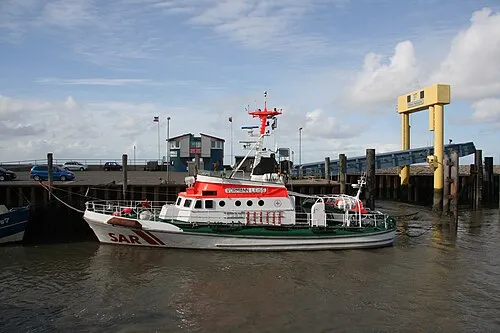 Nordstrand Natural site, Schleswig-Holstein12 km N
Sources & licences
Data last updated: