Bungsberg
Located in Schönwalde am Bungsberg, Kreis Ostholstein Coordinates: 54°12′39″ N 10°43′26″ E
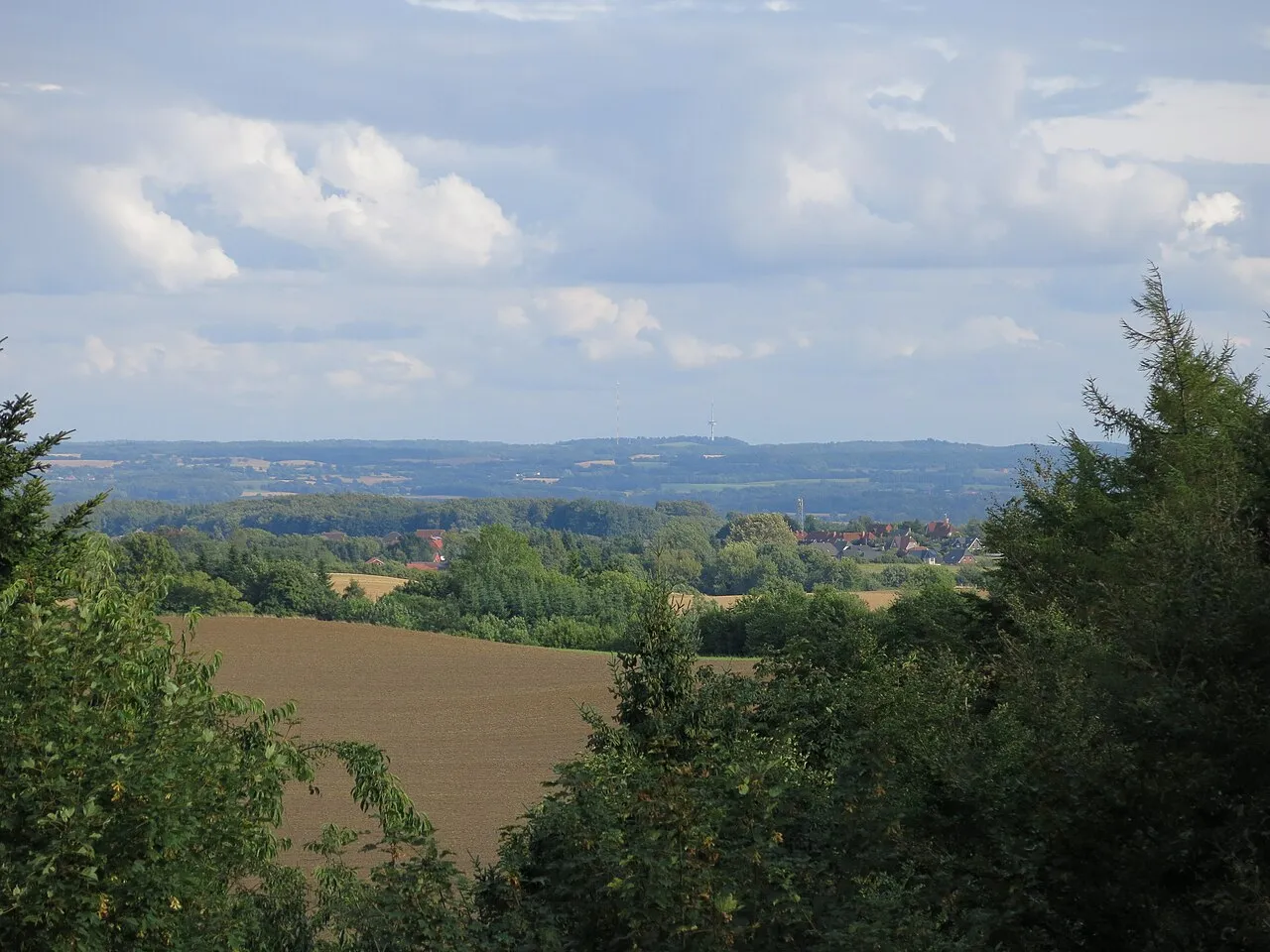
- Elevation
- 168 m
- above sea level
- Local time
- UTC+01:00
- Europe/Berlin · UTC+01:00
- Airports
- LBC Lübeck Blankensee Airport45 km
- HAM Hamburg Helmut Schmidt Airport81 km
About Bungsberg
Bungsberg is a mountain. Location: Schönwalde am Bungsberg, Kreis Ostholstein. Elevation: 168 m.
The Bungsberg () is the highest point in the north German state of Schleswig-Holstein (elevation: 168 metres (551 ft)). It lies in the region known as Holstein Switzerland in the municipality of Schönwalde am Bungsberg between Scheelholz and Mönchsneversdorf. The Bungsberg telecommunications tower is located on the Bungsberg. One of the longest rivers in Schleswig-Holstein, the Schwentine, rises on the Bungsberg.
Source: Wikipedia · CC BY-SA 4.0
Photos of Bungsberg
-

Freddy Fehmarn · CC BY 2.0 -

Ein Dahmer · CC BY-SA 4.0 -

The original uploader was Gurkentee at German Wikipedia · CC BY-SA 2.0 de


Climate of Bungsberg
Best months for sightseeingBest months for sightseeing: June–August.
This month · November
A cold month
Day 6° · Night 2° · Rain 67 mm
- Hottest month
- July (day 20°)
- Coldest month
- January (night -2°)
- Wettest month
- July (71 mm)
- Driest month
- February (42 mm)
Bars: average monthly low and high temperature. Below: precipitation. Monthly averages for 1970–2000 at about 18 km resolution, adjusted for elevation. Highlighted months are mild and relatively dry. Source: WorldClim 2.1 (CC BY 4.0).
Show values as a table
| Month | Jan | Feb | Mar | Apr | May | Jun | Jul | Aug | Sep | Oct | Nov | Dec |
|---|---|---|---|---|---|---|---|---|---|---|---|---|
| Average high (°C) | 2° | 3° | 6° | 10° | 15° | 18° | 20° | 20° | 16° | 12° | 6° | 4° |
| Average low (°C) | -2° | -2° | 0° | 2° | 6° | 10° | 12° | 12° | 9° | 5° | 2° | 0° |
| Precipitation (mm) | 61 | 42 | 55 | 46 | 49 | 64 | 71 | 63 | 64 | 62 | 67 | 69 |
How to get to Bungsberg
The nearest airport is Lübeck Blankensee Airport (LBC), 45 km to the south as the crow flies. For international flights: Hamburg Helmut Schmidt Airport (HAM) (81 km). The nearest large city is Lübeck, 38 km to the south.
Airports
- Lübeck Blankensee Airport (LBC) Lübeck 45 kmsouth
- Hamburg Helmut Schmidt Airport (HAM) Hamburg 81 kmsouthwest
- Sønderborg Airport (SGD) Sønderborg 103 kmnorthwest
Nearby large cities
- Lübeck Population: 212.2K 38 kmsouth
- Kiel Population: 252.7K 40 kmwest
- Rostock Population: 198.3K 94 kmeast
- Odense Population: 180.9K 134 kmnorth
- Bremerhaven Population: 118.6K 159 kmsouthwest
Straight-line distances; road distances are longer. Airport data: OurAirports.
Day trips from Bungsberg
Within 100 km: 288 historic and cultural sites, 2,143 natural sites, 1,196 lakes, rivers and coasts.
0–25 km438 places
- Hundestrand Beach 19 kmS
- Sehlendorfer Strand Beach 11 kmN
- Meerwasser-Wellenbad Beach 20 kmS
- Hankenburg Island 21 kmW
25–60 km964 places
- Fehmarn Island 40 kmNE
- Poel Island Island 52 kmSE
- Spock River 43 kmW
- Köppernitz River 59 kmSE
60–100 km2,225 places
- Tåsinge Island 88 kmN
- Aeroe Island 79 kmN
- Ziegelwerder Island 83 kmSE
- Viertbusch Natural site 82 kmS
Straight-line distances.
Nearest towns and villages
-
Schönwalde am Bungsberg Village, Schönwalde am Bungsberg3.1 km SE
-
Gläserlandskaten Village, Schönwalde am Bungsberg1 km E
-
Bungsberghof Village, Schönwalde am Bungsberg1.2 km S
-
Mönchneversdorf Village, Schönwalde am Bungsberg1.3 km NE
-
Kirchnüchel Village, Kreis Plön2.9 km SW
-
Kirchnüchel Village, Kirchnüchel3 km W
Nearby attractions & nature
Everything nearby-
Hassberg Natural site, Kirchnüchel0.8 km W
-
Schellholz Natural site, Schönwalde am Bungsberg1.2 km SE
-
Fledermausquartier Natural site, Schönwalde am Bungsberg1.4 km NE
-
Thimmhofen Natural site, Schönwalde am Bungsberg1.4 km E
-
Kroßberg Mountain, Kasseedorf1.6 km SW
-
Elisabethturm Landmark, Schönwalde am Bungsberg0.2 km SE
-
Buchholz Natural site, Schönwalde am Bungsberg1.5 km S
-
Lake Mönchneversdorf Lake, Schönwalde am Bungsberg1.4 km NE
Sources & licences
Data last updated: · 2 independent sources