Kreis Schleswig-Flensburg
Located in Schleswig-Holstein, Germany Coordinates: 54°34′40″ N 9°28′09″ E
- Population
- 205,472
- 205.5K
- Elevation
- 24 m
- above sea level
- Local time
- UTC+01:00
- Europe/Berlin · UTC+01:00
- Places inside
- 123
- listed under Kreis Schleswig-Flensburg
- Airports
- SGD Sønderborg Airport48 km
- GWT Westerland Sylt Airport82 km
About Kreis Schleswig-Flensburg
Kreis Schleswig-Flensburg is a municipality. Location: Schleswig-Holstein, Germany. Population: 205,472. Elevation: 24 m. The best months to visit are June–August. The nearest airport is Sønderborg Airport (48 km). Nearby sights include Steinholz and Gammellunder See.
Climate of Kreis Schleswig-Flensburg
Best months for sightseeingBest months for sightseeing: June–August.
This month · November
A cold month
Day 7° · Night 2° · Rain 92 mm
- Hottest month
- August (day 21°)
- Coldest month
- January (night -1°)
- Wettest month
- November (92 mm)
- Driest month
- February (47 mm)
Bars: average monthly low and high temperature. Below: precipitation. Monthly averages for 1970–2000 at about 18 km resolution, adjusted for elevation. Highlighted months are mild and relatively dry. Source: WorldClim 2.1 (CC BY 4.0).
Show values as a table
| Month | Jan | Feb | Mar | Apr | May | Jun | Jul | Aug | Sep | Oct | Nov | Dec |
|---|---|---|---|---|---|---|---|---|---|---|---|---|
| Average high (°C) | 3° | 3° | 6° | 11° | 16° | 19° | 21° | 21° | 17° | 12° | 7° | 4° |
| Average low (°C) | -1° | -1° | 0° | 3° | 7° | 10° | 12° | 12° | 9° | 6° | 2° | 0° |
| Precipitation (mm) | 72 | 47 | 59 | 48 | 52 | 70 | 81 | 76 | 86 | 88 | 92 | 80 |
How to get to Kreis Schleswig-Flensburg
The nearest airport is Sønderborg Airport (SGD), 48 km to the northeast as the crow flies. The nearest large city is Kiel, 52 km to the southeast.
Airports
- Sønderborg Airport (SGD) Sønderborg 48 kmnortheast
- Westerland Sylt Airport (GWT) Sylt 82 kmnorthwest
- Sea-Airport Cuxhaven/Nordholz / Nordholz Naval Airbase (FCN) Wurster Nordseeküste 105 kmsouthwest
Nearby large cities
- Kiel Population: 252.7K 52 kmsoutheast
- Odense Population: 180.9K 108 kmnortheast
- Lübeck Population: 212.2K 112 kmsoutheast
- Bremerhaven Population: 118.6K 128 kmsouthwest
- Bremen Population: 546.5K 173 kmsouth
Straight-line distances; road distances are longer. Airport data: OurAirports.
Day trips from Kreis Schleswig-Flensburg
Within 100 km: 167 historic and cultural sites, 1,129 natural sites, 807 lakes, rivers and coasts.
0–25 km223 places
- Oxbek River 15 kmE
- Kieholm Island 18 kmE
- Hestholm Island 14 kmSE
- Winderatter See Lake 21 kmNE
25–60 km677 places
- Als Island 54 kmNE
- Nordstrand Natural site 39 kmW
- Spock River 59 kmSE
- Solitüde Beach 27 kmN
60–100 km1,203 places
- Tåsinge Island 87 kmNE
- Aeroe Island 65 kmNE
- Aubek River 61 kmS
- Kniepsand Beach 74 kmW
Straight-line distances.
Kreis Schleswig-Flensburg and similar cities
Side by side with cities of similar size in the same country: population, elevation and climate.
| Measure | Kreis Schleswig-Flensburg | Hagen | Lübeck | Rostock |
|---|---|---|---|---|
| Population | 205.5K | 199K | 212.2K | 198.3K |
| Elevation | 24 m | 111 m | 16 m | 18 m |
| Summer day (hottest month) | 21° | 23° | 22° | 22° |
| Winter night (coldest month) | -1° | -1° | -2° | -2° |
| Annual rainfall | 851 mm | 980 mm | 674 mm | 596 mm |
| Best months | Jun–Aug | Jun–Aug | Jun–Aug | Jun–Aug |
| Distance | — | 382 km | 112 km | 182 km |
Climate values are 1970–2000 monthly averages; straight-line distance.
Places in Kreis Schleswig-Flensburg
123 places- 61 Stolk 867
- 62 Steinberg 835
- 63 Selk 809
- 64 Steinfeld 809
- 65 Hüsby 800
- 66 Esgrus 789
- 67 Ellingstedt 763
- 68 Westerholz 741
- 69 Börm 740
- 70 Meyn 736
- 71 Bergenhusen 723
- 72 Borgwedel 710
- 73 Ulsnis 702
- 74 Böel 698
- 75 Meggerdorf 686
- 76 Stoltebüll 680
- 77 Norderbrarup 679
- 78 Struxdorf 677
- 79 Brodersby-Goltoft 669
- 80 Rabenkirchen-Faulück 635
- 81 Hörup 629
- 82 Rabel 612
- 83 Maasholm 604
- 84 Dörpstedt 584
- 85 Ringsberg 547
- 86 Niesgrau 539
- 87 Klein Bennebek 524
- 88 Schnarup-Thumby 523
- 89 Wohlde 513
- 90 Ausacker 508
- 91 Klappholz 504
- 92 Nordhackstedt 479
- 93 Süderfahrenstedt 476
- 94 Twedt 475
- 95 Sollerup 473
- 96 Weesby 437
- 97 Janneby 409
- 98 Uelsby 403
- 99 Geltorf 356
- 100 Süderhackstedt 346
- 101 Klein Rheide 341
- 102 Scheggerott 324
- 103 Alt Bennebek 323
- 104 Osterby 303
- 105 Tielen 298
- 106 Jardelund 296
- 107 Oersberg 293
- 108 Rabenholz 287
- 109 Loit 268
- 110 Kronsgaard 257
- 111 Arnis 251
- 112 Stangheck 249
- 113 Lottorf 243
- 114 Rügge 242
- 115 Wagersrott 221
- 116 Grödersby 219
- 117 Ahneby 201
- 118 Saustrup 181
- 119 Pommerby 158
- 120 Holt 148
Bar: population relative to the most populous place in this list.
Nearby attractions & nature
Everything nearby-
Steinholz Natural site, Schleswig-Holstein2.3 km W
-
Gammellunder See Lake, Schleswig-Holstein2.2 km SW
-
Idstedter See Lake, Schleswig-Holstein3.5 km E
-
Mühlenteich Lake, Schleswig-Holstein3.9 km W
-
Elmholz Natural site, Schleswig-Holstein4.4 km N
-
Arenholzer See Lake, Schleswig-Holstein4.3 km S
-
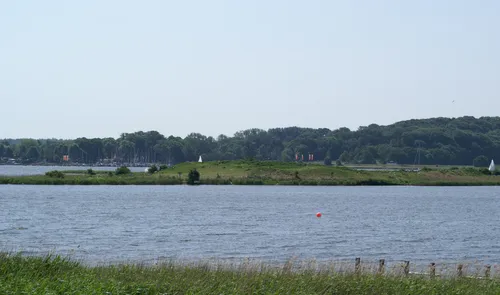 Mövenberg Island, Schleswig-Holstein9.8 km SE
-
Gehege Pöhl Natural site, Schleswig-Holstein7.2 km S
Sources & licences
Data last updated: