- Elevation
- 24 m
- above sea level
- Airports
- HAM Hamburg Helmut Schmidt Airport27 km
- LBC Lübeck Blankensee Airport44 km
About Lindrehmbach
Lindrehmbach is a river. Location: Struvenhütten, Kreis Segeberg. The best months to visit are June–August. The nearest airport is Hamburg Helmut Schmidt Airport (27 km). Nearby sights include Mühlenau and Bredenbek River.
Photos of Lindrehmbach
-
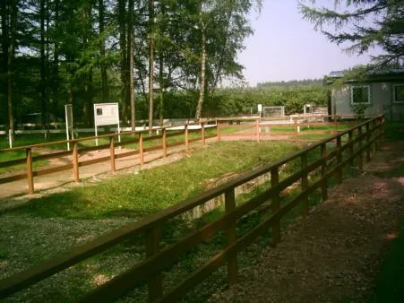
Kaltenkirchen Concentration Camp The original uploader was Wurly-hh at German Wikipedia · Public domain

Climate of Lindrehmbach
Best months for sightseeingBest months for sightseeing: June–August.
This month · November
A cold month
Day 7° · Night 2° · Rain 79 mm
- Hottest month
- July (day 22°)
- Coldest month
- January (night -2°)
- Wettest month
- December (85 mm)
- Driest month
- February (50 mm)
Bars: average monthly low and high temperature. Below: precipitation. Monthly averages for 1970–2000 at about 18 km resolution, adjusted for elevation. Highlighted months are mild and relatively dry. Source: WorldClim 2.1 (CC BY 4.0).
Show values as a table
| Month | Jan | Feb | Mar | Apr | May | Jun | Jul | Aug | Sep | Oct | Nov | Dec |
|---|---|---|---|---|---|---|---|---|---|---|---|---|
| Average high (°C) | 3° | 4° | 7° | 12° | 17° | 20° | 22° | 22° | 17° | 13° | 7° | 4° |
| Average low (°C) | -2° | -2° | 1° | 3° | 7° | 10° | 12° | 12° | 9° | 6° | 2° | 0° |
| Precipitation (mm) | 73 | 50 | 63 | 50 | 52 | 75 | 81 | 70 | 73 | 76 | 79 | 85 |
How to get to Lindrehmbach
The nearest airport is Hamburg Helmut Schmidt Airport (HAM), 27 km to the south as the crow flies. The nearest large city is Lübeck, 41 km to the east.
Airports
- Hamburg Helmut Schmidt Airport (HAM) Hamburg 27 kmsouth
- Lübeck Blankensee Airport (LBC) Lübeck 44 kmeast
- Sea-Airport Cuxhaven/Nordholz / Nordholz Naval Airbase (FCN) Wurster Nordseeküste 93 kmwest
Nearby large cities
- Lübeck Population: 212.2K 41 kmeast
- Kiel Population: 252.7K 51 kmnorth
- Bremerhaven Population: 118.6K 104 kmwest
- Bremen Population: 546.5K 121 kmsouthwest
- Rostock Population: 198.3K 139 kmeast
Straight-line distances; road distances are longer. Airport data: OurAirports.
Day trips from Lindrehmbach
Within 100 km: 361 historic and cultural sites, 2,602 natural sites, 1,294 lakes, rivers and coasts.
0–25 km301 places
- Neversdorfer See Lake 14 kmE
- Neuenteich Lake 16 kmSE
- Mühlenteich Lake 21 kmW
- Mözener See Lake 13 kmNE
25–60 km1,939 places
- Viertbusch Natural site 42 kmSE
- Spock River 35 kmN
- Aubek River 30 kmNW
- Hundestrand Beach 49 kmNE
60–100 km2,017 places
- Fehmarn Island 98 kmNE
- Poel Island Island 91 kmE
- Ziegelwerder Island 98 kmE
- Oxbek River 88 kmN
Straight-line distances.
Nearest towns and villages
-
Struvenhütten Village, Struvenhütten0.3 km W
-
Kattendorf Village, Kreis Segeberg3.4 km SW
-
 Hartenholm Village, Kreis Segeberg4 km N
-
Bredenbekshorst Village, Struvenhütten1.2 km E
-
Sievershütten Village, Kreis Segeberg3.1 km SE
-
Hartenholm Village, Hartenholm3.6 km N
Nearby attractions & nature
Everything nearby-
Mühlenau River, Schleswig-Holstein0.4 km W
-
Bredenbek River River, Schleswig-Holstein0.5 km SE
-
Rendsbek River, Schleswig-Holstein1 km E
-
Wohldbek River, Struvenhütten1.4 km SE
-
Deergraben Natural site, Struvenhütten1.8 km SW
-
Liethberg Mountain, Kattendorf2.4 km SW
-
Breetz Natural site, Schleswig-Holstein1.8 km W
-
Klint Mountain, Kattendorf2.2 km SW
Sources & licences
Data last updated: