Oberalsterniederung
Located in Wakendorf II, Kreis Segeberg Coordinates: 53°46′06″ N 10°05′05″ E
- Elevation
- 25 m
- above sea level
- Airports
- HAM Hamburg Helmut Schmidt Airport17 km
- LBC Lübeck Blankensee Airport42 km
About Oberalsterniederung
Oberalsterniederung is a natural site. Location: Wakendorf II, Kreis Segeberg. The best months to visit are June–August. The nearest airport is Hamburg Helmut Schmidt Airport (17 km). Nearby sights include Rönne and Bredenbek.
Photos of Oberalsterniederung
-
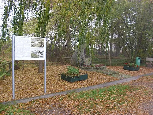
Early Camp Hamburg-Wittmoor Ajepbah · CC BY-SA 3.0

Climate of Oberalsterniederung
Best months for sightseeingBest months for sightseeing: June–August.
This month · November
A cold month
Day 8° · Night 2° · Rain 76 mm
- Hottest month
- August (day 22°)
- Coldest month
- January (night -2°)
- Wettest month
- December (83 mm)
- Driest month
- February (47 mm)
Bars: average monthly low and high temperature. Below: precipitation. Monthly averages for 1970–2000 at about 18 km resolution, adjusted for elevation. Highlighted months are mild and relatively dry. Source: WorldClim 2.1 (CC BY 4.0).
Show values as a table
| Month | Jan | Feb | Mar | Apr | May | Jun | Jul | Aug | Sep | Oct | Nov | Dec |
|---|---|---|---|---|---|---|---|---|---|---|---|---|
| Average high (°C) | 3° | 4° | 7° | 12° | 17° | 20° | 22° | 22° | 18° | 13° | 8° | 5° |
| Average low (°C) | -2° | -2° | 1° | 3° | 7° | 10° | 12° | 12° | 9° | 6° | 2° | 0° |
| Precipitation (mm) | 69 | 47 | 64 | 50 | 53 | 75 | 78 | 73 | 71 | 73 | 76 | 83 |
How to get to Oberalsterniederung
The nearest airport is Hamburg Helmut Schmidt Airport (HAM), 17 km to the southwest as the crow flies. The nearest large city is Lübeck, 41 km to the east.
Airports
- Hamburg Helmut Schmidt Airport (HAM) Hamburg 17 kmsouthwest
- Lübeck Blankensee Airport (LBC) Lübeck 42 kmeast
- Sea-Airport Cuxhaven/Nordholz / Nordholz Naval Airbase (FCN) Wurster Nordseeküste 94 kmwest
Nearby large cities
- Lübeck Population: 212.2K 41 kmeast
- Kiel Population: 252.7K 62 kmnorth
- Bremerhaven Population: 118.6K 103 kmwest
- Bremen Population: 546.5K 115 kmsouthwest
- Rostock Population: 198.3K 140 kmeast
Straight-line distances; road distances are longer. Airport data: OurAirports.
Day trips from Oberalsterniederung
Within 100 km: 375 historic and cultural sites, 2,743 natural sites, 1,325 lakes, rivers and coasts.
0–25 km339 places
- Gurlittinsel Island 24 kmS
- Neversdorfer See Lake 17 kmNE
- Neuenteich Lake 10 kmE
- Mühlenteich Lake 24 kmNW
25–60 km1,800 places
- Viertbusch Natural site 32 kmSE
- Spock River 46 kmN
- Aubek River 39 kmNW
- Hundestrand Beach 53 kmNE
60–100 km2,304 places
- Poel Island Island 92 kmE
- Ziegelwerder Island 94 kmE
- Oxbek River 99 kmN
- Köppernitz River 91 kmE
Straight-line distances.
Nearest towns and villages
-
Tangstedt Village, Kreis Stormarn2.6 km SW
-
 Kayhude Village, Kreis Segeberg3.2 km E
-
Kayhude Village, Kayhude3.4 km SE
-
Tangstedt Town, Tangstedt3.9 km S
-
Wakendorf Zwei Village, Wakendorf II1.9 km N
-
Wakendorfer Moor Village, Wakendorf II2 km E
Nearby attractions & nature
Everything nearby-
Rönne River, Schleswig-Holstein2.2 km E
-
Bredenbek River, Schleswig-Holstein2.2 km NE
-
Bekmoor Natural site, Tangstedt3.1 km S
-
Amhorst Natural site, Schleswig-Holstein3.3 km N
-
Endern Natural site, Kisdorf4 km N
-
Rader Forst Natural site, Tangstedt4.7 km SE
-
Rathkrügen Mountain, Kisdorf6.1 km NW
-
Alsterquelle Natural site, Henstedt-Ulzburg Municipality5.3 km W
Sources & licences
Data last updated: