- Population
- 92
- 92
- Elevation
- -4 m
- above sea level
- Local time
- UTC+01:00
- Europe/Berlin · UTC+01:00
- Places inside
- 2
- listed under Bekdorf
- Airports
- HAM Hamburg Helmut Schmidt Airport51 km
- FCN Sea-Airport Cuxhaven/Nordholz / Nordholz Naval Airbase54 km
About Bekdorf
Bekdorf is a village. Location: Kreis Steinburg, Schleswig-Holstein. Population: 92. Elevation: -4 m.
Bekdorf is a municipality in the district of Steinburg, in Schleswig-Holstein, Germany. It is located next to the Bekau River. Bekdorf can is pronounced as "bɛkˌdɔrf".
Source: Wikipedia · CC BY-SA 4.0
Population of Bekdorf over time
| 1975 | 119 | |
|---|---|---|
| 2014 | 101 | |
| 2019 | 101 | |
| 2021 | 103 | |
| 2022 | 100 | |
| 2023 | 92 | |
| 2024 | 92 | |
| 2025 | 87 |
Censuses and official estimates; source: Wikidata.
Climate of Bekdorf
Best months for sightseeingBest months for sightseeing: June–August.
This month · November
A cold month
Day 8° · Night 2° · Rain 79 mm
- Hottest month
- August (day 22°)
- Coldest month
- January (night -1°)
- Wettest month
- October (81 mm)
- Driest month
- February (44 mm)
Bars: average monthly low and high temperature. Below: precipitation. Monthly averages for 1970–2000 at about 18 km resolution, adjusted for elevation. Highlighted months are mild and relatively dry. Source: WorldClim 2.1 (CC BY 4.0).
Show values as a table
| Month | Jan | Feb | Mar | Apr | May | Jun | Jul | Aug | Sep | Oct | Nov | Dec |
|---|---|---|---|---|---|---|---|---|---|---|---|---|
| Average high (°C) | 3° | 4° | 7° | 12° | 17° | 20° | 22° | 22° | 18° | 13° | 8° | 4° |
| Average low (°C) | -1° | -1° | 1° | 3° | 7° | 10° | 12° | 12° | 9° | 6° | 2° | 0° |
| Precipitation (mm) | 67 | 44 | 61 | 46 | 56 | 79 | 79 | 72 | 79 | 81 | 79 | 78 |
How to get to Bekdorf
The nearest airport is Hamburg Helmut Schmidt Airport (HAM), 51 km to the southeast as the crow flies. The nearest large city is Kiel, 63 km to the northeast.
Airports
- Hamburg Helmut Schmidt Airport (HAM) Hamburg 51 kmsoutheast
- Sea-Airport Cuxhaven/Nordholz / Nordholz Naval Airbase (FCN) Wurster Nordseeküste 54 kmwest
- Lübeck Blankensee Airport (LBC) Lübeck 87 kmeast
Nearby large cities
- Kiel Population: 252.7K 63 kmnortheast
- Bremerhaven Population: 118.6K 70 kmsouthwest
- Lübeck Population: 212.2K 83 kmeast
- Bremen Population: 546.5K 104 kmsouthwest
- Oldenburg Population: 159.2K 120 kmsouthwest
Straight-line distances; road distances are longer. Airport data: OurAirports.
Day trips from Bekdorf
Within 100 km: 339 historic and cultural sites, 2,081 natural sites, 1,265 lakes, rivers and coasts.
0–25 km208 places
- Aubek River 22 kmNE
- Rhinplate Island 18 kmS
- Mühlenteich Lake 23 kmSE
- Lindhorster Teich Lake 15 kmN
25–60 km1,070 places
- Spock River 50 kmNE
- Trischen Island 50 kmW
- Pagensand Island 28 kmS
- Hanskalbsand Island 46 kmS
60–100 km2,407 places
- Nordstrand Natural site 71 kmNW
- Viertbusch Natural site 75 kmSE
- Oxbek River 79 kmN
- Hundestrand Beach 88 kmE
Straight-line distances.
Places in Bekdorf
2 placesBar: population relative to the most populous place in this list.
Cities & villages1
- Am Steindamm · Neighbourhood
Nearby attractions & nature
Everything nearby-
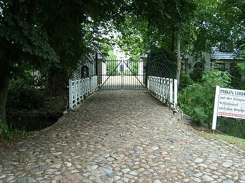 Schloss Heiligenstedten Historic site, Heiligenstedten3.5 km E
-
Bekau River, Schleswig-Holstein2.6 km SE
-
Wilster Au River, Schleswig-Holstein3.1 km SW
-
Heiligenstedter Holz Natural site, Schleswig-Holstein3.9 km E
-
Rahder Holz Natural site, Schleswig-Holstein4 km N
-
Kampritter Wettern River, Schleswig-Holstein4 km S
Sources & licences
Data last updated: · 2 independent sources