Wewelsflether Uhrendorf
Located in Wewelsfleth, Kreis Steinburg Coordinates: 53°50′49″ N 9°25′43″ E
- Elevation
- 4 m
- above sea level
- Local time
- UTC+01:00
- Europe/Berlin · UTC+01:00
- Airports
- HAM Hamburg Helmut Schmidt Airport44 km
- FCN Sea-Airport Cuxhaven/Nordholz / Nordholz Naval Airbase51 km
About Wewelsflether Uhrendorf
Wewelsflether Uhrendorf is a village. Location: Wewelsfleth, Kreis Steinburg. Elevation: 4 m. The best months to visit are June–August. The nearest airport is Hamburg Helmut Schmidt Airport (44 km). Nearby sights include Kremper Au and Stör.
Climate of Wewelsflether Uhrendorf
Best months for sightseeingBest months for sightseeing: June–August.
This month · November
A cold month
Day 8° · Night 2° · Rain 79 mm
- Hottest month
- August (day 22°)
- Coldest month
- January (night -1°)
- Wettest month
- October (81 mm)
- Driest month
- February (44 mm)
Bars: average monthly low and high temperature. Below: precipitation. Monthly averages for 1970–2000 at about 18 km resolution, adjusted for elevation. Highlighted months are mild and relatively dry. Source: WorldClim 2.1 (CC BY 4.0).
Show values as a table
| Month | Jan | Feb | Mar | Apr | May | Jun | Jul | Aug | Sep | Oct | Nov | Dec |
|---|---|---|---|---|---|---|---|---|---|---|---|---|
| Average high (°C) | 3° | 4° | 7° | 12° | 17° | 20° | 22° | 22° | 18° | 13° | 8° | 4° |
| Average low (°C) | -1° | -1° | 1° | 3° | 7° | 10° | 12° | 12° | 9° | 6° | 2° | 0° |
| Precipitation (mm) | 67 | 44 | 61 | 46 | 56 | 79 | 79 | 72 | 79 | 81 | 79 | 78 |
How to get to Wewelsflether Uhrendorf
The nearest airport is Hamburg Helmut Schmidt Airport (HAM), 44 km to the southeast as the crow flies. The nearest large city is Bremerhaven, 65 km to the southwest.
Airports
- Hamburg Helmut Schmidt Airport (HAM) Hamburg 44 kmsoutheast
- Sea-Airport Cuxhaven/Nordholz / Nordholz Naval Airbase (FCN) Wurster Nordseeküste 51 kmwest
- Lübeck Blankensee Airport (LBC) Lübeck 85 kmeast
Nearby large cities
- Bremerhaven Population: 118.6K 65 kmsouthwest
- Kiel Population: 252.7K 70 kmnortheast
- Lübeck Population: 212.2K 83 kmeast
- Bremen Population: 546.5K 95 kmsouthwest
- Oldenburg Population: 159.2K 113 kmsouthwest
Straight-line distances; road distances are longer. Airport data: OurAirports.
Day trips from Wewelsflether Uhrendorf
Within 100 km: 384 historic and cultural sites, 2,177 natural sites, 1,297 lakes, rivers and coasts.
0–25 km179 places
- Rhinplate Island 8 kmS
- Pagensand Island 18 kmS
- Schwarztonnensand Island 16 kmS
- Mühlenteich Lake 21 kmE
25–60 km1,126 places
- Spock River 56 kmNE
- Aubek River 29 kmNE
- Trischen Island 54 kmNW
- Hanskalbsand Island 36 kmSE
60–100 km2,553 places
- Nordstrand Natural site 81 kmNW
- Viertbusch Natural site 69 kmSE
- Oxbek River 89 kmN
- Hundestrand Beach 89 kmE
Straight-line distances.
Nearby attractions & nature
Everything nearby-
Kremper Au River, Schleswig-Holstein1.4 km S
-
Stör River, Schleswig-Holstein4 km SW
-
Rusch River, Blomesche Wildnis5.6 km S
-
Early Camp Glückstadt Historic site, Glückstadt6.2 km S
-
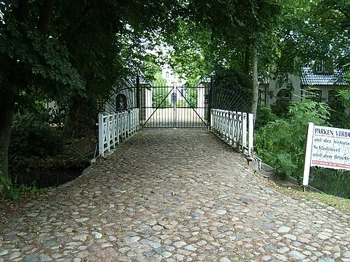 Schloss Heiligenstedten Historic site, Heiligenstedten9.7 km N
-
Neufelder Wettern River, Dammfleth6.5 km NW
Sources & licences
Data last updated: