Billmuthausen
Located in Stadt Heldburg, Landkreis Hildburghausen Coordinates: 50°17′00″ N 10°47′00″ E

- Elevation
- 339 m
- above sea level
- Local time
- UTC+01:00
- Europe/Berlin · UTC+01:00
- Airports
- ERF Erfurt-Weimar Airport78 km
- NUE Nuremberg Airport90 km
About Billmuthausen
Billmuthausen is a village. Location: Stadt Heldburg, Landkreis Hildburghausen. Elevation: 339 m.
Billmuthausen was a village in Germany, founded in 1340. It was destroyed by East German authorities in 1978 as it stood too close to the Inner German border (part of the larger "Iron Curtain"), the border between the post-war states of East and West Germany. It lay in the extreme south of Thuringia in the Heldburger Land in the district of Hildburghausen, only five hundred metres (1,600 ft) away from the Thuringian-Bavarian border. In January 1965, the authorities destroyed the small village church.
Source: Wikipedia · CC BY-SA 4.0
At a glance
- Heritage designation
- Kulturdenkmal
Source: Wikidata
Photos of Billmuthausen
-
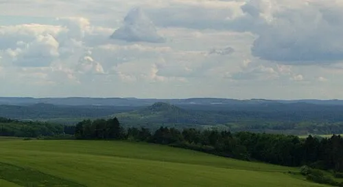
Straufhain Elop · CC BY-SA 2.5

Climate of Billmuthausen
Best months for sightseeingBest months for sightseeing: June–August.
This month · November
A cold month
Day 6° · Night 1° · Rain 59 mm
- Hottest month
- July (day 23°)
- Coldest month
- January (night -3°)
- Wettest month
- July (77 mm)
- Driest month
- February (46 mm)
Bars: average monthly low and high temperature. Below: precipitation. Monthly averages for 1970–2000 at about 18 km resolution, adjusted for elevation. Highlighted months are mild and relatively dry. Source: WorldClim 2.1 (CC BY 4.0).
Show values as a table
| Month | Jan | Feb | Mar | Apr | May | Jun | Jul | Aug | Sep | Oct | Nov | Dec |
|---|---|---|---|---|---|---|---|---|---|---|---|---|
| Average high (°C) | 2° | 3° | 8° | 13° | 18° | 21° | 23° | 23° | 18° | 12° | 6° | 3° |
| Average low (°C) | -3° | -3° | 0° | 3° | 7° | 10° | 12° | 12° | 8° | 4° | 1° | -2° |
| Precipitation (mm) | 56 | 46 | 51 | 48 | 59 | 72 | 77 | 61 | 57 | 56 | 59 | 70 |
How to get to Billmuthausen
The nearest airport is Erfurt-Weimar Airport (ERF), 78 km to the north as the crow flies. The nearest large city is Erlangen, 79 km to the south.
Airports
- Erfurt-Weimar Airport (ERF) Erfurt 78 kmnorth
- Nuremberg Airport (NUE) Nuremberg 90 kmsouth
- Karlovy Vary Airport (KLV) Karlovy Vary 152 kmeast
Nearby large cities
- Erlangen Population: 102.7K 79 kmsouth
- Erfurt Population: 218.8K 79 kmnorth
- Würzburg Population: 133.7K 81 kmsouthwest
- Fürth Population: 132K 91 kmsouth
- Jena Population: 104.7K 92 kmnortheast
Straight-line distances; road distances are longer. Airport data: OurAirports.
Day trips from Billmuthausen
Within 100 km: 1,096 historic and cultural sites, 4,984 natural sites, 913 lakes, rivers and coasts.
0–25 km541 places
- Goldbergsee Lake 11 kmE
- Froschgrundsee Lake 19 kmNE
- Zeilberg Mountain 19 kmNW
- Zeilberg Mountain 12 kmSW
25–60 km2,385 places
- Waldstadion Weismain Landmark 40 kmSE
- Badsee Lake 48 kmSW
- Sennfelder See Lake 47 kmSW
- Talsperre Schwickershausen Lake 34 kmNW
60–100 km4,067 places
- Buchenwald concentration camp Historic site 89 kmN
- Spitzelberg Mountain 94 kmSE
- Stollenberg Mountain 94 kmSE
- Uzbach River 93 kmSW
Straight-line distances.
Nearby attractions & nature
Everything nearby-
Tonberg Mountain, Stadt Heldburg0.6 km S
-
Schlehrangen Mountain, Stadt Heldburg2.2 km SW
-
Kühherg Mountain, Ummerstadt1.5 km S
-
Pfaffenholz Natural site, Thuringia1.3 km SW
-
Hoher Stein Mountain, Bad Rodach1.6 km NW
-
Mühlberg Mountain, Bad Rodach1.9 km NE
Other cities and towns in Stadt Heldburg


Sources & licences
Data last updated: · 2 independent sources