Mittelbau-Dora Concentration Camp
Located in Nordhausen, Landkreis Nordhausen Coordinates: 51°32′07″ N 10°44′56″ E
- Local time
- UTC+01:00
- Europe/Berlin · UTC+01:00
- Elevation
- 237 m
- above sea level
- Airports
- ERF Erfurt-Weimar Airport64 km
- KSF Kassel Airport95 km
About Mittelbau-Dora Concentration Camp
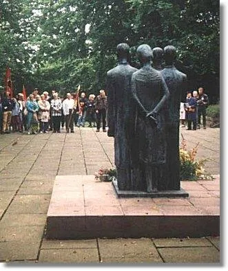
Mittelbau-Dora Concentration Camp is a historic site. Location: Nordhausen, Landkreis Nordhausen.
Mittelbau-Dora (also Dora-Mittelbau and Nordhausen-Dora) was a Nazi concentration camp located near Nordhausen in Thuringia, Germany. It was established in late summer 1943 as a subcamp of Buchenwald concentration camp, supplying slave labour from many Eastern countries occupied by Germany (including evacuated survivors of eastern extermination camps), for extending the nearby tunnels in the Kohnstein and for manufacturing the V-2 rocket and the V-1 flying bomb.
Source: Wikipedia · CC BY-SA 4.0
Photos of Mittelbau-Dora Concentration Camp
-

Thank you to indicate this credit line next to the image in case of reuse: Credit: Polymagou - CC BY-SA I'd appreciate i · CC BY-SA 4.0 -

JesterWr · CC BY-SA 3.0 de -

Siarhei Besarab · CC BY-SA 4.0 -

Jiří Nedas · CC BY-SA 4.0 -

Albertomos · CC BY-SA 4.0


Climate of Mittelbau-Dora Concentration Camp
Best months for sightseeingBest months for sightseeing: June–August.
This month · November
A cold month
Day 7° · Night 1° · Rain 77 mm
- Hottest month
- July (day 22°)
- Coldest month
- January (night -3°)
- Wettest month
- December (85 mm)
- Driest month
- February (55 mm)
Bars: average monthly low and high temperature. Below: precipitation. Monthly averages for 1970–2000 at about 18 km resolution, adjusted for elevation. Highlighted months are mild and relatively dry. Source: WorldClim 2.1 (CC BY 4.0).
Show values as a table
| Month | Jan | Feb | Mar | Apr | May | Jun | Jul | Aug | Sep | Oct | Nov | Dec |
|---|---|---|---|---|---|---|---|---|---|---|---|---|
| Average high (°C) | 3° | 4° | 7° | 12° | 17° | 20° | 22° | 22° | 18° | 13° | 7° | 4° |
| Average low (°C) | -3° | -3° | 0° | 3° | 7° | 10° | 12° | 12° | 9° | 5° | 1° | -1° |
| Precipitation (mm) | 72 | 55 | 75 | 58 | 65 | 80 | 78 | 69 | 66 | 66 | 77 | 85 |
How to get to Mittelbau-Dora Concentration Camp
The nearest airport is Erfurt-Weimar Airport (ERF), 64 km to the south as the crow flies. The nearest large city is Göttingen, 57 km to the west.
Airports
- Erfurt-Weimar Airport (ERF) Erfurt 64 kmsouth
- Kassel Airport (KSF) Calden 95 kmwest
- Leipzig/Halle Airport (LEJ) Schkeuditz 104 kmeast
Nearby large cities
- Göttingen Population: 122.1K 57 kmwest
- Erfurt Population: 218.8K 65 kmsouth
- Salzgitter Population: 105K 73 kmnorth
- Braunschweig Population: 244.7K 83 kmnorth
- Halle Population: 237.9K 86 kmeast
Straight-line distances; road distances are longer. Airport data: OurAirports.
Day trips from Mittelbau-Dora Concentration Camp
Within 100 km: 529 historic and cultural sites, 4,119 natural sites, 786 lakes, rivers and coasts.
0–25 km460 places
- Bere River 1 kmN
- Steinbruchsteich Lake 14 kmNW
- Röstesee Lake 8 kmW
- Rappbodetalsperre Lake 23 kmN
25–60 km1,878 places
- Schalk River 40 kmNW
- Frieda River 58 kmSW
- Aue River 57 kmN
- Aue River 50 kmN
60–100 km3,096 places
- Buchenwald concentration camp Historic site 67 kmSE
- Sarre River 67 kmNE
- Roda River 94 kmSE
- Roda River 95 kmSE
Straight-line distances.
Nearby attractions & nature
Everything nearby-
Dora Concentration Camp Historic site, Nordhausen<0.1 km N
-
Dora concentration camp Historic site, Nordhausen<0.1 km W
-
Woffleben Concentration Camp Historic site, Ellrich3 km NW
-
Bere River, Thuringia1.5 km N
-
Heideberg Mountain, Werther2.8 km SW
-
Mühlberg Mountain, Harztor2.8 km N
-
Harzungen Concentration Camp Historic site, Harztor4.7 km NE
-
Kuhberg Mountain, Nordhausen3.6 km E
Nearest towns and villages
-
 Niedersachswerfen Village, Harztor2.1 km NE
-
Harztor Village, Landkreis Nordhausen2.6 km NE
-
Nordhausen Town, Nordhausen4.9 km SE
-
 Ilfeld Village, Harztor5.1 km NE
Sources & licences
Data last updated: · 2 independent sources