Mutzenberg
Located in Neuhaus am Rennweg, Landkreis Sonneberg Coordinates: 50°32′24″ N 11°12′01″ E
- Elevation
- 773 m
- above sea level
- Local time
- UTC+01:00
- Europe/Berlin · UTC+01:00
- Airports
- ERF Erfurt-Weimar Airport52 km
- NUE Nuremberg Airport116 km
About Mutzenberg
Mutzenberg is a mountain. Location: Neuhaus am Rennweg, Landkreis Sonneberg. Elevation: 773 m.
The Mutzenberg is a 770.0 m high (above sea level) mountain located in the Thuringian Highland, Thuringia (Germany). The German mountain, Mutzenberg, translates to "Mountain Hat”. It is to be found close to the municipality of Lichte, and the Leibis-Lichte Dam in the Saalfeld-Rudolstadt district in the Thuringian Forest Nature Park. The section of the Rennsteig walkway between Neuhaus am Rennweg, Piesau, and Spechtsbrunn runs close to the mountain.
Source: Wikipedia · CC BY-SA 4.0
Photos of Mutzenberg
-

Roter Berg Utabaumfelder · Public domain -
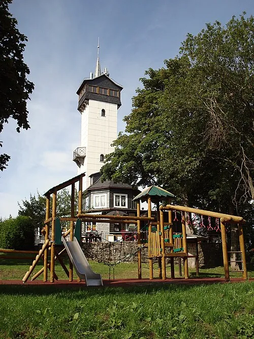
Kirch-Berg User:Bergbahnregion · Public domain


Climate of Mutzenberg
Best months for sightseeingBest months for sightseeing: June–August.
This month · November
A cold month
Day 4° · Night -2° · Rain 82 mm
- Hottest month
- July (day 20°)
- Coldest month
- February (night -6°)
- Wettest month
- July (94 mm)
- Driest month
- February (63 mm)
Bars: average monthly low and high temperature. Below: precipitation. Monthly averages for 1970–2000 at about 18 km resolution, adjusted for elevation. Highlighted months are mild and relatively dry. Source: WorldClim 2.1 (CC BY 4.0).
Show values as a table
| Month | Jan | Feb | Mar | Apr | May | Jun | Jul | Aug | Sep | Oct | Nov | Dec |
|---|---|---|---|---|---|---|---|---|---|---|---|---|
| Average high (°C) | -1° | 1° | 5° | 9° | 15° | 17° | 20° | 19° | 15° | 10° | 4° | 1° |
| Average low (°C) | -5° | -6° | -3° | 0° | 5° | 8° | 10° | 9° | 6° | 2° | -2° | -4° |
| Precipitation (mm) | 73 | 63 | 73 | 63 | 74 | 81 | 94 | 79 | 72 | 69 | 82 | 91 |
How to get to Mutzenberg
The nearest airport is Erfurt-Weimar Airport (ERF), 52 km to the north as the crow flies. The nearest large city is Erfurt, 50 km to the north.
Airports
- Erfurt-Weimar Airport (ERF) Erfurt 52 kmnorth
- Nuremberg Airport (NUE) Nuremberg 116 kmsouth
- Leipzig/Halle Airport (LEJ) Schkeuditz 122 kmnortheast
Nearby large cities
- Erfurt Population: 218.8K 50 kmnorth
- Jena Population: 104.7K 51 kmnortheast
- Gera Population: 104.7K 73 kmnortheast
- Erlangen Population: 102.7K 106 kmsouth
- Halle Population: 237.9K 118 kmnortheast
Straight-line distances; road distances are longer. Airport data: OurAirports.
Day trips from Mutzenberg
Within 100 km: 826 historic and cultural sites, 4,387 natural sites, 836 lakes, rivers and coasts.
0–25 km519 places
- Talsperre Schönbrunn Lake 23 kmW
- Goldisthal Unterbecken Lake 15 kmW
- Hohenwarte-Talsperre Lake 22 kmE
- Dudelteich Lake 18 kmNE
25–60 km2,018 places
- Buchenwald concentration camp Historic site 54 kmN
- Waldstadion Weismain Landmark 50 kmS
- Roda River 47 kmNE
- Roda River 46 kmNE
60–100 km3,512 places
- Sprotte River 97 kmNE
- Felda River 86 kmNW
- Badsee Lake 89 kmSW
- Wüster Teich Lake 65 kmE
Straight-line distances.
Nearest towns and villages
-
Schmiedefeld Village, Saalfeld/Saale1.4 km SE
-
 Lichte Village, Neuhaus am Rennweg2.7 km SW
-
Piesau Village, Neuhaus am Rennweg2.8 km SE
-
 Lamprecht Village, Neuhaus am Rennweg0.8 km SW
-
Geiersthal Village, Neuhaus am Rennweg1 km W
-
 Wallendorf Village, Neuhaus am Rennweg1.4 km SW
Nearby attractions & nature
Everything nearby-
Spitzberg Mountain, Neuhaus am Rennweg0.9 km S
-
Rauhügel Mountain, Saalfeld/Saale1.3 km E
-
Spitzerberg Mountain, Neuhaus am Rennweg1.6 km NW
-
Sauhügel Mountain, Neuhaus am Rennweg1.7 km SW
-
Röderhügel Mountain, Gräfenthal2.5 km E
-
Langer Berg Mountain, Neuhaus am Rennweg2.5 km W
-
Friedrichsgrund Natural site, Thuringia2.7 km NW
-
Finsterer Grund Natural site, Thuringia2.8 km SW
Sources & licences
Data last updated: · 2 independent sources