Mount Athos
Local name: Όρος Άθως
Located in Autonomous Monastic State of the Holy Mountain, Greece Coordinates: 40°09′30″ N 24°19′39″ E
- Elevation
- 2,033 m
- above sea level
- Local time
- UTC+02:00
- Europe/Athens · UTC+02:00
- Airports
- KVA Kavala Alexander the Great International Airport87 km
- SKG Thessaloniki Macedonia International Airport122 km
About Mount Athos
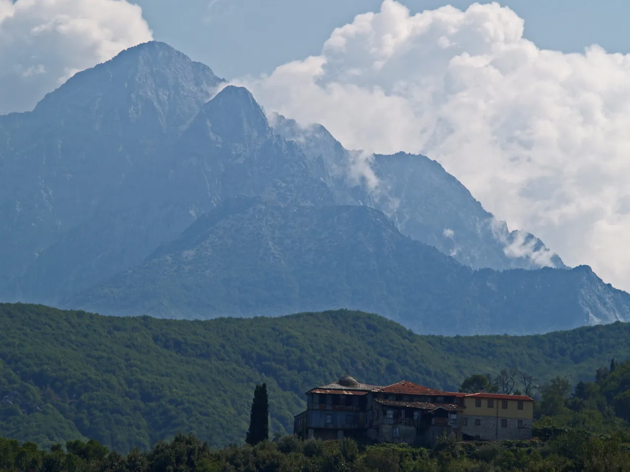
Mount Athos is a mountain. Location: Autonomous Monastic State of the Holy Mountain, Greece. Elevation: 2,033 m.
Mount Athos is a mountain on the Athos peninsula in northeastern Greece directly on the Aegean Sea. It is an important center of Eastern Orthodox monasticism. The mountain and most of the Athos peninsula are governed as an autonomous region in Greece by the monastic community of Mount Athos, which is ecclesiastically under the direct jurisdiction of the Ecumenical Patriarch of Constantinople. The remainder of the peninsula forms part of the Aristotelis municipality.
Source: Wikipedia · CC BY-SA 4.0
At a glance
- Heritage designation
- part of UNESCO World Heritage Site
- Topographic prominence
- 2,012 m
- Area
- 330 km²
Source: Wikidata
Climate of Mount Athos
Best months for sightseeingBest months for sightseeing: June–August.
This month · November
A cold month
Day 3° · Night -3° · Rain 69 mm
- Hottest month
- July (day 17°)
- Coldest month
- February (night -7°)
- Wettest month
- December (78 mm)
- Driest month
- August (18 mm)
Bars: average monthly low and high temperature. Below: precipitation. Monthly averages for 1970–2000 at about 18 km resolution, adjusted for elevation. Highlighted months are mild and relatively dry. Source: WorldClim 2.1 (CC BY 4.0).
Show values as a table
| Month | Jan | Feb | Mar | Apr | May | Jun | Jul | Aug | Sep | Oct | Nov | Dec |
|---|---|---|---|---|---|---|---|---|---|---|---|---|
| Average high (°C) | -2° | -2° | 1° | 5° | 10° | 15° | 17° | 16° | 13° | 8° | 3° | 0° |
| Average low (°C) | -7° | -7° | -5° | -2° | 3° | 7° | 9° | 9° | 6° | 2° | -3° | -6° |
| Precipitation (mm) | 70 | 57 | 56 | 42 | 38 | 34 | 23 | 18 | 25 | 58 | 69 | 78 |
How to get to Mount Athos
The nearest airport is Kavala Alexander the Great International Airport (KVA), 87 km to the north as the crow flies. The nearest large city is Çanakkale, 178 km to the east.
Airports
- Kavala Alexander the Great International Airport (KVA) Kavala 87 kmnorth
- Thessaloniki Macedonia International Airport (SKG) Thessaloniki 122 kmwest
- Skiathos Island National Airport (JSI) Skiathos 130 kmsouthwest
Nearby large cities
- Çanakkale Population: 143.6K 178 kmeast
- Plovdiv Population: 329.5K 224 kmnorth
- Athens Population: 664K 247 kmsouth
- Edirne Population: 180K 252 kmnortheast
- Piraeus Population: 163.7K 253 kmsouth
Straight-line distances; road distances are longer. Airport data: OurAirports.
Day trips from Mount Athos
Within 100 km: 7 historic and cultural sites, 22 lakes, rivers and coasts.
0–25 km1 place
- Monastery of Great Lavra Attraction 5 kmE
25–60 km7 places
- Spalathronísia Island 47 kmW
- Glarokampos Beach Beach 59 kmW
- Agios Isidoros Island 46 kmW
- Alonaki Beach Beach 59 kmW
60–100 km21 places
- Amygdalochóri Historic site 93 kmNW
- Moní Agíou Panteleímonos Attraction 65 kmN
- Diapori Island 65 kmNE
- Moni Analhpseos Attraction 89 kmN
Straight-line distances.
Nearest towns and villages
-
Karyes City, Autonomous Monastic State of the Holy Mountain13 km NW
-
Pantokratoros Monastery Village, Autonomous Monastic State of the Holy Mountain15 km N
-
Vatopedi Village, Autonomous Monastic State of the Holy Mountain20 km NW
-
Sithonia Municipality, Chalkidikí43 km W
-
Sarti Village, Sithonia31 km W
-
Sykia Village, Sithonia36 km W
Sources & licences
Data last updated: · 2 independent sources