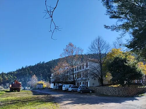
Nea Agnanti
Located in Molos-Agios Konstantinos, Phthiotis Coordinates: 38°44′42″ N 22°51′39″ E
- Population
- 79
- 79
- Elevation
- 106 m
- above sea level
- Local time
- UTC+02:00
- Europe/Athens · UTC+02:00
- Airports
- VOL Nea Anchialos National Airport53 km
- JSI Skiathos Island National Airport74 km
About Nea Agnanti
Nea Agnanti is a village. Location: Molos-Agios Konstantinos, Phthiotis. Population: 79. Elevation: 106 m. The best months to visit are April–May, October. The nearest airport is Nea Anchialos National Airport (53 km). Nearby sights include Ierá Moní Odigítrias and Ákra Dhrépanon.
Climate of Nea Agnanti
Best months for sightseeingBest months for sightseeing: April–May, October.
This month · November
Outside the best season
Day 17° · Night 9° · Rain 75 mm
- Hottest month
- July (day 32°)
- Coldest month
- January (night 4°)
- Wettest month
- December (92 mm)
- Driest month
- July (11 mm)
Bars: average monthly low and high temperature. Below: precipitation. Monthly averages for 1970–2000 at about 18 km resolution, adjusted for elevation. Highlighted months are mild and relatively dry. Source: WorldClim 2.1 (CC BY 4.0).
Show values as a table
| Month | Jan | Feb | Mar | Apr | May | Jun | Jul | Aug | Sep | Oct | Nov | Dec |
|---|---|---|---|---|---|---|---|---|---|---|---|---|
| Average high (°C) | 12° | 12° | 15° | 19° | 24° | 30° | 32° | 32° | 28° | 22° | 17° | 13° |
| Average low (°C) | 4° | 5° | 6° | 9° | 14° | 18° | 20° | 20° | 17° | 13° | 9° | 6° |
| Precipitation (mm) | 70 | 68 | 64 | 42 | 31 | 20 | 11 | 15 | 26 | 68 | 75 | 92 |
How to get to Nea Agnanti
The nearest airport is Nea Anchialos National Airport (VOL), 53 km to the north as the crow flies. For international flights: Athens Eleftherios Venizelos International Airport (ATH) (131 km). The nearest large city is Piraeus, 113 km to the southeast.
Airports
- Nea Anchialos National Airport (VOL) Nea Anchialos 53 kmnorth
- Skiathos Island National Airport (JSI) Skiathos 74 kmnortheast
- Athens Eleftherios Venizelos International Airport (ATH) Spata-Artemida 131 kmsoutheast
Nearby large cities
- Piraeus Population: 163.7K 113 kmsoutheast
- Athens Population: 664K 114 kmsoutheast
- Çanakkale Population: 143.6K 343 kmnortheast
- Çiğli Population: 214.1K 368 kmeast
- Konak Population: 332.3K 371 kmeast
Straight-line distances; road distances are longer. Airport data: OurAirports.
Day trips from Nea Agnanti
Within 100 km: 14 historic and cultural sites, 2 natural sites, 16 lakes, rivers and coasts.
0–25 km3 places
- Ierá Moní Odigítrias Attraction 25 kmSW
- Ágios Nikolaos Island 21 kmE
- Ákra Dhrépanon Natural site 16 kmNW
25–60 km8 places
- Moní Genesíou Theotókou Damástas Attraction 33 kmW
- Moni Osiou David Attraction 38 kmE
- Moní Antinítsis Attraction 49 kmNW
- Hosios Loukas Attraction 40 kmS
60–100 km21 places
- Moní Agíou Ierothéou Attraction 89 kmSE
- Paximada Island 78 kmNE
- Chorefto Beach Beach 82 kmN
- Ntammouchari Beach Beach 78 kmN
Straight-line distances.
Nearby attractions & nature
Everything nearby-
 Ierá Moní Odigítrias Attraction, Amfikleia-Elateia25 km SW
-
Ákra Dhrépanon Natural site, Stylida16 km NW
-
Ágios Nikolaos Island, Lokroi21 km E
Sources & licences
Data last updated: