Malia
Local name: Μάλια
Located in Chersonisos, Heraklion Regional Unit Coordinates: 35°17′01″ N 25°27′45″ E
- Population
- 4,343
- 4.3K
- Elevation
- 28 m
- above sea level
- Local time
- UTC+02:00
- Europe/Athens · UTC+02:00
About Malia
Malia is a village. Location: Chersonisos, Heraklion Regional Unit. Population: 4,343. Elevation: 28 m.
Malia (Greek: Μάλια) is a coastal town and municipal unit situated in the northeast corner of the Heraklion region of Crete, Greece. It is part of the municipality of Hersonissos and is located approximately 34 kilometers (21 miles) east of Heraklion. As of 2021, the population of the municipal unit was 5,501. The area also encompasses the villages of Mochos (Greek: Μοχός), Krasi (Greek: Κράσι), and Stalida (Greek: Σταλίδα), covering a total area of 60.720 square kilometers (23.444 sq mi).
Read more on Wikipedia Text: Wikipedia contributors · CC BY-SA 4.0 · shortened
In comparison
- Most populous of 35 places in Chersonisos
- Nearest larger town: Chersonisos, 9 km W
Climate of Malia
Best months for sightseeing: April–May, October.
| Month | Jan | Feb | Mar | Apr | May | Jun | Jul | Aug | Sep | Oct | Nov | Dec |
|---|---|---|---|---|---|---|---|---|---|---|---|---|
| Average high (°C) | 15° | 15° | 17° | 20° | 25° | 29° | 31° | 31° | 28° | 24° | 20° | 17° |
| Average low (°C) | 10° | 9° | 10° | 13° | 16° | 20° | 23° | 23° | 21° | 17° | 14° | 11° |
| Precipitation (mm) | 143 | 108 | 87 | 41 | 20 | 7 | 3 | 2 | 21 | 79 | 84 | 127 |
Monthly averages for 1970–2000 at about 18 km resolution, adjusted for elevation. Highlighted months are mild and relatively dry. Source: WorldClim 2.1 (CC BY 4.0).
Airports nearest to Malia
- Heraklion International Nikos Kazantzakis Airport (HER) Heraklion 26 km
- Sitia Airport (JSH) Crete Island 59 km
- Chania International Airport (CHQ) Souda 122 km
Straight-line distance; airports with scheduled flights only. Source: OurAirports (public domain).
Nearby attractions & nature
Everything nearby-
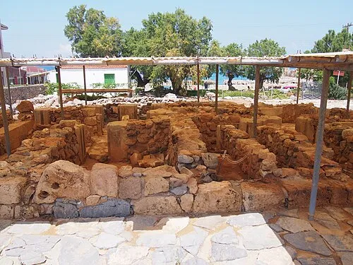 Kokkini Nirou Historic site, Chersonisos20 km W
-
Paxamadi Island Island, Heraklion Regional Unit24 km NW
Sources & licences
Data last updated: · 2 independent sources