- Elevation
- 32 m
- above sea level
- Local time
- UTC+02:00
- Europe/Athens · UTC+02:00
- Airports
- KVA Kavala Alexander the Great International Airport31 km
- AXD Alexandroupoli Democritus Airport119 km
About Kalyvia
Kalyvia is a neighbourhood. Location: Thasos, Kavala.
Kalyvia (Greek: Καλύβια) is a village located in the southwest of Thasos island, approximately 1 km from Limenaria. The name of the village comes from the Greek word καλύβα, meaning "hut", chosen due to the huts constructed by the Asia Minor refugees and inhabitants coming from Kastro at the beginning of the 20th century. In 1903, the German company Speidel began exploiting the iron mines of Metallia (near Limenaria). During the mining period, the village experienced great prosperity and expanded considerably.
Source: Wikipedia · CC BY-SA 4.0
Climate of Kalyvia
Best months for sightseeingBest months for sightseeing: May, September.
This month · November
Outside the best season
Day 15° · Night 8° · Rain 75 mm
- Hottest month
- July (day 31°)
- Coldest month
- January (night 3°)
- Wettest month
- December (78 mm)
- Driest month
- August (12 mm)
Bars: average monthly low and high temperature. Below: precipitation. Monthly averages for 1970–2000 at about 18 km resolution, adjusted for elevation. Highlighted months are mild and relatively dry. Source: WorldClim 2.1 (CC BY 4.0).
Show values as a table
| Month | Jan | Feb | Mar | Apr | May | Jun | Jul | Aug | Sep | Oct | Nov | Dec |
|---|---|---|---|---|---|---|---|---|---|---|---|---|
| Average high (°C) | 10° | 10° | 13° | 18° | 23° | 28° | 31° | 30° | 26° | 20° | 15° | 11° |
| Average low (°C) | 3° | 3° | 6° | 10° | 14° | 19° | 21° | 21° | 17° | 13° | 8° | 5° |
| Precipitation (mm) | 70 | 46 | 50 | 35 | 35 | 36 | 23 | 12 | 24 | 57 | 75 | 78 |
How to get to Kalyvia
The nearest airport is Kavala Alexander the Great International Airport (KVA), 31 km to the north as the crow flies. The nearest large city is Çanakkale, 165 km to the east.
Airports
- Kavala Alexander the Great International Airport (KVA) Kavala 31 kmnorth
- Alexandroupoli Democritus Airport (AXD) Alexandroupolis 119 kmeast
- Thessaloniki Macedonia International Airport (SKG) Thessaloniki 136 kmwest
Nearby large cities
- Çanakkale Population: 143.6K 165 kmeast
- Plovdiv Population: 329.5K 169 kmnorth
- Edirne Population: 180K 202 kmnortheast
- Stara Zagora Population: 121.6K 218 kmnortheast
- Tekirdağ Population: 122.3K 251 kmeast
Straight-line distances; road distances are longer. Airport data: OurAirports.
Day trips from Kalyvia
Within 100 km: 10 historic and cultural sites, 2 natural sites, 6 lakes, rivers and coasts.
0–25 km4 places
- Moní Agíou Panteleímonos Attraction 8 kmN
- Panagia Island Island 10 kmSE
- Diapori Island 18 kmE
- Pelagos Island 10 kmSE
25–60 km5 places
- Monastery of Great Lavra Attraction 54 kmS
- Mount Athos Mountain 57 kmS
- Moni Analhpseos Attraction 55 kmNW
- Kynigós Historic site 51 kmN
60–100 km9 places
- Amygdalochóri Historic site 79 kmW
- Spalathronísia Island 95 kmSW
- Ekklisia Zoodochos Pigi Attraction 69 kmNW
- Nisída Siderítis Island 83 kmSE
Straight-line distances.
Nearby attractions & nature
Everything nearby-
Moní Agíou Panteleímonos Attraction, Thasos8 km N
-
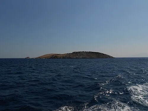 Panagia Island Island, East Macedonia and Thrace9.6 km SE
-
Pelagos Island, Kavala10 km SE
-
Diapori Island, Thasos18 km E
Sources & licences
Data last updated: · 2 independent sources