Orraon Archearological Site
Local name: Όρραον
Located in Municipality of Arta, Nomós Ártas Coordinates: 39°16′17″ N 20°55′32″ E
- Local time
- UTC+02:00
- Europe/Athens · UTC+02:00
- Elevation
- 236 m
- above sea level
- Airports
- PVK Aktion National Airport41 km
- IOA Ioannina King Pyrrhus National Airport48 km
About Orraon Archearological Site
Orraon Archearological Site is a historic site. Location: Municipality of Arta, Nomós Ártas.
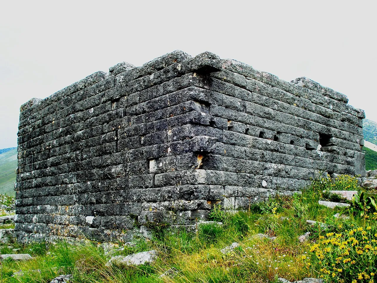
Horreum or Orraon or Horraon (Ancient Greek: Ὄρραον) was a Greek city of ancient Epirus. Orraon is located on a hill by the Amvrakikos Gulf which is located in Northwestern Greece, to the west of Ammotopos. It guards the passage all the way down to the Ioannina Basin.
Source: Wikipedia · CC BY-SA 4.0
At a glance
- Heritage designation
- archaeological site in Greece
Source: Wikidata
Photos of Orraon Archearological Site
-

Kostas Vassis · CC BY-SA 4.0 -

Χαράλαμπος Γκούβας · CC BY-SA 3.0 -

Kostas Vassis · CC BY-SA 4.0 -

Antopant2021 · CC BY-SA 4.0 -

Astrea12 · CC BY-SA 4.0


Climate of Orraon Archearological Site
Best months for sightseeingBest months for sightseeing: May, October.
This month · November
A wet month
Day 16° · Night 7° · Rain 148 mm
- Hottest month
- July (day 32°)
- Coldest month
- January (night 3°)
- Wettest month
- November (148 mm)
- Driest month
- July (19 mm)
Bars: average monthly low and high temperature. Below: precipitation. Monthly averages for 1970–2000 at about 18 km resolution, adjusted for elevation. Highlighted months are mild and relatively dry. Source: WorldClim 2.1 (CC BY 4.0).
Show values as a table
| Month | Jan | Feb | Mar | Apr | May | Jun | Jul | Aug | Sep | Oct | Nov | Dec |
|---|---|---|---|---|---|---|---|---|---|---|---|---|
| Average high (°C) | 11° | 12° | 15° | 19° | 24° | 29° | 32° | 32° | 28° | 22° | 16° | 12° |
| Average low (°C) | 3° | 4° | 5° | 8° | 12° | 15° | 18° | 18° | 15° | 11° | 7° | 4° |
| Precipitation (mm) | 105 | 112 | 89 | 71 | 48 | 24 | 19 | 23 | 50 | 100 | 148 | 144 |
How to get to Orraon Archearological Site
The nearest airport is Aktion National Airport (PVK), 41 km to the south as the crow flies. For international flights: Corfu Ioannis Kapodistrias International Airport (CFU) (95 km). The nearest large city is Piraeus, 279 km to the southeast.
Airports
- Aktion National Airport (PVK) Preveza 41 kmsouth
- Ioannina King Pyrrhus National Airport (IOA) Ioannina 48 kmnorth
- Corfu Ioannis Kapodistrias International Airport (CFU) Kerkyra (Corfu) 95 kmnorthwest
Nearby large cities
- Piraeus Population: 163.7K 279 kmsoutheast
- Athens Population: 664K 283 kmsoutheast
Straight-line distances; road distances are longer. Airport data: OurAirports.
Day trips from Orraon Archearological Site
Within 100 km: 13 historic and cultural sites, 1 natural site, 20 lakes, rivers and coasts.
0–25 km1 place
- Bridge of Arta Landmark 14 kmS
25–60 km10 places
- Moni Spilias Attraction 51 kmE
- Moni Retha Attraction 35 kmSE
- Moni pantanassas Attraction 56 kmN
- Makronísi Island 27 kmS
60–100 km23 places
- Moni Tatárnas Attraction 63 kmSE
- Kablafka Beach 80 kmS
- Kanouli Beach 94 kmW
- Asprogiali Beach 82 kmS
Straight-line distances.
Nearest towns and villages
-
Ammotopos Village, Municipality of Arta1.5 km E
-
Kastrí Village, Ziros1.9 km N
-
Gymnótopos Village, Ziros2.7 km NW
-
Dryófyto Village, Ziros3.5 km W
Sources & licences
Data last updated: · 2 independent sources