Limeni
Local name: Λιμένι
Located in East Mani, Laconia Coordinates: 36°40′46″ N 22°22′42″ E
- Population
- 11
- 11
- Elevation
- 28 m
- above sea level
- Local time
- UTC+02:00
- Europe/Athens · UTC+02:00
About Limeni
Limeni is a village. Location: East Mani, Laconia. Population: 11. Elevation: 28 m.
Areopoli (Greek: Αρεόπολη; before 1912 Τσίμοβα, Tsimova) is a town on the Mani Peninsula, Laconia, Greece. The word Areopoli, which means "city of Ares", the ancient Greek god of war, became the official name in 1912. It was the seat of Oitylo municipality. The Greek War of Independence was started at Areopoli on March 17, 1821 by Petros Pierrakos, also known as Petros Mavromichalis, the last bey of Mani. Now Areopoli has grown into a flourishing town.
Read more on Wikipedia Text: Wikipedia contributors · CC BY-SA 4.0 · shortened
In comparison
- No. 97 of 130 places in East Mani by population
- Nearest larger town: Neo Itilo, 1 km NE
Climate of Limeni
Best months for sightseeing: May, October.
| Month | Jan | Feb | Mar | Apr | May | Jun | Jul | Aug | Sep | Oct | Nov | Dec |
|---|---|---|---|---|---|---|---|---|---|---|---|---|
| Average high (°C) | 14° | 14° | 16° | 19° | 24° | 29° | 31° | 31° | 28° | 23° | 19° | 15° |
| Average low (°C) | 7° | 7° | 9° | 11° | 15° | 19° | 22° | 22° | 19° | 15° | 11° | 9° |
| Precipitation (mm) | 107 | 93 | 71 | 51 | 22 | 8 | 8 | 11 | 21 | 74 | 115 | 124 |
Monthly averages for 1970–2000 at about 18 km resolution, adjusted for elevation. Highlighted months are mild and relatively dry. Source: WorldClim 2.1 (CC BY 4.0).
Airports nearest to Limeni
- Kalamata Airport (KLX) Kalamata 53 km
- Zakynthos International Airport "Dionysios Solomos" (ZTH) Zakynthos 178 km
- Patras Araxos Agamemnon Airport (GPA) Patras 184 km
Straight-line distance; airports with scheduled flights only. Source: OurAirports (public domain).
Nearby attractions & nature
Everything nearby-
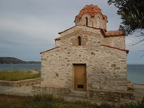 Agia Varvara Attraction, East Mani11 km E
-
Stoupa beach Beach, Peloponnese21 km NW
-
Delphinia beach Beach, Peloponnese23 km NW
-
Foneas beach Beach, West Mani24 km NW
-
Kalogria beach Beach, Peloponnese22 km NW
Sources & licences
Data last updated: · 2 independent sources