Melivoia
Local name: Μελίβοια
Located in Agia, Nomós Larísis Coordinates: 39°45′01″ N 22°47′43″ E
- Population
- 805
- 805
- Elevation
- 406 m
- above sea level
- Local time
- UTC+02:00
- Europe/Athens · UTC+02:00
- Airports
- VOL Nea Anchialos National Airport59 km
- SKG Thessaloniki Macedonia International Airport87 km
About Melivoia
Melivoia is a village. Location: Agia, Nomós Larísis. Population: 805. Elevation: 406 m.
Melivoia (Greek: Μελίβοια) is a town and a former municipality in the Larissa regional unit, Thessaly, Greece. Since the 2011 local government reform it is part of the municipality Agia, of which it is a municipal unit. The municipal unit has an area of 197.633 km2. The seat of the municipality was in Kato Sotiritsa. Melivoia is located east of Larissa, the capital of the regional unit and Thessaly, and a few kilometers north of Agia.
Source: Wikipedia · CC BY-SA 4.0
Population of Melivoia over time
| 1991 | 1,527 | |
|---|---|---|
| 2001 | 1,165 | |
| 2011 | 805 | |
| 2021 | 847 |
Censuses and official estimates; source: Wikidata.
Climate of Melivoia
Best months for sightseeingBest months for sightseeing: May–June, September.
This month · November
Outside the best season
Day 13° · Night 6° · Rain 62 mm
- Hottest month
- July (day 29°)
- Coldest month
- January (night 2°)
- Wettest month
- November (62 mm)
- Driest month
- August (23 mm)
Bars: average monthly low and high temperature. Below: precipitation. Monthly averages for 1970–2000 at about 18 km resolution, adjusted for elevation. Highlighted months are mild and relatively dry. Source: WorldClim 2.1 (CC BY 4.0).
Show values as a table
| Month | Jan | Feb | Mar | Apr | May | Jun | Jul | Aug | Sep | Oct | Nov | Dec |
|---|---|---|---|---|---|---|---|---|---|---|---|---|
| Average high (°C) | 8° | 9° | 12° | 17° | 22° | 27° | 29° | 29° | 25° | 19° | 13° | 9° |
| Average low (°C) | 2° | 2° | 4° | 7° | 11° | 16° | 18° | 18° | 15° | 11° | 6° | 3° |
| Precipitation (mm) | 46 | 49 | 50 | 47 | 44 | 29 | 25 | 23 | 28 | 55 | 62 | 58 |
How to get to Melivoia
The nearest airport is Nea Anchialos National Airport (VOL), 59 km to the south as the crow flies. For international flights: Thessaloniki Macedonia International Airport (SKG) (87 km). The nearest large city is Athens, 212 km to the southeast.
Airports
- Nea Anchialos National Airport (VOL) Nea Anchialos 59 kmsouth
- Thessaloniki Macedonia International Airport (SKG) Thessaloniki 87 kmnorth
- Skiathos Island National Airport (JSI) Skiathos 88 kmsoutheast
Nearby large cities
- Athens Population: 664K 212 kmsoutheast
- Piraeus Population: 163.7K 214 kmsouth
- Çanakkale Population: 143.6K 312 kmeast
- Plovdiv Population: 329.5K 314 kmnortheast
- Sofia Population: 1.2M 330 kmnorth
Straight-line distances; road distances are longer. Airport data: OurAirports.
Day trips from Melivoia
Within 100 km: 17 historic and cultural sites, 3 natural sites, 36 lakes, rivers and coasts.
0–25 km3 places
- Stomio Beach Beach 14 kmN
- Nea Mesagkala Beach Beach 24 kmN
- Kouloura Beach Beach 22 kmN
25–60 km15 places
- Chorefto Beach Beach 43 kmSE
- Skotina Beach Beach 36 kmNW
- Pantelehmonas Beach Beach 34 kmNW
- Platamonas Beach Beach 31 kmNW
60–100 km38 places
- Moní Antinítsis Attraction 90 kmS
- Monastery of Agios Athanasios Sfinissis Attraction 91 kmN
- Spalathronísia Island 92 kmE
- Paximada Island 96 kmSE
Straight-line distances.
Nearby attractions & nature
Everything nearby-
Stomio Beach Beach, Agia14 km N
-
Nea Mesagkala Beach Beach, Tempi24 km N
-
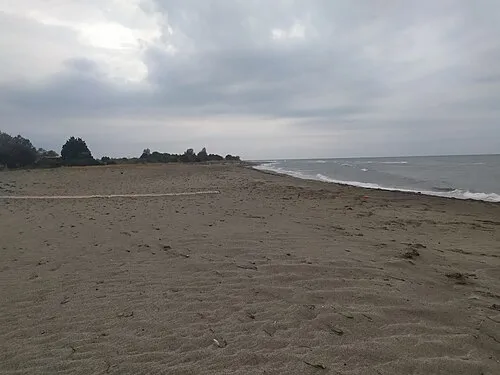 Kouloura Beach Beach, Nomós Larísis22 km N
Sources & licences
Data last updated: · 2 independent sources