Mathitikes Kataskinosis Larisas
Local name: Μαθητικές Κατασκηνώσεις
Located in Tempi, Nomós Larísis Coordinates: 39°55′56″ N 22°33′34″ E
- Elevation
- 515 m
- above sea level
- Local time
- UTC+02:00
- Europe/Athens · UTC+02:00
- Airports
- KZI Kozani National Airport Filippos73 km
- SKG Thessaloniki Macedonia International Airport74 km
About Mathitikes Kataskinosis Larisas
Mathitikes Kataskinosis Larisas is a village. Location: Tempi, Nomós Larísis. Elevation: 515 m. The best months to visit are May–June, September. The nearest airport is Kozani National Airport Filippos (73 km). Nearby sights include Platamonas Beach and Nei Pori Beach.
Climate of Mathitikes Kataskinosis Larisas
Best months for sightseeingBest months for sightseeing: May–June, September.
This month · November
Outside the best season
Day 12° · Night 5° · Rain 58 mm
- Hottest month
- July (day 29°)
- Coldest month
- January (night 0°)
- Wettest month
- November (58 mm)
- Driest month
- August (23 mm)
Bars: average monthly low and high temperature. Below: precipitation. Monthly averages for 1970–2000 at about 18 km resolution, adjusted for elevation. Highlighted months are mild and relatively dry. Source: WorldClim 2.1 (CC BY 4.0).
Show values as a table
| Month | Jan | Feb | Mar | Apr | May | Jun | Jul | Aug | Sep | Oct | Nov | Dec |
|---|---|---|---|---|---|---|---|---|---|---|---|---|
| Average high (°C) | 7° | 8° | 11° | 16° | 22° | 27° | 29° | 28° | 24° | 18° | 12° | 8° |
| Average low (°C) | 0° | 1° | 3° | 6° | 10° | 15° | 17° | 17° | 13° | 9° | 5° | 1° |
| Precipitation (mm) | 39 | 42 | 45 | 46 | 44 | 28 | 25 | 23 | 27 | 51 | 58 | 50 |
How to get to Mathitikes Kataskinosis Larisas
The nearest airport is Kozani National Airport Filippos (KZI), 73 km to the northwest as the crow flies. For international flights: Thessaloniki Macedonia International Airport (SKG) (74 km). The nearest large city is Athens, 239 km to the southeast.
Airports
- Kozani National Airport Filippos (KZI) Kozani 73 kmnorthwest
- Thessaloniki Macedonia International Airport (SKG) Thessaloniki 74 kmnortheast
- Nea Anchialos National Airport (VOL) Nea Anchialos 82 kmsouth
Nearby large cities
- Athens Population: 664K 239 kmsoutheast
- Piraeus Population: 163.7K 240 kmsoutheast
- Plovdiv Population: 329.5K 308 kmnortheast
- Sofia Population: 1.2M 314 kmnorth
- Çanakkale Population: 143.6K 330 kmeast
Straight-line distances; road distances are longer. Airport data: OurAirports.
Day trips from Mathitikes Kataskinosis Larisas
Within 100 km: 17 historic and cultural sites, 2 natural sites, 32 lakes, rivers and coasts.
0–25 km7 places
- Stomio Beach Beach 17 kmSE
- Skotina Beach Beach 11 kmN
- Pantelehmonas Beach Beach 10 kmN
- Platamonas Beach Beach 9 kmNE
25–60 km4 places
- Ágios Antónios Attraction 38 kmN
- Agia Triada Attraction 38 kmN
- Yeni Mosque Attraction 35 kmS
- Archaeological Museum of Dion Museum 27 kmN
60–100 km40 places
- Monastery of Agios Athanasios Sfinissis Attraction 68 kmN
- Dionisiou Beach Beach 69 kmNE
- Chorefto Beach Beach 72 kmSE
- Ntammouchari Beach Beach 79 kmSE
Straight-line distances.
Nearby attractions & nature
Everything nearby-
Platamonas Beach Beach, Dio-Olympos8.6 km NE
-
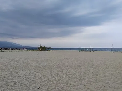 Nei Pori Beach Beach, Dio-Olympos9 km NE
-
Nea Mesagkala Beach Beach, Tempi12 km E
-
Pantelehmonas Beach Beach, Dio-Olympos9.6 km N
-
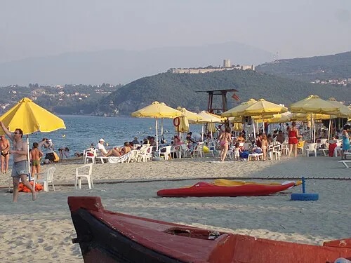 Skotina Beach Beach, Dio-Olympos11 km N
-
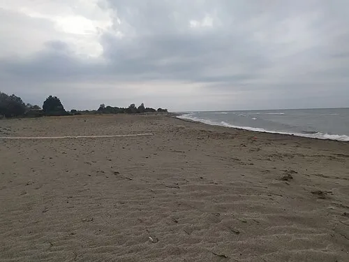 Kouloura Beach Beach, Nomós Larísis13 km E
Sources & licences
Data last updated: · 2 independent sources