Rio–Antirrio Bridge
Located in Nafpaktia, Aitoloakarnania Coordinates: 38°19′15″ N 21°46′23″ E

- Local time
- UTC+02:00
- Europe/Athens · UTC+02:00
- Airports
- GPA Patras Araxos Agamemnon Airport36 km
- ZTH Zakynthos International Airport "Dionysios Solomos"100 km
About Rio–Antirrio Bridge
Rio–Antirrio Bridge is a landmark. Location: Nafpaktia, Aitoloakarnania.
The Rio–Antirrio Bridge (Greek: Γέφυρα Ρίου–Αντιρρίου), officially the Charilaos Trikoupis Bridge, is one of the world's longest multi-span cable-stayed bridges and longest of the fully suspended type. It crosses the Rion Strait between the Gulf of Corinth and Gulf of Patras, linking the town of Rio on the Peloponnese peninsula to Antirrio on mainland Greece by road. It opened one day before the Athens 2004 Summer Olympics, on 12 August 2004, and was used to transport the Olympic flame.
Source: Wikipedia · CC BY-SA 4.0
At a glance
- Built
- 2004
- Opened
- 2004
- Height
- 164 m
- Length
- 2.9 km
- Official website
- gefyra.gr
Source: Wikidata
Photos of Rio–Antirrio Bridge
-

Holger Uwe Schmitt · CC BY-SA 4.0 -

Julien Seguinot from Lille, France · CC BY-SA 2.0 -

Julien Seguinot from Lille, France · CC BY-SA 2.0 -

Nikoskpa · CC BY-SA 4.0 -

Annatsach · CC BY-SA 4.0


Climate of Rio–Antirrio Bridge
Best months for sightseeingBest months for sightseeing: May, October.
This month · November
A wet month
Day 16° · Night 7° · Rain 128 mm
- Hottest month
- July (day 31°)
- Coldest month
- January (night 3°)
- Wettest month
- November (128 mm)
- Driest month
- July (11 mm)
Bars: average monthly low and high temperature. Below: precipitation. Monthly averages for 1970–2000 at about 18 km resolution, adjusted for elevation. Highlighted months are mild and relatively dry. Source: WorldClim 2.1 (CC BY 4.0).
Show values as a table
| Month | Jan | Feb | Mar | Apr | May | Jun | Jul | Aug | Sep | Oct | Nov | Dec |
|---|---|---|---|---|---|---|---|---|---|---|---|---|
| Average high (°C) | 12° | 12° | 14° | 18° | 23° | 28° | 31° | 31° | 27° | 22° | 16° | 13° |
| Average low (°C) | 3° | 3° | 5° | 8° | 12° | 15° | 17° | 17° | 15° | 11° | 7° | 4° |
| Precipitation (mm) | 92 | 91 | 71 | 53 | 30 | 14 | 11 | 13 | 30 | 81 | 128 | 116 |
How to get to Rio–Antirrio Bridge
The nearest airport is Patras Araxos Agamemnon Airport (GPA), 36 km to the southwest as the crow flies. For international flights: Zakynthos International Airport "Dionysios Solomos" (ZTH) (100 km). The nearest large city is Piraeus, 170 km to the east.
Airports
- Patras Araxos Agamemnon Airport (GPA) Patras 36 kmsouthwest
- Zakynthos International Airport "Dionysios Solomos" (ZTH) Zakynthos 100 kmsouthwest
- Aktion National Airport (PVK) Preveza 110 kmnorthwest
Nearby large cities
- Piraeus Population: 163.7K 170 kmeast
- Athens Population: 664K 175 kmeast
- Tirana Population: 418.5K 373 kmnorthwest
- Durrës Population: 195.9K 388 kmnorthwest
Straight-line distances; road distances are longer. Airport data: OurAirports.
Day trips from Rio–Antirrio Bridge
Within 100 km: 17 historic and cultural sites, 1 natural site, 21 lakes, rivers and coasts.
0–25 km3 places
- Rígani Mountain 15 kmN
- Panagia Panaxiotissa Attraction 15 kmNW
- Pampeloponnisiako Stadium Landmark 11 kmS
25–60 km9 places
- Nisída Sáranta Island 29 kmW
- Nisídes Falarídes Island 58 kmW
- Lakopetra Beach Beach 30 kmSW
- Nisída Vasilikó Island 27 kmW
60–100 km27 places
- Ierá Moní Odigítrias Attraction 84 kmE
- Moní Genesíou Theotókou Damástas Attraction 79 kmNE
- Moni Tatárnas Attraction 73 kmN
- Moní Antinítsis Attraction 93 kmNE
Straight-line distances.
Nearby attractions & nature
Everything nearby-
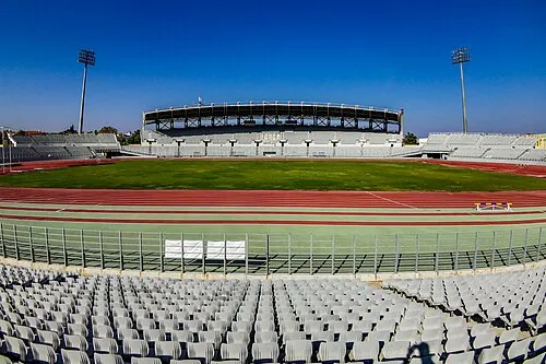 Pampeloponnisiako Stadium Landmark, Patras11 km S
-
 Panagia Panaxiotissa Attraction, Nafpaktia15 km NW
-
Rígani Mountain, Nafpaktia15 km N
Nearest towns and villages
-
Antirrio Village, Nafpaktia1.3 km NW
-
Rio Town, Patras3 km S
-
Spartoráchi Village, Nafpaktia1.8 km NW
-
Myrtiá Village, Nafpaktia1.8 km NW
Sources & licences
Data last updated: · 2 independent sources