Vogatsiko
Local name: Βογατσικό
Located in Argos Orestiko, Kastoria Coordinates: 40°24′52″ N 21°22′49″ E
- Population
- 438
- 438
- Elevation
- 778 m
- above sea level
- Local time
- UTC+02:00
- Europe/Athens · UTC+02:00
- Airports
- KZI Kozani National Airport Filippos42 km
- IOA Ioannina King Pyrrhus National Airport93 km
About Vogatsiko
Vogatsiko is a village. Location: Argos Orestiko, Kastoria. Population: 438. Elevation: 778 m.
Vogatsiko (Greek: Βογατσικό) is a village and a community in northern Greece in the geographic region of Macedonia, located at the southeast corner of the Kastoria regional unit. Between 1997 and 2010, it was the seat of the municipality of Ion Dragoumis. The population was 438 at the 2021 census. It is surrounded by mountains on three sides and overlooks a valley through which the Aliakmon river passes.
Source: Wikipedia · CC BY-SA 4.0
Population of Vogatsiko over time
| 1991 | 927 | |
|---|---|---|
| 2001 | 793 | |
| 2011 | 543 | |
| 2021 | 434 |
Censuses and official estimates; source: Wikidata.
Climate of Vogatsiko
Best months for sightseeingBest months for sightseeing: May–June, September.
This month · November
A cold month
Day 11° · Night 3° · Rain 87 mm
- Hottest month
- July (day 28°)
- Coldest month
- January (night -2°)
- Wettest month
- November (87 mm)
- Driest month
- July (39 mm)
Bars: average monthly low and high temperature. Below: precipitation. Monthly averages for 1970–2000 at about 18 km resolution, adjusted for elevation. Highlighted months are mild and relatively dry. Source: WorldClim 2.1 (CC BY 4.0).
Show values as a table
| Month | Jan | Feb | Mar | Apr | May | Jun | Jul | Aug | Sep | Oct | Nov | Dec |
|---|---|---|---|---|---|---|---|---|---|---|---|---|
| Average high (°C) | 6° | 7° | 11° | 16° | 21° | 26° | 28° | 28° | 24° | 18° | 11° | 8° |
| Average low (°C) | -2° | -1° | 1° | 5° | 9° | 12° | 15° | 15° | 11° | 7° | 3° | 0° |
| Precipitation (mm) | 63 | 56 | 59 | 62 | 61 | 42 | 39 | 40 | 46 | 83 | 87 | 71 |
How to get to Vogatsiko
The nearest airport is Kozani National Airport Filippos (KZI), 42 km to the east as the crow flies. For international flights: Ohrid St. Paul the Apostle Airport (OHD) (101 km). The nearest large city is Sofia, 301 km to the northeast.
Airports
- Kozani National Airport Filippos (KZI) Kozani 42 kmeast
- Ioannina King Pyrrhus National Airport (IOA) Ioannina 93 kmsouthwest
- Ohrid St. Paul the Apostle Airport (OHD) Ohrid 101 kmnorthwest
Nearby large cities
- Sofia Population: 1.2M 301 kmnortheast
- Niš Population: 250K 326 kmnorth
- Piraeus Population: 163.7K 337 kmsoutheast
- Athens Population: 664K 338 kmsoutheast
- Plovdiv Population: 329.5K 342 kmnortheast
Straight-line distances; road distances are longer. Airport data: OurAirports.
Day trips from Vogatsiko
Within 100 km: 16 historic and cultural sites, 6 natural sites.
0–25 km2 places
- Moní Agíon Anargyron Attraction 19 kmN
- Byzantine Museum of Kastoria Museum 15 kmNW
25–60 km9 places
- Pindus Mountains Mountain 53 kmSW
- Óros Vérno Mountain 30 kmN
- Baltan Mountain 54 kmN
- Moní Taksiarchón Tsoúkas Attraction 26 kmW
60–100 km11 places
- Monastery of Agios Athanasios Sfinissis Attraction 94 kmE
- Voras Mountain 67 kmNE
- Moni pantanassas Attraction 88 kmSW
- Ágios Antónios Attraction 94 kmE
Straight-line distances.
Nearby attractions & nature
Everything nearby-
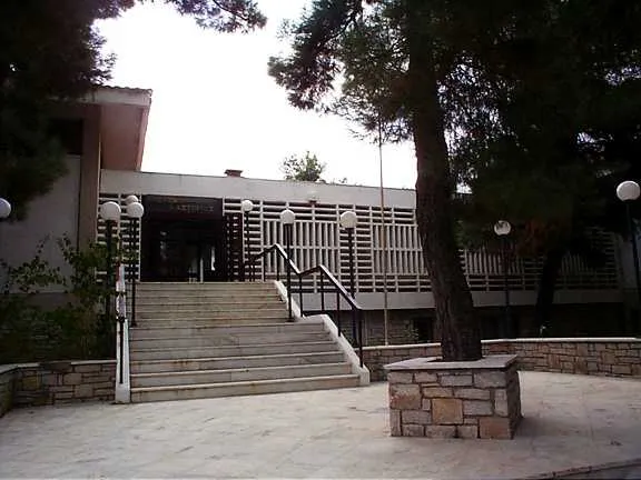 Byzantine Museum of Kastoria Museum, Kastoria15 km NW
-
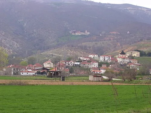 Moní Agíon Anargyron Attraction, Kastoria19 km N
Sources & licences
Data last updated: · 2 independent sources