Mátramindszent
Located in Nógrád megye, Hungary Coordinates: 47°59′08″ N 19°56′25″ E
- Population
- 842
- 842
- Elevation
- 247 m
- above sea level
- Local time
- UTC+01:00
- Europe/Budapest · UTC+01:00
About Mátramindszent
Mátramindszent is a village. Location: Nógrád megye, Hungary. Population: 842. Elevation: 247 m.
Mátramindszent is a village in Nógrád County, Hungary, in the Mátra mountain range, at the bottom of the north side of the Galya-tető peak. The Mindszenti creek flows through the settlement. As of 2022 census, it has a population of 707 (see Demographics). The village is located 2.0 km from (Nr. 84) Kisterenye–Kál-Kápolna railway line, 11.7 km from the main road 21 and 52.1 km from the M25 expressway.
Read more on Wikipedia Text: Wikipedia contributors · CC BY-SA 4.0 · shortened
At a glance
- Area
- 16.7 km²
Source: Wikidata
In comparison
- No. 60 of 126 places in Nógrád megye by population
- Nearest larger town: Dorogháza, 3 km W
- 2 sights and natural places within 10 km Lajszka, Kisterenye Ghetto
Nearby attractions & nature
Everything nearby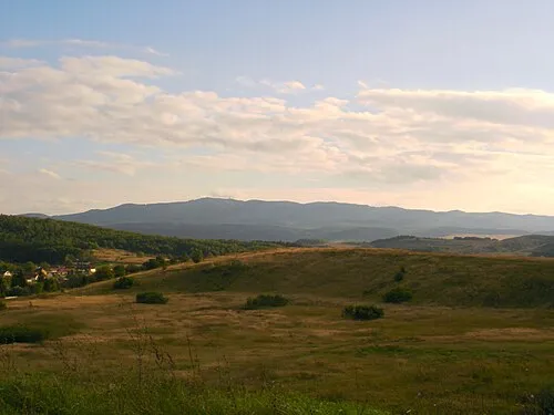
Sources & licences
Data last updated: · 2 independent sources