Inisheer
Local name: Inis Oírr
Located in County Galway, Connacht Coordinates: 53°03′27″ N 9°31′38″ W
- Elevation
- 52 m
- above sea level
- Local time
- UTC+00:00
- Europe/Dublin · UTC+00:00
- Population
- 249
- 249
- Airports
- SNN Shannon Airport57 km
- KIR Kerry Airport98 km
About Inisheer
Inisheer is an island. Location: County Galway, Connacht. Population: 249.
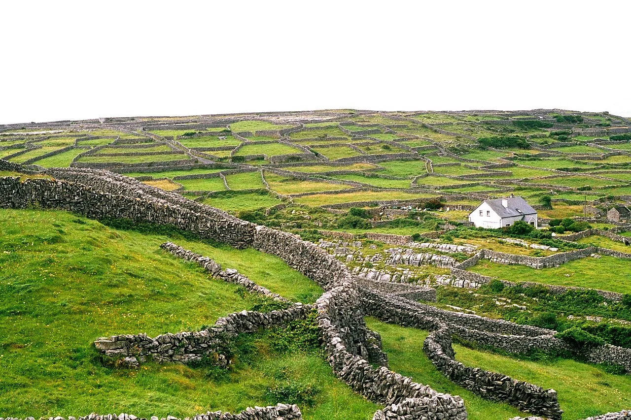
Inisheer (Irish: Inis Oírr [ˈɪnʲɪʃ iːɾˠ], Inis Thiar [ˈɪnʲɪʃ hiəɾˠ] or Inis Oirthir [ˈɪnʲɪʃ ˈɛɾʲhəɾʲ]) is the smallest and most easterly of the three Aran Islands in Galway Bay, Ireland. With 343 residents as of the 2022 census, it is second-most populous of the Arans. Caomhán of Inis Oírr is the island's patron saint. There are five small settlements: Baile Thiar, Chapeltown (Baile an tSéipéil), Castle Village (Baile an Chaisleáin), Baile an Fhormna and Baile an Lorgain.
Source: Wikipedia · CC BY-SA 4.0
At a glance
- Area
- 8 km²
Source: Wikidata
Climate of Inisheer
Best months for sightseeingBest months for sightseeing: June–August.
This month · November
A wet month
Day 11° · Night 6° · Rain 141 mm
- Hottest month
- August (day 18°)
- Coldest month
- January (night 4°)
- Wettest month
- November (141 mm)
- Driest month
- April (65 mm)
Bars: average monthly low and high temperature. Below: precipitation. Monthly averages for 1970–2000 at about 18 km resolution, adjusted for elevation. Highlighted months are mild and relatively dry. Source: WorldClim 2.1 (CC BY 4.0).
Show values as a table
| Month | Jan | Feb | Mar | Apr | May | Jun | Jul | Aug | Sep | Oct | Nov | Dec |
|---|---|---|---|---|---|---|---|---|---|---|---|---|
| Average high (°C) | 9° | 9° | 10° | 12° | 14° | 16° | 18° | 18° | 16° | 14° | 11° | 10° |
| Average low (°C) | 4° | 4° | 4° | 5° | 8° | 10° | 12° | 12° | 10° | 8° | 6° | 5° |
| Precipitation (mm) | 132 | 87 | 87 | 65 | 76 | 72 | 78 | 94 | 118 | 130 | 141 | 140 |
How to get to Inisheer
The nearest airport is Shannon Airport (SNN), 57 km to the southeast as the crow flies. The nearest large city is Limerick, 75 km to the southeast.
Airports
- Shannon Airport (SNN) Shannon 57 kmsoutheast
- Kerry Airport (KIR) Farranfore 98 kmsouth
- Ireland West Airport Knock (NOC) Charlestown 106 kmnortheast
Nearby large cities
- Limerick Population: 102.3K 75 kmsoutheast
- Cork Population: 224K 148 kmsoutheast
- Dublin Population: 1M 221 kmeast
- Belfast Population: 348K 293 kmnortheast
Straight-line distances; road distances are longer. Airport data: OurAirports.
Nearest towns and villages
-
Baile an tSéipéil Village, County Galway0.6 km N
-
Baile an Chaisleáin Village, County Galway0.9 km NE
-
Baile an Lurgain Village, County Galway1 km N
-
An Baile Thiar Village, County Galway1.1 km N
-
Baile an Fhormna Village, County Galway1.2 km E
-
Furmina Village, County Clare1.1 km SE
Nearby attractions & nature
Everything nearby-
Inisheer Lighthouse Landmark, County Galway1.3 km S
-
Sandhead Natural site, County Galway5.1 km NW
-
Inishman Island, County Galway5.5 km NW
-
Illaunanaur Island, County Galway8.4 km NW
-
Aran Islands Island, County Galway8.2 km NW
-
Crab Island Island, County Clare8.9 km SE
-
Oileán na Tuí Island, County Galway9.5 km NW
-
Dogs Head Natural site, County Galway9.2 km NW
Sources & licences
Data last updated: · 2 independent sources