- Elevation
- 12 m
- above sea level
- Local time
- UTC+00:00
- Europe/Dublin · UTC+00:00
- Airports
- NOC Ireland West Airport Knock77 km
- CFN Donegal Airport150 km
About Roy Lough
Roy Lough is a lake. Location: County Mayo, Connacht. Elevation: 12 m. The best months to visit are June–August. The nearest airport is Ireland West Airport Knock (77 km). Nearby sights include Rath Hill and Blacksod Bay.
Climate of Roy Lough
Best months for sightseeingBest months for sightseeing: June–August.
This month · November
A wet month
Day 11° · Night 5° · Rain 135 mm
- Hottest month
- August (day 18°)
- Coldest month
- February (night 3°)
- Wettest month
- October (137 mm)
- Driest month
- April (66 mm)
Bars: average monthly low and high temperature. Below: precipitation. Monthly averages for 1970–2000 at about 18 km resolution, adjusted for elevation. Highlighted months are mild and relatively dry. Source: WorldClim 2.1 (CC BY 4.0).
Show values as a table
| Month | Jan | Feb | Mar | Apr | May | Jun | Jul | Aug | Sep | Oct | Nov | Dec |
|---|---|---|---|---|---|---|---|---|---|---|---|---|
| Average high (°C) | 9° | 9° | 10° | 12° | 14° | 16° | 18° | 18° | 16° | 14° | 11° | 9° |
| Average low (°C) | 3° | 3° | 4° | 5° | 7° | 10° | 12° | 12° | 10° | 8° | 5° | 4° |
| Precipitation (mm) | 133 | 92 | 99 | 66 | 68 | 70 | 72 | 97 | 108 | 137 | 135 | 132 |
How to get to Roy Lough
The nearest airport is Ireland West Airport Knock (NOC), 77 km to the east as the crow flies. The nearest large city is Limerick, 181 km to the southeast.
Airports
- Ireland West Airport Knock (NOC) Charlestown 77 kmeast
- Donegal Airport (CFN) Donegal 150 kmnortheast
- Shannon Airport (SNN) Shannon 168 kmsoutheast
Nearby large cities
- Limerick Population: 102.3K 181 kmsoutheast
- Dublin Population: 1M 258 kmeast
- Cork Population: 224K 262 kmsoutheast
- Belfast Population: 348K 268 kmeast
Straight-line distances; road distances are longer. Airport data: OurAirports.
Nearest towns and villages
-
Doohooma Village, County Mayo0.9 km SE
-
Roy Village, County Mayo1.4 km NW
-
Tullaghanbaun Village, County Mayo2.2 km E
-
Dooyork Village, County Mayo2.9 km N
-
Trawnanaskil Village, County Mayo3.4 km E
-
Tullaghanduff Village, County Mayo3.8 km NE
Nearby attractions & nature
Everything nearby-
Rath Hill Mountain, County Mayo1 km E
-
Blacksod Bay Natural site, County Mayo4.4 km W
-
Gubnahardia Strand Beach, County Mayo6.4 km S
-
Fahy Lough Lake, County Mayo5.8 km SE
-
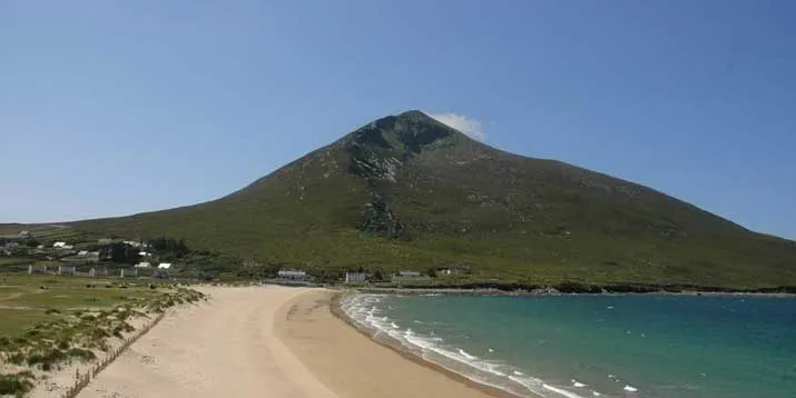 Slievemore Mountain, County Mayo11 km SW
-
Gubbiacorraun Natural site, County Mayo7.8 km SE
-
Tullaghan Bay Natural site, County Mayo5.8 km E
-
Knocknagnauve Mountain, County Mayo8.8 km W
Sources & licences
Data last updated: