- Elevation
- 169 m
- above sea level
- Local time
- UTC+00:00
- Europe/Dublin · UTC+00:00
- Airports
- NOC Ireland West Airport Knock34 km
- CFN Donegal Airport111 km
About Knockroe
Knockroe is a village. Location: County Sligo, Connacht. Elevation: 169 m. The best months to visit are June–August. The nearest airport is Ireland West Airport Knock (34 km). Nearby sights include Annaghgowla Island and Carricknahorna.
Climate of Knockroe
Best months for sightseeingBest months for sightseeing: June–August.
This month · November
A wet month
Day 9° · Night 4° · Rain 169 mm
- Hottest month
- July (day 18°)
- Coldest month
- January (night 1°)
- Wettest month
- January (177 mm)
- Driest month
- May (87 mm)
Bars: average monthly low and high temperature. Below: precipitation. Monthly averages for 1970–2000 at about 18 km resolution, adjusted for elevation. Highlighted months are mild and relatively dry. Source: WorldClim 2.1 (CC BY 4.0).
Show values as a table
| Month | Jan | Feb | Mar | Apr | May | Jun | Jul | Aug | Sep | Oct | Nov | Dec |
|---|---|---|---|---|---|---|---|---|---|---|---|---|
| Average high (°C) | 7° | 7° | 9° | 11° | 14° | 16° | 18° | 18° | 16° | 12° | 9° | 7° |
| Average low (°C) | 1° | 2° | 3° | 4° | 6° | 9° | 11° | 10° | 8° | 6° | 4° | 2° |
| Precipitation (mm) | 177 | 126 | 142 | 88 | 87 | 89 | 94 | 120 | 133 | 168 | 169 | 172 |
How to get to Knockroe
The nearest airport is Ireland West Airport Knock (NOC), 34 km to the southwest as the crow flies. The nearest large city is Limerick, 155 km to the south.
Airports
- Ireland West Airport Knock (NOC) Charlestown 34 kmsouthwest
- Donegal Airport (CFN) Donegal 111 kmnorth
- City of Derry Airport (LDY) Derry, Derry and Strabane 135 kmnortheast
Nearby large cities
- Limerick Population: 102.3K 155 kmsouth
- Dublin Population: 1M 160 kmsoutheast
- Belfast Population: 348K 169 kmeast
- Cork Population: 224K 239 kmsouth
- Glasgow Population: 626.4K 331 kmnortheast
Straight-line distances; road distances are longer. Airport data: OurAirports.
Day trips from Knockroe
Within 100 km: 228 historic and cultural sites, 601 natural sites, 1,440 lakes, rivers and coasts.
0–25 km229 places
- Drumman’s Island Island 10 kmSE
- Bullock Island Island 9 kmSE
- Stag Island Island 7 kmSE
- O’Reilly’s Island Island 20 kmE
25–60 km650 places
- Strandhill Beach Beach 30 kmNW
- Dunmoran Strand Beach 35 kmNW
- Inishteige Island 40 kmNE
- Inishmurray Island 48 kmNW
60–100 km1,390 places
- Inishlyre Island 89 kmW
- Station Island Island 70 kmNE
- Rathlin O’Birne Island Island 75 kmNW
- Pig Island Island 95 kmW
Straight-line distances.
Nearby attractions & nature
Everything nearby-
Annaghgowla Island Island, County Sligo3.2 km N
-
Carricknahorna Mountain, County Sligo1.6 km SW
-
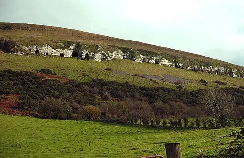 Bricklieve Mountains Mountain, County Sligo1.9 km NW
-
Lough Annaminvrack Lake, County Sligo1.9 km N
-
Muck Island Island, County Sligo2.4 km E
-
Inishbeg Island, County Sligo2.5 km NE
Sources & licences
Data last updated: