Sligo
Local name: Sligeach
Located in County Sligo, Connacht Coordinates: 54°16′11″ N 8°28′10″ W

- Population
- 20,608
- 20.6K
- Elevation
- 13 m
- above sea level
- Local time
- UTC+00:00
- Europe/Dublin · UTC+00:00
- Airports
- NOC Ireland West Airport Knock46 km
- CFN Donegal Airport87 km
About Sligo
Sligo is a city. Location: County Sligo, Connacht. Population: 20,608. Elevation: 13 m.
Sligo (; Irish: Sligeach [ˈʃl̠ʲɪɟəx]; lit. 'abounding in shells') is a coastal seaport and the county town of County Sligo, Ireland, within the western province of Connacht. With a population of 20,608 in 2022, it is the county's largest urban centre (constituting 29.5% of the county's population) and the 24th largest in the Republic of Ireland. Sligo is a commercial and cultural centre situated on the west coast of Ireland. Its surrounding coast and countryside, as well as its connections to the poet W. B.
Source: Wikipedia · CC BY-SA 4.0
Travel notes for Sligo
From Wikivoyage
Sligo (Sligeach in Irish, meaning shelly place) is the principal town in County Sligo in Northwest Ireland & Lakelands. In 2022 it had a population of 21,000, with the service sector the main employer.
Understand+
Sligo in Irish is Sligeach (say "SHLEE-gok"), meaning the place of shells, from the abundant shellfish in its tidal river and bay. The bay's entrance is blocked by three islands, Maguins and Coney near the south shore, and Oyster Island in the main channel by the north shore. So the tides are funnelled, twice a day rising and twice ebbing, as all the water in the bay rushes past these obstructions. That's hazardous for swimming but great for shellfish, which catch their food from the current.
Get in+
By plane:
"I know that I shall meet my fate / somewhere among the clouds above" - an Irish Airman foresees the 2011 collapse of Sligo Airport, perhaps.
Best option is Dublin (DUB IATA), with good flight connections and onward public transport - Bus 23 runs direct from the airport to Sligo, see below.
You could also fly into Belfast or Derry and hire a car. Knock Airport is closer, 55 km south in County Mayo, but has few flights.
By train:
Trains from Dublin Connolly take 3 hr 20 min to Sligo via Drumcondra, Maynooth, Mullingar, Longford, Dromod, Carrick-on-Shannon, Boyle and Ballymote. There are 7 M-F, 6 Sa and 5 Sunday, see Irish Rail for timetables, fares and online tickets.
1 Sligo Railway and Bus Station are together on Knappagh Rd just west of town centre. The railway station is called MacDiarmada, for Seán MacDiarmada (1883-1916), a leading member of the Irish Republican Brotherhood executed for his part in the Easter Rising. The station has a ticket office staffed M-F 6:30AM-2:30PM, ticket machines and toilets. There is step-free access to the platforms.
By bus:
Expressway Bus 23 runs six times a day from Dublin Busáras, taking four hours to Sligo via Dublin Airport, Lucan, Maynooth, Mullingar, Longford, Dromod and Carrick-on-Shannon.
Expressway Bus 64 runs every two hours from Derry via Letterkenny and Donegal Town to Sligo, continuing to Knock village and airport, Tuam and Galway.
From Belfast take Goldliner Bus 261 to Enniskillen then change for Bus 64 or 458.
Bus Feda 964 runs twice a day from Galway via Tuam and Knock to Sligo, continuing to Donegal Town, Letterkenny and Gweedore. Bus 480 also runs twice a day between Donegal and Sligo.
Bus Éireann 458 runs every couple of hours from Enniskillen to Belcoo, Glenfarne, Manorhamilton, Glencar, Sligo, then west along the coast to Enniscrone and Ballina.
Local Link Bus 572 runs three times M-Sa from Drumshanbo to Sligo (70 min) and the university.
By road:
Source: Wikivoyage · CC BY-SA 4.0 · abridged
Twin towns and sister cities of Sligo
- Tallahassee· United States
Source: Wikidata. Only places with a page on this site are shown.
Climate of Sligo
Best months for sightseeingBest months for sightseeing: June–August.
This month · November
A wet month
Day 10° · Night 5° · Rain 155 mm
- Hottest month
- July (day 19°)
- Coldest month
- January (night 3°)
- Wettest month
- January (156 mm)
- Driest month
- April (80 mm)
Bars: average monthly low and high temperature. Below: precipitation. Monthly averages for 1970–2000 at about 18 km resolution, adjusted for elevation. Highlighted months are mild and relatively dry. Source: WorldClim 2.1 (CC BY 4.0).
Show values as a table
| Month | Jan | Feb | Mar | Apr | May | Jun | Jul | Aug | Sep | Oct | Nov | Dec |
|---|---|---|---|---|---|---|---|---|---|---|---|---|
| Average high (°C) | 8° | 8° | 10° | 12° | 15° | 17° | 19° | 19° | 16° | 13° | 10° | 9° |
| Average low (°C) | 3° | 3° | 4° | 5° | 7° | 10° | 12° | 12° | 10° | 7° | 5° | 4° |
| Precipitation (mm) | 156 | 109 | 127 | 80 | 82 | 85 | 91 | 112 | 126 | 152 | 155 | 156 |
How to get to Sligo
The nearest airport is Ireland West Airport Knock (NOC), 46 km to the southwest as the crow flies. The nearest large city is Belfast, 169 km to the east.
Airports
- Ireland West Airport Knock (NOC) Charlestown 46 kmsouthwest
- Donegal Airport (CFN) Donegal 87 kmnorth
- City of Derry Airport (LDY) Derry, Derry and Strabane 121 kmnortheast
Nearby large cities
- Belfast Population: 348K 169 kmeast
- Limerick Population: 102.3K 179 kmsouth
- Dublin Population: 1M 180 kmsoutheast
- Cork Population: 224K 264 kmsouth
- Glasgow Population: 626.4K 322 kmnortheast
Straight-line distances; road distances are longer. Airport data: OurAirports.
Nearby attractions & nature
Everything nearby-
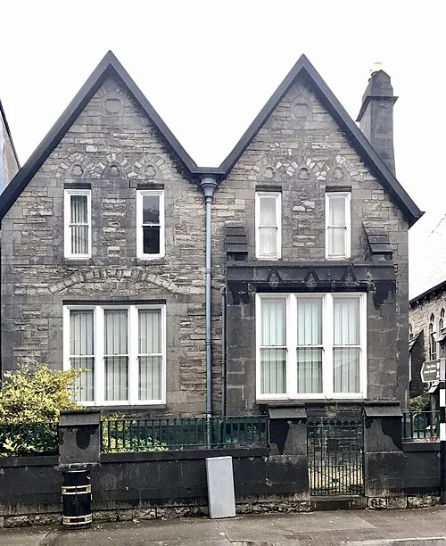 Sligo County Museum Museum, County Sligo0.4 km NW
-
Sligo Abbey Attraction, County Sligo0.1 km N
-
Showgrounds Landmark, County Sligo1.2 km W
-
Carns Hill Mountain, County Sligo2 km SE
-
Annagh Bay Natural site, County Sligo3 km E
-
Tobernalt Bay Natural site, County Sligo3.3 km SE
-
River Garvogue River, County Sligo1.8 km NW
-
Annagh Island Island, County Sligo3.4 km E
Sources & licences
Data last updated: · 2 independent sources