Brandon Hill
Local name: Cnoc Bhréanail
Located in County Kilkenny, Leinster Coordinates: 52°30′35″ N 6°58′27″ W
- Elevation
- 515 m
- above sea level
- Local time
- UTC+00:00
- Europe/Dublin · UTC+00:00
- Airports
- DUB Dublin Airport113 km
- ORK Cork International Airport128 km
About Brandon Hill
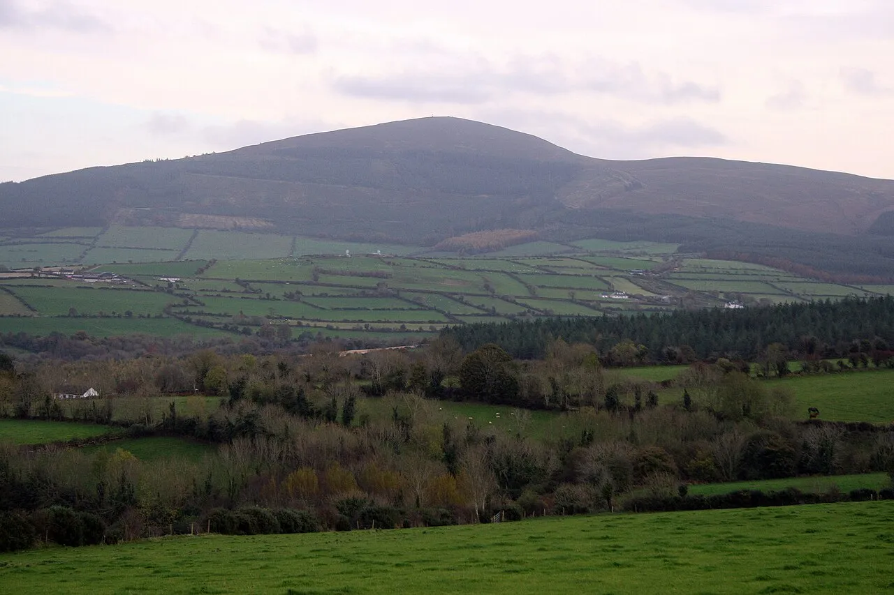
Brandon Hill is a mountain. Location: County Kilkenny, Leinster. Elevation: 515 m.
Brandon Hill (Irish: Cnoc Bhréanail) is the highest mountain in County Kilkenny, Ireland, with an elevation of 515 m (1,690 ft) and prominence at 448 m (1,470 ft). The South Leinster Way, a long-distance trail, meandering through the Barrow Valley and traverses Brandon Hill. The village of Graiguenamanagh and River Barrow are at the base of the hill. It is classified as a county high point, an Arderin, a Myrddyn Dewey, and a Marilyn.
Source: Wikipedia · CC BY-SA 4.0
At a glance
- Topographic prominence
- 450 m
Source: Wikidata
Climate of Brandon Hill
Best months for sightseeingBest months for sightseeing: July–August.
This month · November
A wet month
Day 8° · Night 2° · Rain 101 mm
- Hottest month
- July (day 17°)
- Coldest month
- January (night 0°)
- Wettest month
- January (114 mm)
- Driest month
- June (62 mm)
Bars: average monthly low and high temperature. Below: precipitation. Monthly averages for 1970–2000 at about 18 km resolution, adjusted for elevation. Highlighted months are mild and relatively dry. Source: WorldClim 2.1 (CC BY 4.0).
Show values as a table
| Month | Jan | Feb | Mar | Apr | May | Jun | Jul | Aug | Sep | Oct | Nov | Dec |
|---|---|---|---|---|---|---|---|---|---|---|---|---|
| Average high (°C) | 6° | 6° | 8° | 10° | 12° | 15° | 17° | 16° | 14° | 11° | 8° | 6° |
| Average low (°C) | 0° | 0° | 1° | 2° | 5° | 7° | 9° | 9° | 7° | 5° | 2° | 1° |
| Precipitation (mm) | 114 | 90 | 82 | 64 | 69 | 62 | 63 | 82 | 90 | 105 | 101 | 113 |
How to get to Brandon Hill
The nearest airport is Dublin Airport (DUB), 113 km to the northeast as the crow flies. The nearest large city is Dublin, 104 km to the northeast.
Airports
- Dublin Airport (DUB) Dublin 113 kmnortheast
- Cork International Airport (ORK) Cork 128 kmsouthwest
- Shannon Airport (SNN) Shannon 134 kmwest
Nearby large cities
- Dublin Population: 1M 104 kmnortheast
- Limerick Population: 102.3K 113 kmwest
- Cork Population: 224K 123 kmsouthwest
- Swansea Population: 300.4K 230 kmsoutheast
- Belfast Population: 348K 242 kmnorth
Straight-line distances; road distances are longer. Airport data: OurAirports.
Day trips from Brandon Hill
Within 100 km: 233 historic and cultural sites, 700 natural sites, 336 lakes, rivers and coasts.
0–25 km80 places
- Lough Cullin Lake 24 kmS
- White Mountain Mountain 10 kmE
- Mount Leinster Mountain 18 kmNE
- Knockroe Mountain 15 kmNE
25–60 km456 places
- Curracloe Beach Beach 44 kmE
- Saltee Islands Island 50 kmSE
- Lady’s Island Island 53 kmSE
- Keeragh Islands Island 39 kmSE
60–100 km733 places
- Wicklow Mountains Mountain 77 kmNE
- Capel Island Island 92 kmSW
- Lough Tay Lake 82 kmNE
- Rathmines and Rathgar Waterworks Lake 91 kmNE
Straight-line distances.
Nearest towns and villages
-
Graiguenamanagh Village, County Kilkenny3.6 km N
-
Inistioge Village, County Kilkenny6.5 km W
-
Ballygub Village, County Kilkenny3.7 km SW
-
Fiddaun Bridge Village, County Kilkenny3.9 km W
-
Tinnahinch Village, County Carlow3.7 km NE
-
Saint Mullins Village, County Carlow4 km SE
Nearby attractions & nature
Everything nearby-
Gorlnigh Wood Natural site, County Kilkenny0.8 km NW
-
Bahana Wood Natural site, County Carlow3.1 km E
-
Saddle Hill Mountain, County Kilkenny5.2 km W
-
Coppanagh Mountain, County Kilkenny5.6 km NW
-
Croghan Mountain, County Kilkenny6.2 km NW
-
Dranagh Mountain Mountain, County Carlow7.4 km E
-
Glencoum Wood Natural site, County Kilkenny6.1 km N
-
Carrigvahanagh Mountain, County Wexford8.2 km E
Sources & licences
Data last updated: · 2 independent sources