Saggart
Located in South Dublin, Leinster Coordinates: 53°16′49″ N 6°26′40″ W
- Population
- 3,133
- 3.1K
- Elevation
- 129 m
- above sea level
- Local time
- UTC+00:00
- Europe/Dublin · UTC+00:00
About Saggart
Saggart is a village. Location: South Dublin, Leinster. Population: 3,133. Elevation: 129 m.
Saggart (Irish: Teach Sagard) is a village in County Dublin, Ireland, south-west of Dublin city, in the local government area of South Dublin. It lies between the N7 (Naas Road), Rathcoole, Citywest and Tallaght. It is one of the fastest-growing settlements in Ireland, with its population doubling between 2011 and 2022. The village is in a townland and civil parish of the same name, in the barony of Newcastle.
Read more on Wikipedia Text: Wikipedia contributors · CC BY-SA 4.0 · shortened
In comparison
- No. 16 of 18 places in South Dublin by population
- Nearest larger town: Rathcoole, 2 km W
- 19 sights and natural places within 10 km Verschoyles Hill, Knockannavea
Nearby attractions & nature
Everything nearby-
Verschoyles Hill Mountain, South Dublin2.1 km S
-
Knockannavea Mountain, South Dublin3.9 km SE
-
Nangor Castle Historic site, South Dublin4.6 km N
-
Butter Mountain Mountain, County Wicklow7.2 km S
-
Saggart Hill Mountain, South Dublin4.3 km SW
-
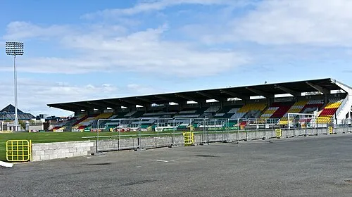 Tallaght Stadium Landmark, South Dublin4.7 km E
Sources & licences
Data last updated: · 2 independent sources