Buck Leary’s Cross Roads
Located in County Cork, Munster Coordinates: 51°57′47″ N 8°24′33″ W
- Elevation
- 101 m
- above sea level
- Local time
- UTC+00:00
- Europe/Dublin · UTC+00:00
- Airports
- ORK Cork International Airport15 km
- KIR Kerry Airport80 km
About Buck Leary’s Cross Roads
Buck Leary’s Cross Roads is a village. Location: County Cork, Munster. Elevation: 101 m. The best months to visit are June–August. The nearest airport is Cork International Airport (15 km). Nearby sights include Black Brook and Coolgreen Glen.
Climate of Buck Leary’s Cross Roads
Best months for sightseeingBest months for sightseeing: June–August.
This month · November
A wet month
Day 10° · Night 5° · Rain 126 mm
- Hottest month
- July (day 19°)
- Coldest month
- January (night 3°)
- Wettest month
- January (147 mm)
- Driest month
- June (60 mm)
Bars: average monthly low and high temperature. Below: precipitation. Monthly averages for 1970–2000 at about 18 km resolution, adjusted for elevation. Highlighted months are mild and relatively dry. Source: WorldClim 2.1 (CC BY 4.0).
Show values as a table
| Month | Jan | Feb | Mar | Apr | May | Jun | Jul | Aug | Sep | Oct | Nov | Dec |
|---|---|---|---|---|---|---|---|---|---|---|---|---|
| Average high (°C) | 8° | 8° | 10° | 12° | 15° | 17° | 19° | 19° | 17° | 13° | 10° | 9° |
| Average low (°C) | 3° | 3° | 4° | 5° | 7° | 10° | 12° | 11° | 10° | 8° | 5° | 4° |
| Precipitation (mm) | 147 | 115 | 101 | 64 | 70 | 60 | 61 | 75 | 93 | 126 | 126 | 139 |
How to get to Buck Leary’s Cross Roads
The nearest airport is Cork International Airport (ORK), 15 km to the southwest as the crow flies. The nearest large city is Cork, 8 km to the southwest.
Airports
- Cork International Airport (ORK) Cork 15 kmsouthwest
- Kerry Airport (KIR) Farranfore 80 kmwest
- Shannon Airport (SNN) Shannon 89 kmnorthwest
Nearby large cities
- Cork Population: 224K 8 kmsouthwest
- Limerick Population: 102.3K 79 kmnorth
- Dublin Population: 1M 211 kmnortheast
- Swansea Population: 300.4K 310 kmeast
- Belfast Population: 348K 337 kmnortheast
Straight-line distances; road distances are longer. Airport data: OurAirports.
Day trips from Buck Leary’s Cross Roads
Within 100 km: 167 historic and cultural sites, 856 natural sites, 628 lakes, rivers and coasts.
0–25 km134 places
- Rocky Island Island 16 kmSE
- Roaninish Island 14 kmSW
- Ringaskiddy Island Island 16 kmSE
- Little Island Island 8 kmS
25–60 km462 places
- Sovereign Islands Island 32 kmS
- Capel Island Island 39 kmE
- Ballycotton Island Island 33 kmSE
- Big Sovereign Island 32 kmS
60–100 km1,055 places
- Bush Island Island 84 kmN
- Whiddy Island Island 81 kmW
- Sherkin Island Island 89 kmSW
- Saint Thomas Island Island 82 kmN
Straight-line distances.
Nearby attractions & nature
Everything nearby-
Black Brook River, County Cork1.3 km W
-
Coolgreen Glen Natural site, County Cork3.4 km N
-
Fellsfort Historic site, County Cork5.2 km NE
-
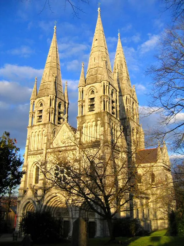 Saint Fin Barre's Cathedral Attraction, Cork City9.1 km SW
-
Butlerstown River River, County Cork4.3 km S
-
The Marina Natural site, County Cork7.2 km S
Other cities and towns in County Cork
-
Watergrasshill Village, County Cork7 km NE
-
 Sallybrook Village, County Cork3.5 km SE
-
Butlerstown Village, County Cork2.7 km SE
-
Ballinvinny North Village, County Cork3 km NE
-
Coole East Village, County Cork3.5 km W
-
Ballindeenisk Cross Roads Village, County Cork3.5 km N
Sources & licences
Data last updated: