Crosshaven
Local name: Bun an Tábhairne
Located in County Cork, Munster Coordinates: 51°47′54″ N 8°18′03″ W
- Population
- 2,577
- 2.6K
- Elevation
- 76 m
- above sea level
- Local time
- UTC+00:00
- Europe/Dublin · UTC+00:00
About Crosshaven
Crosshaven is a village. Location: County Cork, Munster. Population: 2,577. Elevation: 76 m.
Crosshaven (Irish: Bun an Tábhairne) is a village in County Cork, Ireland. It is in lower Cork Harbour at the mouth of the River Owenabue, across from Currabinny Wood, 15 km south-east of the centre of Cork city. Originally a fishing village, from the 19th century, the economy of the area became more reliant on a growing tourism industry.
Read more on Wikipedia Text: Wikipedia contributors · CC BY-SA 4.0 · shortened
At a glance
- Area
- 1.6 km²
Source: Wikidata
In comparison
- No. 22 of 121 places in County Cork by population
- Nearest larger town: Cobh, 6 km N
- 39 sights and natural places within 10 km Camden Fort, Curraghbinny Wood
Nearby attractions & nature
Everything nearby-
Curraghbinny Wood Natural site, County Cork1.3 km N
-
Camden Fort Historic site, County Cork1.2 km E
-
Myrtleville Bay Natural site, County Cork1.5 km S
-
Fort Meagher Historic site, County Cork2 km NE
-
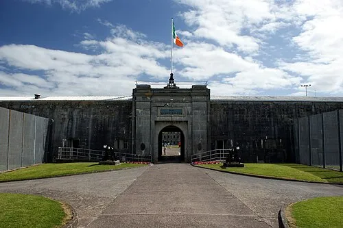 Spike Island Island, County Cork4.1 km N
-
Ringabella Bay Natural site, County Cork2.6 km S
Sources & licences
Data last updated: · 2 independent sources