- Elevation
- 9 m
- above sea level
- Local time
- UTC+00:00
- Europe/Dublin · UTC+00:00
- Airports
- KIR Kerry Airport79 km
- ORK Cork International Airport93 km
About Rock Island
Rock Island is a natural site. Location: County Cork, Munster. The best months to visit are June–August. The nearest airport is Kerry Airport (79 km). Nearby sights include Streek Head and Crookhaven Lighthouse.
Climate of Rock Island
Best months for sightseeingBest months for sightseeing: June–August.
This month · November
A wet month
Day 12° · Night 7° · Rain 156 mm
- Hottest month
- August (day 18°)
- Coldest month
- January (night 5°)
- Wettest month
- January (176 mm)
- Driest month
- June (75 mm)
Bars: average monthly low and high temperature. Below: precipitation. Monthly averages for 1970–2000 at about 18 km resolution, adjusted for elevation. Highlighted months are mild and relatively dry. Source: WorldClim 2.1 (CC BY 4.0).
Show values as a table
| Month | Jan | Feb | Mar | Apr | May | Jun | Jul | Aug | Sep | Oct | Nov | Dec |
|---|---|---|---|---|---|---|---|---|---|---|---|---|
| Average high (°C) | 10° | 10° | 10° | 12° | 14° | 16° | 18° | 18° | 17° | 14° | 12° | 10° |
| Average low (°C) | 5° | 5° | 5° | 6° | 8° | 11° | 12° | 12° | 11° | 9° | 7° | 6° |
| Precipitation (mm) | 176 | 141 | 120 | 78 | 89 | 75 | 76 | 108 | 126 | 151 | 156 | 173 |
How to get to Rock Island
The nearest airport is Kerry Airport (KIR), 79 km to the north as the crow flies. For international flights: Cork International Airport (ORK) (93 km). The nearest large city is Cork, 98 km to the northeast.
Airports
- Kerry Airport (KIR) Farranfore 79 kmnorth
- Cork International Airport (ORK) Cork 93 kmnortheast
- Shannon Airport (SNN) Shannon 146 kmnorth
Nearby large cities
- Cork Population: 224K 98 kmnortheast
- Limerick Population: 102.3K 152 kmnortheast
- Dublin Population: 1M 313 kmnortheast
Straight-line distances; road distances are longer. Airport data: OurAirports.
Day trips from Rock Island
Within 100 km: 73 historic and cultural sites, 737 natural sites, 507 lakes, rivers and coasts.
0–25 km110 places
- Sherkin Island Island 20 kmE
- Roancarrig Island Island 20 kmN
- Little Roancarrig Island Island 20 kmN
- Ringarogy Island Island 23 kmE
25–60 km603 places
- White Strand Beach 33 kmNW
- Derrynane Beach Beach 43 kmNW
- Whiddy Island Island 28 kmNE
- Sherky Island Island 38 kmN
60–100 km604 places
- Valentia Island Island 66 kmNW
- Banna Strand Beach 97 kmN
- Inch beach Beach 75 kmN
- Rossbeigh Strand Beach 68 kmN
Straight-line distances.
Nearest towns and villages
-
Sanavalley Village, County Cork0.3 km N
-
Rock Island Neighbourhood, County Cork0.2 km W
-
Coast Guard Cottages Neighbourhood, County Cork0.8 km SW
-
Spanishcove Neighbourhood, County Cork0.9 km N
-
Crookhaven Village, County Cork1.7 km SW
-
Colleras Village, County Cork1.1 km N
Nearby attractions & nature
Everything nearby-
Streek Head Natural site, County Cork0.9 km SE
-
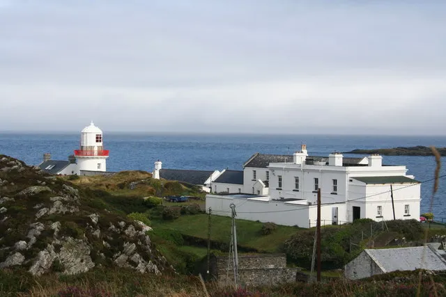 Crookhaven Lighthouse Landmark, County Cork0.3 km E
-
Crook Haven Natural site, County Cork1.4 km SW
-
Cloghanaculleen Mountain, County Cork2.6 km NW
-
Ballydivlin Bay Natural site, Munster2.4 km NE
-
Knocknamaddree Mountain, County Cork4.2 km NW
-
Lackenakea Mountain, County Cork3.8 km W
-
Knockaphuca Mountain, County Cork4.5 km N
More nature in Ireland
-
Mallavoye Mountain, County Cork4.6 km SW
-
Foilaloughaun Mountain, County Cork5.7 km NW
-
Balteen Mountain, County Cork5.9 km NW
-
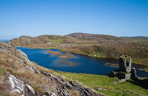 Three Castle Head Natural site, County Cork8.9 km W
-
Brow Head Natural site, County Cork5.5 km SW
-
Knockatassonig Mountain, County Cork6.3 km W
Sources & licences
Data last updated: