- Elevation
- 233 m
- above sea level
- Local time
- UTC+00:00
- Europe/Dublin · UTC+00:00
- Airports
- KIR Kerry Airport31 km
- ORK Cork International Airport90 km
About Lough Namweela
Lough Namweela is a lake. Location: County Kerry, Munster. Elevation: 233 m. The best months to visit are July–August. The nearest airport is Kerry Airport (31 km). Nearby sights include Knockaunanattin and Stumpa Duloigh SW Top.
Climate of Lough Namweela
Best months for sightseeingBest months for sightseeing: July–August.
This month · November
A wet month
Day 10° · Night 5° · Rain 201 mm
- Hottest month
- August (day 17°)
- Coldest month
- January (night 3°)
- Wettest month
- January (217 mm)
- Driest month
- July (98 mm)
Bars: average monthly low and high temperature. Below: precipitation. Monthly averages for 1970–2000 at about 18 km resolution, adjusted for elevation. Highlighted months are mild and relatively dry. Source: WorldClim 2.1 (CC BY 4.0).
Show values as a table
| Month | Jan | Feb | Mar | Apr | May | Jun | Jul | Aug | Sep | Oct | Nov | Dec |
|---|---|---|---|---|---|---|---|---|---|---|---|---|
| Average high (°C) | 8° | 8° | 9° | 11° | 14° | 16° | 17° | 17° | 16° | 13° | 10° | 9° |
| Average low (°C) | 3° | 3° | 4° | 4° | 7° | 9° | 11° | 11° | 10° | 7° | 5° | 4° |
| Precipitation (mm) | 217 | 160 | 161 | 110 | 117 | 100 | 98 | 128 | 148 | 193 | 201 | 215 |
How to get to Lough Namweela
The nearest airport is Kerry Airport (KIR), 31 km to the northeast as the crow flies. For international flights: Cork International Airport (ORK) (90 km). The nearest large city is Cork, 90 km to the east.
Airports
- Kerry Airport (KIR) Farranfore 31 kmnortheast
- Cork International Airport (ORK) Cork 90 kmeast
- Shannon Airport (SNN) Shannon 102 kmnortheast
Nearby large cities
- Cork Population: 224K 90 kmeast
- Limerick Population: 102.3K 112 kmnortheast
- Dublin Population: 1M 284 kmnortheast
- Belfast Population: 348K 391 kmnortheast
Straight-line distances; road distances are longer. Airport data: OurAirports.
Day trips from Lough Namweela
Within 100 km: 113 historic and cultural sites, 837 natural sites, 635 lakes, rivers and coasts.
0–25 km375 places
- Inch beach Beach 23 kmNW
- Rossbeigh Strand Beach 18 kmNW
- Sherky Island Island 20 kmSW
- Rossmore Island Island 13 kmS
25–60 km794 places
- Valentia Island Island 41 kmW
- White Strand Beach 45 kmSW
- Banna Strand Beach 43 kmN
- Derrynane Beach Beach 32 kmSW
60–100 km416 places
- White Strand Beach 91 kmN
- Inishtearaght Island 61 kmW
- Sovereign Islands Island 97 kmE
- Scattery Island Island 75 kmN
Straight-line distances.
Nearest towns and villages
-
Maghanlawaun Village, County Kerry1.8 km N
-
Derreeny Village, County Kerry2.2 km S
-
Inchinglanna Village, County Kerry2.2 km SE
-
Cockow Village, County Kerry4.3 km E
-
Derrylicka Village, County Kerry4.4 km S
-
Keeas Village, County Kerry4.8 km W
Nearby attractions & nature
Everything nearby-
Knockaunanattin Mountain, County Kerry0.8 km SW
-
Stumpa Duloigh SW Top Mountain, County Kerry0.7 km S
-
Stumpa Duloigh Mountain, County Kerry1.2 km E
-
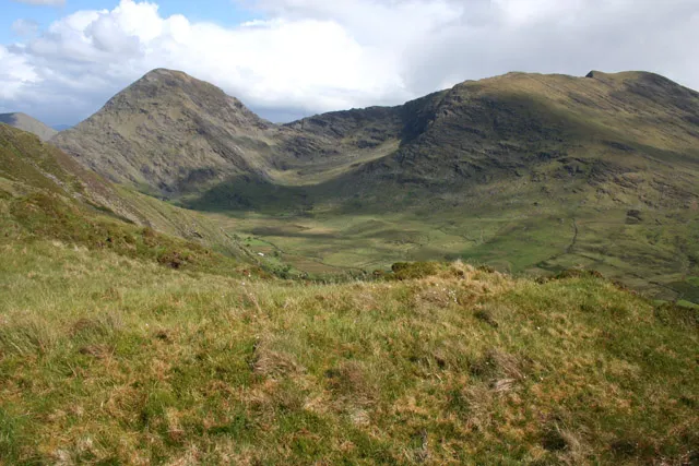 Broaghnabinnia Mountain, County Kerry3.1 km NE
-
Lough Duff Lake, County Kerry1.7 km E
-
Knockaunanattin W Top Mountain, County Kerry2.1 km SW
-
Beendarrig Mountain, County Kerry3.3 km NW
-
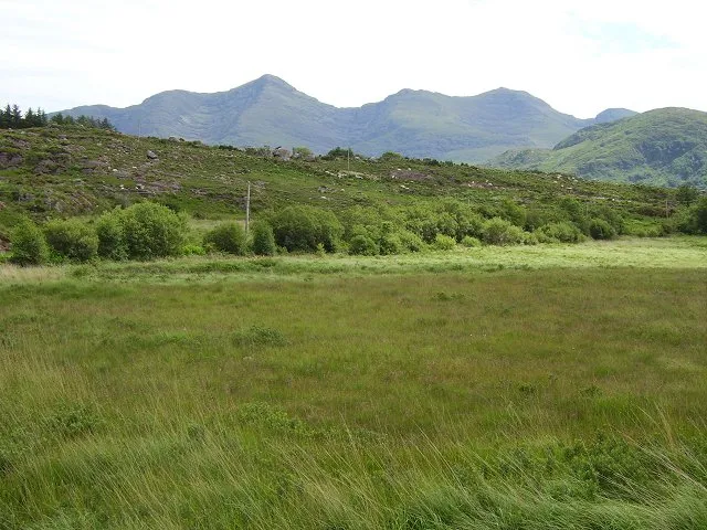 Mullaghanattin Mountain, County Kerry4.4 km SW
Sources & licences
Data last updated: