
- Population
- 63
- 63
- Elevation
- 1,260 m
- above sea level
- Local time
- UTC+01:00
- Europe/Rome · UTC+01:00
- Airports
- PSR Abruzzo Airport61 km
- CIA Ciampino–G. B. Pastine International Airport107 km
About Frattura
Frattura is a village. Location: Scanno, Province of L'Aquila. Population: 63. Elevation: 1,260 m.
Frattura is a frazione of Scanno, in the Province of L'Aquila in the Abruzzo, region of Italy.
Source: Wikipedia · CC BY-SA 4.0
Photos of Frattura
-

Superchilum · CC BY-SA 4.0 -

Marica Massaro · CC BY-SA 4.0 -

Marica Massaro · CC BY-SA 4.0 -
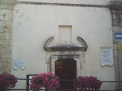
Chiesa delle Anime Sante Utente:Angelorenzi · Public domain -
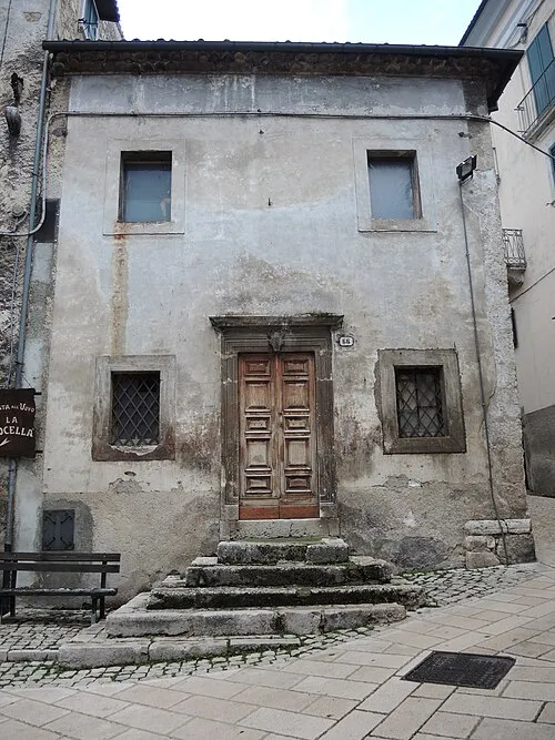
Chiesa di Santa Maria delle Grazie Pietro · CC BY-SA 4.0


Climate of Frattura
Best months for sightseeingBest months for sightseeing: July–August.
This month · November
A cold month
Day 8° · Night 3° · Rain 88 mm
- Hottest month
- August (day 22°)
- Coldest month
- February (night -2°)
- Wettest month
- November (88 mm)
- Driest month
- January (51 mm)
Bars: average monthly low and high temperature. Below: precipitation. Monthly averages for 1970–2000 at about 18 km resolution, adjusted for elevation. Highlighted months are mild and relatively dry. Source: WorldClim 2.1 (CC BY 4.0).
Show values as a table
| Month | Jan | Feb | Mar | Apr | May | Jun | Jul | Aug | Sep | Oct | Nov | Dec |
|---|---|---|---|---|---|---|---|---|---|---|---|---|
| Average high (°C) | 3° | 3° | 5° | 9° | 15° | 19° | 22° | 22° | 18° | 13° | 8° | 5° |
| Average low (°C) | -1° | -2° | 0° | 3° | 7° | 11° | 14° | 14° | 11° | 7° | 3° | 0° |
| Precipitation (mm) | 51 | 56 | 56 | 68 | 68 | 60 | 54 | 55 | 76 | 85 | 88 | 64 |
How to get to Frattura
The nearest airport is Abruzzo Airport (PSR), 61 km to the northeast as the crow flies. The nearest large city is Split, 274 km to the northeast.
Airports
- Abruzzo Airport (PSR) Pescara 61 kmnortheast
- Ciampino–G. B. Pastine International Airport (CIA) Rome 107 kmwest
- Naples International Airport (NAP) Napoli 121 kmsouth
Nearby large cities
- Split Population: 149.8K 274 kmnortheast
- Rijeka Population: 108K 380 kmnorth
Straight-line distances; road distances are longer. Airport data: OurAirports.
Day trips from Frattura
Within 100 km: 162 historic and cultural sites, 271 natural sites, 44 lakes, rivers and coasts.
0–25 km40 places
- Monte Urano Mountain 23 kmNW
- Serra Tre Monti Mountain 25 kmE
- Monte Pietrafitta Mountain 13 kmNW
- Colle Nero Mountain 24 kmS
25–60 km160 places
- Cimarone del Villaneto Mountain 41 kmS
- Monte Viglio Mountain 42 kmW
- Monte Veticoso Mountain 56 kmN
- Monte Tutoglio Mountain 39 kmE
60–100 km277 places
- Ripari di Giobbe Beach 65 kmNE
- Vallone Grande Natural site 78 kmE
- Valle Covatta Natural site 70 kmSE
- Giulianova Beach Beach 93 kmN
Straight-line distances.
Nearby attractions & nature
Everything nearby-
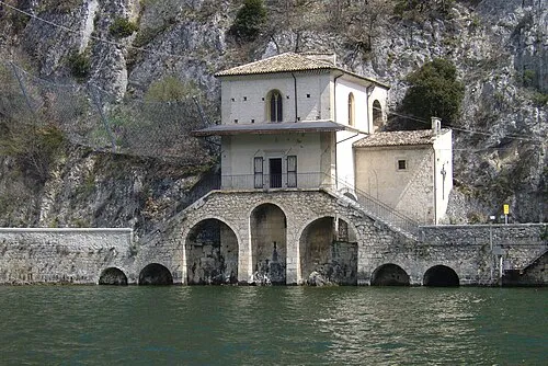 Chiesa della Madonna del Lago Attraction, Scanno1.3 km S
-
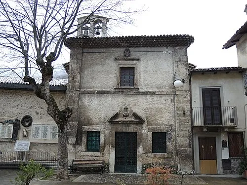 Chiesa della Madonna di Costantinopoli Attraction, Scanno3 km S
-
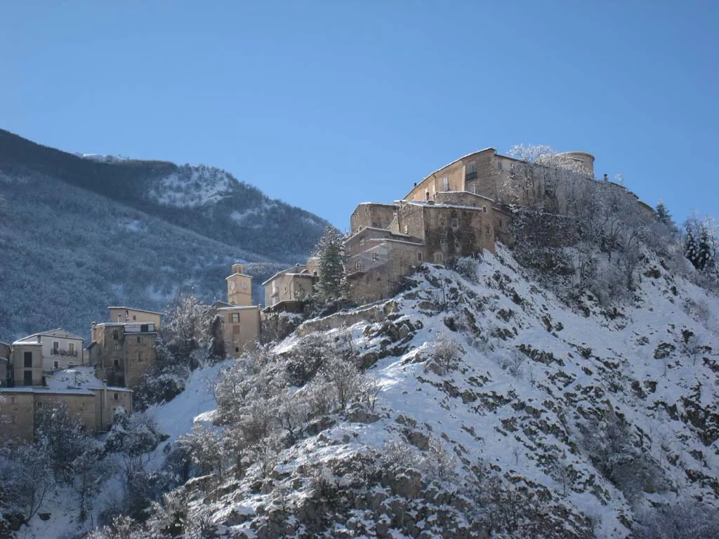 Rocca di Villalago Historic site, Villalago2.9 km W
-
Chiesa delle Anime Sante Attraction, Scanno3.1 km S
-
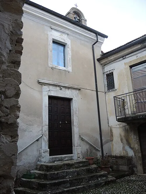 Chiesa della Madonna Addolorata Attraction, Villalago2.9 km W
-
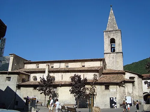 Chiesa di Santa Maria della Valle Attraction, Scanno3.1 km S
Sources & licences
Data last updated: · 2 independent sources