- Population
- 622,183
- 622.2K
- Elevation
- 73 m
- above sea level
- Local time
- UTC+01:00
- Europe/Rome · UTC+01:00
- Places inside
- 61
- listed under Province of Foggia
- Airports
- FOG Foggia Gino Lisa Airport2 km
- QSR Salerno Costa d'Amalfi Airport106 km
About Province of Foggia
Province of Foggia is a district. Location: Apulia, Italy. Population: 622,183. The best months to visit are May, October. The nearest airport is Foggia Gino Lisa Airport (2 km).
Photos of Province of Foggia
-
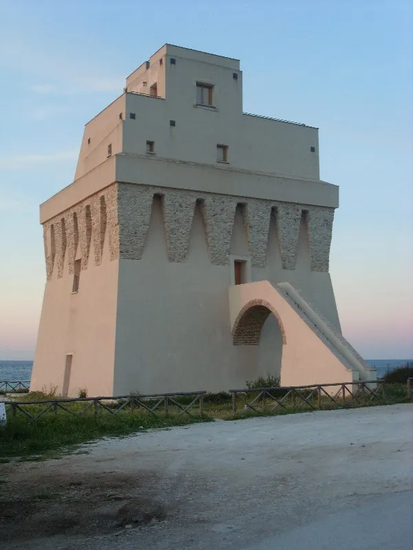
Torre Mileto ekphrasis · CC BY-SA 3.0 -
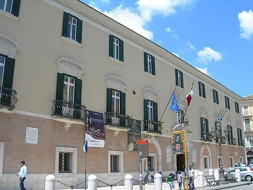
Palazzo Dogana Francesco interman · Public domain -
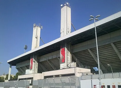
Stadio Pino Zaccheria it:Francesco Ippolito · CC BY-SA 3.0 -
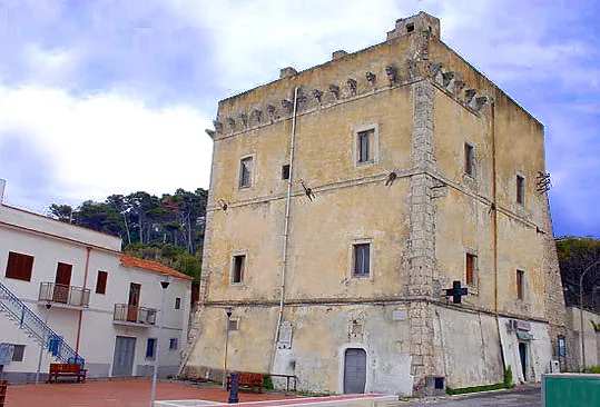
Torre dei Preposti Theirrules · Public domain


Climate of Province of Foggia
Best months for sightseeingBest months for sightseeing: May, October.
This month · November
Outside the best season
Day 16° · Night 8° · Rain 63 mm
- Hottest month
- July (day 31°)
- Coldest month
- February (night 4°)
- Wettest month
- November (63 mm)
- Driest month
- July (27 mm)
Bars: average monthly low and high temperature. Below: precipitation. Monthly averages for 1970–2000 at about 18 km resolution, adjusted for elevation. Highlighted months are mild and relatively dry. Source: WorldClim 2.1 (CC BY 4.0).
Show values as a table
| Month | Jan | Feb | Mar | Apr | May | Jun | Jul | Aug | Sep | Oct | Nov | Dec |
|---|---|---|---|---|---|---|---|---|---|---|---|---|
| Average high (°C) | 12° | 12° | 15° | 18° | 24° | 28° | 31° | 31° | 27° | 22° | 16° | 13° |
| Average low (°C) | 4° | 4° | 5° | 8° | 12° | 16° | 19° | 19° | 16° | 12° | 8° | 5° |
| Precipitation (mm) | 42 | 42 | 43 | 40 | 35 | 30 | 27 | 30 | 48 | 53 | 63 | 50 |
How to get to Province of Foggia
The nearest airport is Foggia Gino Lisa Airport (FOG), 2 km to the south as the crow flies. For international flights: Bari Karol Wojtyła International Airport (BRI) (108 km). The nearest large city is Split, 241 km to the north.
Airports
- Foggia Gino Lisa Airport (FOG) Foggia (FG) 2 kmsouth
- Salerno Costa d'Amalfi Airport (QSR) Salerno 106 kmsouthwest
- Bari Karol Wojtyła International Airport (BRI) Bari 108 kmeast
Nearby large cities
- Split Population: 149.8K 241 kmnorth
Straight-line distances; road distances are longer. Airport data: OurAirports.
Day trips from Province of Foggia
Within 100 km: 17 historic and cultural sites, 77 natural sites, 30 lakes, rivers and coasts.
0–25 km2 places
- Palazzo Dogana Historic site 2 kmNE
- Stadio Pino Zaccheria Landmark 1 kmNE
25–60 km26 places
- Torre Mileto Beach 52 kmN
- Lido del Gargano Beach 58 kmNE
- Spiaggia Marina di Lesina Beach 54 kmN
- Spiaggia Lido Cormoran Beach 54 kmN
60–100 km96 places
- Vallone Grande Natural site 72 kmNW
- Valle Covatta Natural site 79 kmW
- Capo Colonna Natural site 78 kmE
- Spiaggia Zaiana Beach 69 kmNE
Straight-line distances.
Places in Province of Foggia
61 places- 1 Foggia 151.2K
- 2 Cerignola 58.6K
- 3 Manfredonia 56.7K
- 4 San Severo 52.4K
- 5 Lucera 32.9K
- 6 San Giovanni Rotondo 27.1K
- 7 Orta Nova 17.6K
- 8 Torremaggiore 17K
- 9 San Nicandro Garganico 15.1K
- 10 Vieste 13.9K
- 11 San Marco in Lamis 13.4K
- 12 Apricena 13.1K
- 13 Monte Sant'Angelo 12.2K
- 14 Vico del Gargano 7.6K
- 15 Cagnano Varano 7.1K
- 16 Troia 7K
- 17 Carapelle 6.6K
- 18 Lesina 6.3K
- 19 Mattinata 6.2K
- 20 Ascoli Satriano 6.1K
- 21 Stornara 5.8K
- 22 San Paolo di Civitate 5.7K
- 23 Stornarella 5.3K
- 24 Peschici 4.5K
- 25 Ischitella 4.4K
- 26 Carpino 4.1K
- 27 Serracapriola 3.9K
- 28 Deliceto 3.7K
- 29 Rodi Garganico 3.6K
- 30 Zapponeta 3.4K
- 31 Bovino 3.2K
- 32 Ordona 2.8K
- 33 Candela 2.8K
- 34 Biccari 2.7K
- 35 Orsara di Puglia 2.7K
- 36 Pietramontecorvino 2.6K
- 37 Poggio Imperiale 2.6K
- 38 Accadia 2.3K
- 39 Castelluccio dei Sauri 2.1K
- 40 Rignano Garganico 2K
- 41 Sant'Agata di Puglia 1.9K
- 42 Rocchetta Sant'Antonio 1.8K
- 43 Casalvecchio di Puglia 1.8K
- 44 Volturino 1.7K
- 45 Chieuti 1.7K
- 46 Celenza Valfortore 1.5K
- 47 Casalnuovo Monterotaro 1.5K
- 48 Castelnuovo della Daunia 1.4K
- 49 Castelluccio Valmaggiore 1.2K
- 50 Anzano di Puglia 1.2K
- 51 Roseto Valfortore 1.1K
- 52 Monteleone di Puglia 1K
- 53 San Marco la Catola 963
- 54 Carlantino 957
- 55 Alberona 925
- 56 Panni 749
- 57 Motta Montecorvino 695
- 58 Faeto 621
- 59 Isole Tremiti 475
- 60 Volturara Appula 408
Bar: population relative to the most populous place in this list.
Nature and heritage in Province of Foggia
Sources & licences
Data last updated: