- Population
- 31,585
- 31.6K
- Elevation
- 26 m
- above sea level
- Local time
- UTC+01:00
- Europe/Rome · UTC+01:00
- Places inside
- 18
- listed under Sarno
- Airports
- NAP Naples International Airport29 km
- QSR Salerno Costa d'Amalfi Airport32 km
About Sarno
Sarno is a municipality. Location: Province of Salerno, Campania. Population: 31,585. Elevation: 26 m. The best months to visit are May–June, October. The nearest airport is Naples International Airport (29 km). Nearby sights include Vallo di Lauro and Herculaneum.
Climate of Sarno
Best months for sightseeingBest months for sightseeing: May–June, October.
This month · November
A wet month
Day 17° · Night 9° · Rain 144 mm
- Hottest month
- July (day 30°)
- Coldest month
- January (night 5°)
- Wettest month
- November (144 mm)
- Driest month
- July (26 mm)
Bars: average monthly low and high temperature. Below: precipitation. Monthly averages for 1970–2000 at about 18 km resolution, adjusted for elevation. Highlighted months are mild and relatively dry. Source: WorldClim 2.1 (CC BY 4.0).
Show values as a table
| Month | Jan | Feb | Mar | Apr | May | Jun | Jul | Aug | Sep | Oct | Nov | Dec |
|---|---|---|---|---|---|---|---|---|---|---|---|---|
| Average high (°C) | 13° | 14° | 16° | 19° | 23° | 27° | 30° | 30° | 26° | 22° | 17° | 14° |
| Average low (°C) | 5° | 6° | 7° | 9° | 13° | 17° | 19° | 19° | 17° | 13° | 9° | 6° |
| Precipitation (mm) | 108 | 91 | 79 | 84 | 55 | 30 | 26 | 38 | 81 | 118 | 144 | 118 |
How to get to Sarno
The nearest airport is Naples International Airport (NAP), 29 km to the west as the crow flies. The nearest large city is Split, 335 km to the northeast.
Airports
- Naples International Airport (NAP) Napoli 29 kmwest
- Salerno Costa d'Amalfi Airport (QSR) Salerno 32 kmsoutheast
- Foggia Gino Lisa Airport (FOG) Foggia (FG) 103 kmnortheast
Nearby large cities
- Split Population: 149.8K 335 kmnortheast
Straight-line distances; road distances are longer. Airport data: OurAirports.
Day trips from Sarno
Within 100 km: 29 historic and cultural sites, 129 natural sites, 37 lakes, rivers and coasts.
0–25 km42 places
- Colle Umberto Mountain 18 kmW
- Spiaggia Castellammare di Stabia Beach 17 kmSW
- Spiaggia Torre Annunziata Beach 16 kmSW
- Spiaggia di Vietri sul Mare Beach 18 kmSE
25–60 km68 places
- S.L.O Rodolfo beach Beach 59 kmW
- Lido di Liccola Beach 49 kmW
- Marina di Varcaturo Beach 51 kmW
- Spiaggia Miliscola Beach 46 kmW
60–100 km85 places
- Valle Covatta Natural site 91 kmN
- Spiaggia dei Sassolini Beach 92 kmNW
- Spiaggia di Sèrapo Beach 99 kmNW
- Spiaggia Citara Beach 65 kmW
Straight-line distances.
Places in Sarno
18 places- 1 Sarno 28.8K
- 2 Ponte San Michele 803
- 3 Tuostolo 189
- 4 Masseria de Crescenzi 124
- 5 Sant'Eramo I 96
- 6 Cutricchio 79
- 7 La Marmora I 79
- 8 Vecchia Striano 67
- 9 San Vito 58
- 10 Turner 53
- 11 Sant'Eramo 51
- 12 Masseria Londrone 49
- 13 Fiorentini 34
- 14 Santa Maria della Foce II 32
- 15 Santo Iasso 31
- 16 La Marmora III 22
- 17 San Marco 17
- 18 Santa Maria della Foce III 17
Bar: population relative to the most populous place in this list.
Nearby attractions & nature
Everything nearby-
Vallo di Lauro Natural site, Campania8.2 km N
-
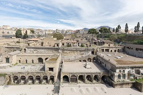 Herculaneum Historic site, Ercolano23 km W
-
Stadio Romeo Menti Landmark, Castellammare di Stabia16 km SW
-
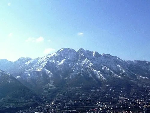 Monte Finestra Mountain, Tramonti14 km S
-
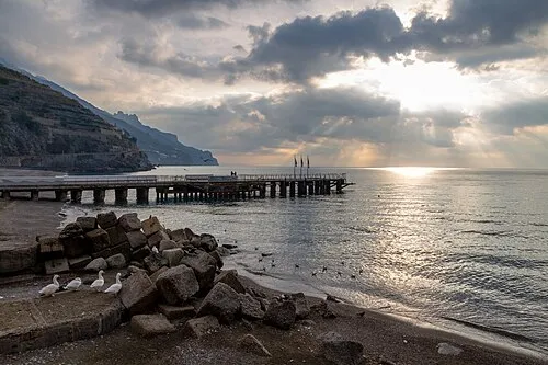 Spiaggia di Minori Beach, Province of Salerno18 km S
-
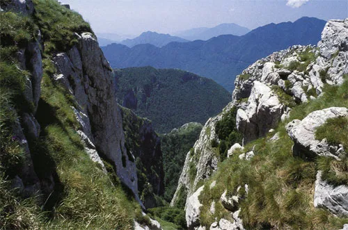 Appennino Campano Mountain, Campania11 km E
-
Colle della Serra Mountain, Tramonti15 km S
-
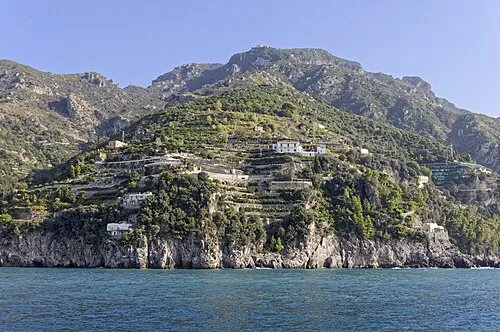 Monte dell'Avvocata Mountain, Maiori18 km S
Sources & licences
Data last updated: