Alto Reno Terme
Located in Province of Bologna, Emilia-Romagna Coordinates: 44°07′43″ N 10°56′14″ E
- Population
- 6,904
- 6.9K
- Elevation
- 954 m
- above sea level
- Local time
- UTC+01:00
- Europe/Rome · UTC+01:00
- Places inside
- 45
- listed under Alto Reno Terme
- Airports
- FLR Florence Airport, Peretola41 km
- BLQ Bologna Guglielmo Marconi Airport53 km
About Alto Reno Terme
Alto Reno Terme is a municipality. Location: Province of Bologna, Emilia-Romagna. Population: 6,904. Elevation: 954 m. The best months to visit are July–August. The nearest airport is Florence Airport, Peretola (41 km). Nearby sights include Poggio dei Lagoni and Poggio del Papa.
Climate of Alto Reno Terme
Best months for sightseeingBest months for sightseeing: July–August.
This month · November
A wet month
Day 9° · Night 2° · Rain 207 mm
- Hottest month
- August (day 23°)
- Coldest month
- January (night -1°)
- Wettest month
- November (207 mm)
- Driest month
- July (58 mm)
Bars: average monthly low and high temperature. Below: precipitation. Monthly averages for 1970–2000 at about 18 km resolution, adjusted for elevation. Highlighted months are mild and relatively dry. Source: WorldClim 2.1 (CC BY 4.0).
Show values as a table
| Month | Jan | Feb | Mar | Apr | May | Jun | Jul | Aug | Sep | Oct | Nov | Dec |
|---|---|---|---|---|---|---|---|---|---|---|---|---|
| Average high (°C) | 5° | 6° | 8° | 11° | 16° | 20° | 23° | 23° | 19° | 14° | 9° | 6° |
| Average low (°C) | -1° | -1° | 1° | 3° | 8° | 11° | 14° | 14° | 11° | 7° | 2° | 0° |
| Precipitation (mm) | 154 | 123 | 140 | 158 | 106 | 98 | 58 | 89 | 140 | 192 | 207 | 170 |
How to get to Alto Reno Terme
The nearest airport is Florence Airport, Peretola (FLR), 41 km to the southeast as the crow flies. The nearest large city is Nice, 299 km to the west.
Airports
- Florence Airport, Peretola (FLR) Firenze (FI) 41 kmsoutheast
- Bologna Guglielmo Marconi Airport (BLQ) Bologna 53 kmnortheast
- Pisa International Airport (PSA) Pisa (PI) 66 kmsouthwest
Nearby large cities
- Nice Population: 342.7K 299 kmwest
- Rijeka Population: 108K 308 kmnortheast
- Innsbruck Population: 132.5K 350 kmnorth
- Ljubljana Population: 272.2K 353 kmnortheast
- Klagenfurt Population: 100.3K 383 kmnortheast
Straight-line distances; road distances are longer. Airport data: OurAirports.
Day trips from Alto Reno Terme
Within 100 km: 76 historic and cultural sites, 210 natural sites, 28 lakes, rivers and coasts.
0–25 km53 places
- Poggio di Iavello Mountain 22 kmSE
- Monte Vigese Mountain 15 kmNE
- Monte la Croce Mountain 12 kmSE
- Monte Acuto Mountain 19 kmSE
25–60 km96 places
- Monte Santa Giulia Mountain 37 kmNW
- Monte Santa Croce Mountain 47 kmE
- Monte Morello Mountain 36 kmSE
- Monte Lama Mountain 27 kmNW
60–100 km165 places
- Cala del Leone Beach 88 kmSW
- Spiaggia di Calignaia Beach 88 kmSW
- Spiaggia per Cani Beach 85 kmSW
- Spiaggia del Felciaio Beach 84 kmSW
Straight-line distances.
Places in Alto Reno Terme
45 places- 1 Porretta Terme 3.6K
- 2 Ponte della Venturina 1.4K
- 3 Cà Battista-Ca' Bettini 159
- 4 Castelluccio 126
- 5 Molino del Pallone 119
- 6 Granaglione 100
- 7 Borgo Capanne 94
- 8 Poggio di Borgo Capanne 57
- 9 La Piazza 50
- 10 Cà di Giano 46
- 11 Lustrola 40
- 12 Cà di Marsili 39
- 13 Case Forlai 38
- 14 Case Boni 36
- 15 Greppe 35
- 16 Castellaro 28
- 17 Campoferraio 27
- 18 Vetica 26
- 19 Casa Cioni 25
- 20 Le Croci 25
- 21 Gallinaia 24
- 22 Cà di Giannini 22
- 23 Madognana 21
- 24 Serenna 21
- 25 Vizzero 21
- 26 Cà di Janni 20
- 27 Varano 20
- 28 Cà Micheletto 17
- 29 Case Calistri 17
- 30 Randaragna 17
- 31 Parchiè 16
- 32 Sambucedro 16
- 33 Cà dei Bacicci 10
- 34 Lucaiola 9
- 35 Serra 9
- 36 Cà di Giorgi 8
- 37 Casa Lazzaroni 7
- 38 Casa Moschini 7
- 39 Pennola 7
- 40 Casa Zacchi-Casa Evangelisti 6
- 41 Prato Novello 6
- 42 Tideri-Verginina 6
Bar: population relative to the most populous place in this list.
Mountains & nature3
- Monte Cavallo · Mountain
- Monte Pianaccetto · Mountain
- Monte Tresca · Mountain
Nearby attractions & nature
Everything nearby-
Poggio dei Lagoni Mountain, Pistoia9.2 km S
-
Poggio del Papa Mountain, Pistoia9.5 km S
-
Poggio Orticaia Mountain, Pistoia9.7 km S
-
Poggio Fuso Mountain, Pistoia10 km S
-
Poggio del Castelluccio Mountain, Pistoia10 km S
-
Poggio Ripa Mountain, Pistoia11 km S
-
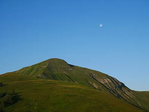 Monte Spigolino Mountain, San Marcello Piteglio11 km W
-
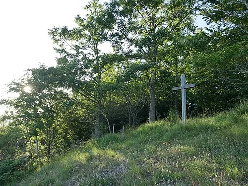 Poggio Roncomannaio Mountain, Cantagallo11 km SE
Sources & licences
Data last updated: