Castelnuovo Rangone
Located in Province of Modena, Emilia-Romagna Coordinates: 44°33′05″ N 10°56′06″ E
- Population
- 15,083
- 15.1K
- Elevation
- 77 m
- above sea level
- Local time
- UTC+01:00
- Europe/Rome · UTC+01:00
- Places inside
- 10
- listed under Castelnuovo Rangone
- Airports
- BLQ Bologna Guglielmo Marconi Airport28 km
- PMF Parma Airport59 km
About Castelnuovo Rangone
Castelnuovo Rangone is a municipality. Location: Province of Modena, Emilia-Romagna. Population: 15,083. Elevation: 77 m. The best months to visit are May, September. The nearest airport is Bologna Guglielmo Marconi Airport (28 km). Nearby sights include Castello di Formigine and Stadio Alberto Braglia.
Photos of Castelnuovo Rangone
-
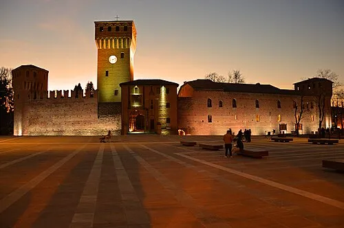
Castello di Formigine Rondinone Carlo · CC BY-SA 4.0

Climate of Castelnuovo Rangone
Best months for sightseeingBest months for sightseeing: May, September.
This month · November
A cold month
Day 12° · Night 4° · Rain 78 mm
- Hottest month
- July (day 31°)
- Coldest month
- January (night -1°)
- Wettest month
- October (84 mm)
- Driest month
- February (45 mm)
Bars: average monthly low and high temperature. Below: precipitation. Monthly averages for 1970–2000 at about 18 km resolution, adjusted for elevation. Highlighted months are mild and relatively dry. Source: WorldClim 2.1 (CC BY 4.0).
Show values as a table
| Month | Jan | Feb | Mar | Apr | May | Jun | Jul | Aug | Sep | Oct | Nov | Dec |
|---|---|---|---|---|---|---|---|---|---|---|---|---|
| Average high (°C) | 6° | 9° | 14° | 18° | 23° | 28° | 31° | 31° | 26° | 19° | 12° | 7° |
| Average low (°C) | -1° | 0° | 3° | 7° | 11° | 15° | 17° | 17° | 14° | 9° | 4° | 0° |
| Precipitation (mm) | 50 | 45 | 61 | 72 | 64 | 62 | 46 | 63 | 73 | 84 | 78 | 57 |
How to get to Castelnuovo Rangone
The nearest airport is Bologna Guglielmo Marconi Airport (BLQ), 28 km to the east as the crow flies. The nearest large city is Rijeka, 290 km to the east.
Airports
- Bologna Guglielmo Marconi Airport (BLQ) Bologna 28 kmeast
- Parma Airport (PMF) Parma (PR) 59 kmnorthwest
- Florence Airport, Peretola (FLR) Firenze (FI) 85 kmsouth
Nearby large cities
- Rijeka Population: 108K 290 kmeast
- Innsbruck Population: 132.5K 303 kmnorth
- Nice Population: 342.7K 308 kmwest
- Ljubljana Population: 272.2K 326 kmnortheast
- Klagenfurt Population: 100.3K 350 kmnortheast
Straight-line distances; road distances are longer. Airport data: OurAirports.
Day trips from Castelnuovo Rangone
Within 100 km: 68 historic and cultural sites, 147 natural sites, 13 lakes, rivers and coasts.
0–25 km4 places
- Poggio Castro Mountain 24 kmS
- Teatro Storchi Attraction 10 kmN
- Castello di Formigine Historic site 8 kmW
- Stadio Alberto Braglia Landmark 11 kmN
25–60 km76 places
- Correggio Beach Beach 26 kmNW
- Monte Vigese Mountain 41 kmS
- Monte Santa Giulia Mountain 28 kmSW
- Monte Lama Mountain 40 kmSW
60–100 km148 places
- Poggio di Iavello Mountain 66 kmS
- La Lecciona Beach 96 kmSW
- Spiaggia della Marinella di San Terenzo Beach 98 kmSW
- Spiaggia Forte dei Marmi Beach 90 kmSW
Straight-line distances.
Places in Castelnuovo Rangone
10 places- 1 Castelnuovo Rangone 8.1K
- 2 Montale 4.1K
- 3 Balugola 168
- 4 Cavidole 164
- 5 San Lorenzo 77
- 6 Gualinga 54
- 7 Oratorio di Sant'Anna 41
- 8 Castello 35
- 9 Ca' Bergomi 20
- 10 Sapi 4
Bar: population relative to the most populous place in this list.
Nearby attractions & nature
Everything nearby-
Castello di Formigine Historic site, Formigine7.5 km W
-
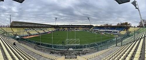 Stadio Alberto Braglia Landmark, Modena11 km N
-
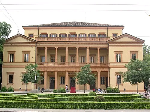 Teatro Storchi Attraction, Modena10 km N
-
Poggio Castro Mountain, Pavullo nel Frignano24 km S
Sources & licences
Data last updated: