Mirandola
Located in Province of Modena, Emilia-Romagna Coordinates: 44°53′12″ N 11°03′58″ E
- Population
- 23,895
- 23.9K
- Elevation
- 24 m
- above sea level
- Local time
- UTC+01:00
- Europe/Rome · UTC+01:00
- Places inside
- 23
- listed under Mirandola
- Airports
- BLQ Bologna Guglielmo Marconi Airport43 km
- VRN Verona Villafranca Valerio Catullo Airport58 km
About Mirandola
Mirandola is a municipality. Location: Province of Modena, Emilia-Romagna. Population: 23,895. Elevation: 24 m. The best months to visit are May, September. The nearest airport is Bologna Guglielmo Marconi Airport (43 km).
Photos of Mirandola
-
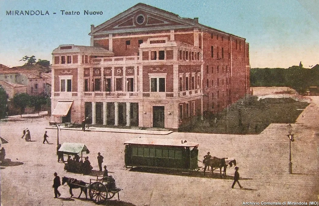
Teatro Nuovo Cartolina storica · Public domain

Climate of Mirandola
Best months for sightseeingBest months for sightseeing: May, September.
This month · November
A cold month
Day 11° · Night 4° · Rain 64 mm
- Hottest month
- July (day 31°)
- Coldest month
- January (night -1°)
- Wettest month
- October (72 mm)
- Driest month
- February (36 mm)
Bars: average monthly low and high temperature. Below: precipitation. Monthly averages for 1970–2000 at about 18 km resolution, adjusted for elevation. Highlighted months are mild and relatively dry. Source: WorldClim 2.1 (CC BY 4.0).
Show values as a table
| Month | Jan | Feb | Mar | Apr | May | Jun | Jul | Aug | Sep | Oct | Nov | Dec |
|---|---|---|---|---|---|---|---|---|---|---|---|---|
| Average high (°C) | 6° | 9° | 14° | 18° | 23° | 27° | 31° | 30° | 25° | 18° | 11° | 6° |
| Average low (°C) | -1° | 0° | 3° | 7° | 12° | 16° | 18° | 18° | 14° | 9° | 4° | 0° |
| Precipitation (mm) | 45 | 36 | 48 | 56 | 58 | 54 | 48 | 62 | 60 | 72 | 64 | 49 |
How to get to Mirandola
The nearest airport is Bologna Guglielmo Marconi Airport (BLQ), 43 km to the southeast as the crow flies. The nearest large city is Innsbruck, 265 km to the north.
Airports
- Bologna Guglielmo Marconi Airport (BLQ) Bologna 43 kmsoutheast
- Verona Villafranca Valerio Catullo Airport (VRN) Caselle (VR) 58 kmnorth
- Parma Airport (PMF) Parma (PR) 61 kmwest
Nearby large cities
- Innsbruck Population: 132.5K 265 kmnorth
- Rijeka Population: 108K 270 kmeast
- Ljubljana Population: 272.2K 298 kmnortheast
- Klagenfurt Population: 100.3K 317 kmnortheast
- Nice Population: 342.7K 331 kmwest
Straight-line distances; road distances are longer. Airport data: OurAirports.
Day trips from Mirandola
Within 100 km: 49 historic and cultural sites, 199 natural sites, 2 lakes, rivers and coasts.
0–25 km2 places
- Teatro Nuovo Attraction 1 kmN
- Stadio Sandro Cabassi Landmark 19 kmSW
25–60 km17 places
- Correggio Beach Beach 27 kmSW
- Valle del Setta Natural site 59 kmS
- Valle del Savena Natural site 53 kmSE
- Valle del Po Natural site 46 kmW
60–100 km231 places
- Lido di Pomposa Beach 95 kmE
- Santa Corona Attraction 83 kmNE
- Selvata Mountain 100 kmN
- Monte Vigese Mountain 76 kmS
Straight-line distances.
Places in Mirandola
23 places- 1 Mirandola 17.4K
- 2 Quarantoli 1.1K
- 3 San Martino Spino 684
- 4 San Martino Carano 316
- 5 Gavello 293
- 6 Tramuschio 276
- 7 Baia 238
- 8 Carrobbio Zeni 118
- 9 Tre Gobbi 89
- 10 Bastiglia 85
- 11 Ponte Pietra 72
- 12 Stazione Ferroviaria 72
- 13 Maffea 58
- 14 Nocedella 53
- 15 Svolta de' Secchi 46
- 16 Bigozzi 44
- 17 Malavicina 35
- 18 Ponte Santa Maria 35
- 19 Castello Tondino 34
- 20 Grazi 19
- 21 I Gazzuoli 17
- 22 Castello Venezia 15
Bar: population relative to the most populous place in this list.
Heritage & sights1
- Teatro Nuovo · Attraction
Sources & licences
Data last updated: