- Population
- 32
- 32
- Elevation
- 193 m
- above sea level
- Local time
- UTC+01:00
- Europe/Rome · UTC+01:00
- Airports
- PMF Parma Airport24 km
- BLQ Bologna Guglielmo Marconi Airport74 km
About Gabbiola II
Gabbiola II is a village. Location: Traversetolo, Province of Parma. Population: 32. Elevation: 193 m. The best months to visit are May–June, September. The nearest airport is Parma Airport (24 km). Nearby sights include Palazzo della Pilotta and Palazzo del Governatore.
Climate of Gabbiola II
Best months for sightseeingBest months for sightseeing: May–June, September.
This month · November
A wet month
Day 11° · Night 3° · Rain 123 mm
- Hottest month
- July (day 29°)
- Coldest month
- January (night -1°)
- Wettest month
- October (125 mm)
- Driest month
- July (49 mm)
Bars: average monthly low and high temperature. Below: precipitation. Monthly averages for 1970–2000 at about 18 km resolution, adjusted for elevation. Highlighted months are mild and relatively dry. Source: WorldClim 2.1 (CC BY 4.0).
Show values as a table
| Month | Jan | Feb | Mar | Apr | May | Jun | Jul | Aug | Sep | Oct | Nov | Dec |
|---|---|---|---|---|---|---|---|---|---|---|---|---|
| Average high (°C) | 7° | 9° | 13° | 17° | 22° | 26° | 29° | 29° | 24° | 18° | 11° | 7° |
| Average low (°C) | -1° | 0° | 3° | 6° | 10° | 14° | 16° | 16° | 13° | 9° | 3° | 0° |
| Precipitation (mm) | 78 | 66 | 84 | 106 | 77 | 74 | 49 | 83 | 97 | 125 | 123 | 87 |
How to get to Gabbiola II
The nearest airport is Parma Airport (PMF), 24 km to the north as the crow flies. For international flights: Bologna Guglielmo Marconi Airport (BLQ) (74 km). The nearest large city is Nice, 268 km to the west.
Airports
- Parma Airport (PMF) Parma (PR) 24 kmnorth
- Bologna Guglielmo Marconi Airport (BLQ) Bologna 74 kmeast
- Brescia Gabriele d'Annunzio Airport (VBS) Montichiari (BS) 90 kmnorth
Nearby large cities
- Nice Population: 342.7K 268 kmwest
- Innsbruck Population: 132.5K 304 kmnorth
- Rijeka Population: 108K 331 kmeast
- Zurich Population: 415.4K 336 kmnorthwest
- Bern Population: 121.6K 344 kmnorthwest
Straight-line distances; road distances are longer. Airport data: OurAirports.
Day trips from Gabbiola II
Within 100 km: 26 historic and cultural sites, 246 natural sites, 25 lakes, rivers and coasts.
0–25 km6 places
- Monte Caio Mountain 24 kmSW
- Palazzo del Governatore Historic site 20 kmN
- Stadio Ennio Tardini Landmark 20 kmN
- Stadio Mirabello Landmark 23 kmE
25–60 km74 places
- Correggio Beach Beach 36 kmNE
- Alpe di Succiso Mountain 35 kmSW
- Monte Santa Giulia Mountain 35 kmSE
- Monte Lama Mountain 46 kmSE
60–100 km217 places
- Rotteri Mountain 76 kmW
- Poggio di Iavello Mountain 93 kmSE
- Gifarco Mountain 82 kmW
- Bagni Pagana Beach 96 kmW
Straight-line distances.
Nearby attractions & nature
Everything nearby-
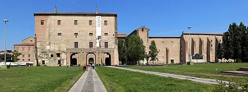 Palazzo della Pilotta Historic site, Parma21 km N
-
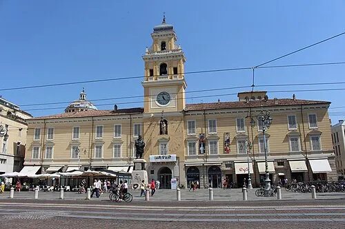 Palazzo del Governatore Historic site, Parma20 km N
-
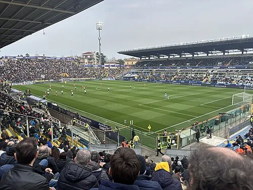 Stadio Ennio Tardini Landmark, Parma20 km N
-
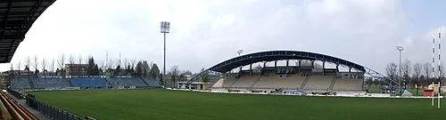 Stadio Sergio Lanfranchi Landmark, Parma23 km N
-
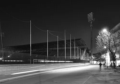 Stadio Mirabello Landmark, Reggio nell'Emilia23 km E
-
Monte Caio Mountain, Tuscany24 km SW
Other cities and towns in Traversetolo
-
 Vignale Village, Traversetolo3.3 km NE
-
 Torre Village, Traversetolo1.6 km W
-
Villa Carbognani Village, Traversetolo2 km NE
-
Cazzola-Il Borgo Village, Traversetolo3.1 km NW
-
Case Cavalli Village, Traversetolo1.9 km E
-
Case Pozzo Village, Traversetolo2.3 km N
Sources & licences
Data last updated: · 2 independent sources