Ravenna
Located in Province of Ravenna, Emilia-Romagna Coordinates: 44°25′01″ N 12°11′55″ E
- Population
- 157,663
- 157.7K
- Elevation
- 6 m
- above sea level
- Local time
- UTC+01:00
- Europe/Rome · UTC+01:00
- Places inside
- 67
- listed under Ravenna
- Airports
- FRL Forlì-Luigi Ridolfi International Airport27 km
- RMI Federico Fellini International Airport55 km
About Ravenna
Ravenna is a municipality. Location: Province of Ravenna, Emilia-Romagna. Population: 157,663. Elevation: 6 m. The best months to visit are May–June, September. The nearest airport is Forlì-Luigi Ridolfi International Airport (27 km). Nearby sights include Spiaggia Milano Marittima and Spiaggia Pinarella.
Photos of Ravenna
-
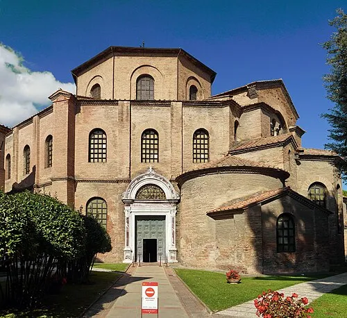
Basilica of San Vitale Commonists · CC BY-SA 4.0 -
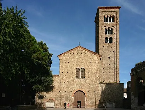
Basilica di San Francesco José Luiz · CC BY-SA 4.0


Climate of Ravenna
Best months for sightseeingBest months for sightseeing: May–June, September.
This month · November
A cold month
Day 12° · Night 5° · Rain 79 mm
- Hottest month
- July (day 30°)
- Coldest month
- January (night 0°)
- Wettest month
- November (79 mm)
- Driest month
- February (36 mm)
Bars: average monthly low and high temperature. Below: precipitation. Monthly averages for 1970–2000 at about 18 km resolution, adjusted for elevation. Highlighted months are mild and relatively dry. Source: WorldClim 2.1 (CC BY 4.0).
Show values as a table
| Month | Jan | Feb | Mar | Apr | May | Jun | Jul | Aug | Sep | Oct | Nov | Dec |
|---|---|---|---|---|---|---|---|---|---|---|---|---|
| Average high (°C) | 6° | 9° | 13° | 17° | 23° | 27° | 30° | 29° | 25° | 19° | 12° | 7° |
| Average low (°C) | 0° | 1° | 5° | 8° | 13° | 16° | 19° | 19° | 15° | 11° | 5° | 1° |
| Precipitation (mm) | 40 | 36 | 52 | 54 | 51 | 49 | 46 | 58 | 70 | 66 | 79 | 54 |
How to get to Ravenna
The nearest airport is Forlì-Luigi Ridolfi International Airport (FRL), 27 km to the southwest as the crow flies. For international flights: Federico Fellini International Airport (RMI) (55 km). The nearest large city is Rijeka, 204 km to the northeast.
Airports
- Forlì-Luigi Ridolfi International Airport (FRL) Forlì (FC) 27 kmsouthwest
- Federico Fellini International Airport (RMI) Rimini (RN) 55 kmsoutheast
- Bologna Guglielmo Marconi Airport (BLQ) Bologna 74 kmwest
Nearby large cities
- Rijeka Population: 108K 204 kmnortheast
- Ljubljana Population: 272.2K 256 kmnortheast
- Klagenfurt Population: 100.3K 295 kmnortheast
- Innsbruck Population: 132.5K 322 kmnorth
- Zagreb Population: 663.6K 335 kmnortheast
Straight-line distances; road distances are longer. Airport data: OurAirports.
Day trips from Ravenna
Within 100 km: 18 historic and cultural sites, 119 natural sites, 36 lakes, rivers and coasts.
0–25 km7 places
- Vela Beach 8 kmNE
- Big Mama Beach Beach 10 kmNE
- Spiaggia Pinarella Beach 24 kmSE
- Spiaggia Cervia Beach 21 kmSE
25–60 km46 places
- Lido di Pomposa Beach 34 kmN
- Spiaggia Cesenatico Beach 29 kmSE
- Vatikaki Beach 47 kmSE
- Miramare Beach Beach 54 kmSE
60–100 km120 places
- Monte del Pantano Mountain 99 kmS
- Litorale di Pellestrina Beach 96 kmN
- Augusto Stefano Beach 65 kmSE
- Spiaggia Cattolica Beach 66 kmSE
Straight-line distances.
Places in Ravenna
67 places- 1 Lido Adriano 5.7K
- 2 Marina di Ravenna 3.5K
- 3 Porto Fuori 3.4K
- 4 Punta Marina 3.3K
- 5 Mezzano 2.8K
- 6 Piangipane 2.4K
- 7 Sant'Alberto 2.2K
- 8 Santo Stefano-Carraie 2.1K
- 9 Classe 2K
- 10 Savarna-Conventello 1.8K
- 11 San Pietro In Vincoli 1.6K
- 12 Savio 1.5K
- 13 Porto Corsini 1.5K
- 14 Madonna Dell'Albero 1.5K
- 15 Fosso Ghiaia 1.3K
- 16 Marina Romea 1.2K
- 17 Fornace Zarattini 1.1K
- 18 Santerno 1K
- 19 San Zaccaria 932
- 20 Campiano 884
- 21 Romea Vecchia 875
- 22 Casalborsetti 802
- 23 San Bartolo 705
- 24 Roncalceci 655
- 25 Camerlona 619
- 26 Villanova 602
- 27 Alfonsine 584
- 28 Lido di Savio 563
- 29 San Michele 563
- 30 San Pietro in Trento 539
- 31 Lido di Classe 503
- 32 San Pietro In Campiano 482
- 33 Lido DI Dante 426
- 34 Coccolia 425
- 35 Gambellara 371
- 36 Borgo Masotti 322
- 37 Mandriole 310
- 38 San Romualdo 295
- 39 Ghibullo 276
- 40 Frazione Prima 267
- 41 Filetto 245
- 42 Casemurate 233
- 43 San Marco 232
- 44 Osteria 230
- 45 Torri 229
- 46 Ragone 226
- 47 Bastia-Borgo Pasna 192
- 48 Pilastro 176
- 49 Area Industriale 171
- 50 Borgo Faina 156
- 51 Borgo Sisa 106
- 52 Matellica 99
- 53 Mensa 96
- 54 Guarniera 86
- 55 Sant'Antonio 85
- 56 Ducenta 81
- 57 CàDi Guardia 76
- 58 Massa 68
- 59 Longana 59
- 60 Borgo Papale 43
Bar: population relative to the most populous place in this list.
Nearby attractions & nature
Everything nearby-
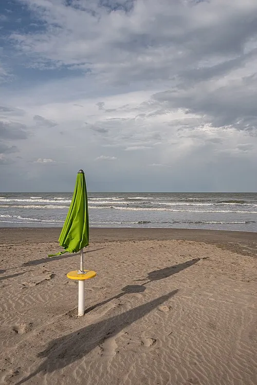 Spiaggia Milano Marittima Beach, Cervia20 km SE
-
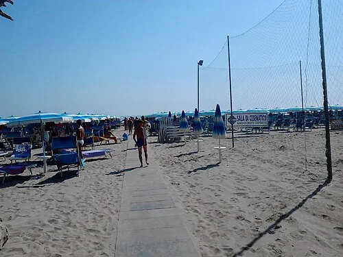 Spiaggia Pinarella Beach, Cervia24 km SE
-
Spiaggia Cervia Beach, Cervia21 km SE
Sources & licences
Data last updated: