Gualtieri
Located in Province of Reggio Emilia, Emilia-Romagna Coordinates: 44°53′56″ N 10°37′49″ E
- Population
- 6,507
- 6.5K
- Elevation
- 23 m
- above sea level
- Local time
- UTC+01:00
- Europe/Rome · UTC+01:00
- Places inside
- 10
- listed under Gualtieri
- Airports
- PMF Parma Airport28 km
- VRN Verona Villafranca Valerio Catullo Airport59 km
About Gualtieri
Gualtieri is a municipality. Location: Province of Reggio Emilia, Emilia-Romagna. Population: 6,507. Elevation: 23 m. The best months to visit are May, September. The nearest airport is Parma Airport (28 km). Nearby sights include Stadio Sergio Lanfranchi and Stadio Sandro Cabassi.
Climate of Gualtieri
Best months for sightseeingBest months for sightseeing: May, September.
This month · November
A cold month
Day 11° · Night 4° · Rain 68 mm
- Hottest month
- July (day 30°)
- Coldest month
- January (night -1°)
- Wettest month
- October (84 mm)
- Driest month
- July (38 mm)
Bars: average monthly low and high temperature. Below: precipitation. Monthly averages for 1970–2000 at about 18 km resolution, adjusted for elevation. Highlighted months are mild and relatively dry. Source: WorldClim 2.1 (CC BY 4.0).
Show values as a table
| Month | Jan | Feb | Mar | Apr | May | Jun | Jul | Aug | Sep | Oct | Nov | Dec |
|---|---|---|---|---|---|---|---|---|---|---|---|---|
| Average high (°C) | 5° | 9° | 14° | 18° | 23° | 27° | 30° | 30° | 25° | 18° | 11° | 6° |
| Average low (°C) | -1° | 0° | 3° | 7° | 11° | 15° | 18° | 18° | 14° | 9° | 4° | 0° |
| Precipitation (mm) | 51 | 41 | 51 | 59 | 60 | 56 | 38 | 65 | 61 | 84 | 68 | 52 |
How to get to Gualtieri
The nearest airport is Parma Airport (PMF), 28 km to the west as the crow flies. For international flights: Verona Villafranca Valerio Catullo Airport (VRN) (59 km). The nearest large city is Innsbruck, 269 km to the north.
Airports
- Parma Airport (PMF) Parma (PR) 28 kmwest
- Verona Villafranca Valerio Catullo Airport (VRN) Caselle (VR) 59 kmnorth
- Brescia Gabriele d'Annunzio Airport (VBS) Montichiari (BS) 63 kmnorth
Nearby large cities
- Innsbruck Population: 132.5K 269 kmnorth
- Nice Population: 342.7K 300 kmsouthwest
- Rijeka Population: 108K 304 kmeast
- Zurich Population: 415.4K 318 kmnorthwest
- Winterthur Population: 111.8K 325 kmnorthwest
Straight-line distances; road distances are longer. Airport data: OurAirports.
Day trips from Gualtieri
Within 100 km: 39 historic and cultural sites, 217 natural sites, 1 lake, river or coast.
0–25 km5 places
- Correggio Beach Beach 20 kmSE
- Valle del Po Natural site 15 kmNW
- Stadio Mirabello Landmark 23 kmS
- Stadio Sandro Cabassi Landmark 24 kmSE
25–60 km14 places
- Monte Santa Giulia Mountain 56 kmS
- Monte Rocchetta Mountain 54 kmN
- Monte Rosso Mountain 55 kmN
- Monte San Martino Mountain 59 kmS
60–100 km238 places
- Monte Vigese Mountain 86 kmSE
- Alpe di Succiso Mountain 72 kmSW
- Monte Maddalena Mountain 77 kmN
- Monti Lessini Mountain 99 kmNE
Straight-line distances.
Places in Gualtieri
10 places- 1 Gualtieri 3.5K
- 2 Santa Vittoria 2K
- 3 Pieve Saliceto 721
- 4 Bigliardi 47
- 5 Marinona 42
- 6 Livello 40
- 7 Bigliana 27
- 8 Vecchia 26
- 9 Canossa 22
- 10 Soliani 19
Bar: population relative to the most populous place in this list.
Nearby attractions & nature
Everything nearby-
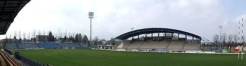 Stadio Sergio Lanfranchi Landmark, Parma25 km W
-
Stadio Sandro Cabassi Landmark, Carpi24 km SE
-
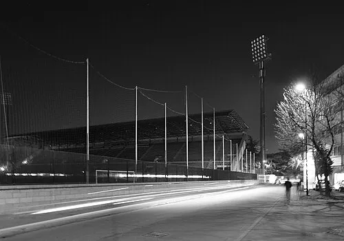 Stadio Mirabello Landmark, Reggio nell'Emilia23 km S
-
Valle del Po Natural site, Lombardy15 km NW
-
Correggio Beach Beach, Correggio20 km SE
Sources & licences
Data last updated: