Attimis
Located in Province of Udine, Friuli Venezia Giulia Coordinates: 46°11′22″ N 13°18′26″ E
- Population
- 1,721
- 1.7K
- Elevation
- 198 m
- above sea level
- Local time
- UTC+01:00
- Europe/Rome · UTC+01:00
- Places inside
- 15
- listed under Attimis
- Airports
- TRS Trieste Airport42 km
- LJU Ljubljana Jože Pučnik Airport89 km
About Attimis
Attimis is a municipality. Location: Province of Udine, Friuli Venezia Giulia. Population: 1,721. Elevation: 198 m. The best months to visit are May–June, September. The nearest airport is Trieste Airport (42 km). Nearby sights include Monte Carnizza and Monte Cladis.
Climate of Attimis
Best months for sightseeingBest months for sightseeing: May–June, September.
This month · November
A wet month
Day 11° · Night 4° · Rain 196 mm
- Hottest month
- July (day 28°)
- Coldest month
- January (night -1°)
- Wettest month
- October (219 mm)
- Driest month
- February (86 mm)
Bars: average monthly low and high temperature. Below: precipitation. Monthly averages for 1970–2000 at about 18 km resolution, adjusted for elevation. Highlighted months are mild and relatively dry. Source: WorldClim 2.1 (CC BY 4.0).
Show values as a table
| Month | Jan | Feb | Mar | Apr | May | Jun | Jul | Aug | Sep | Oct | Nov | Dec |
|---|---|---|---|---|---|---|---|---|---|---|---|---|
| Average high (°C) | 7° | 9° | 13° | 16° | 21° | 25° | 28° | 28° | 23° | 18° | 11° | 8° |
| Average low (°C) | -1° | 0° | 3° | 7° | 11° | 15° | 17° | 17° | 13° | 9° | 4° | 0° |
| Precipitation (mm) | 121 | 86 | 131 | 176 | 181 | 187 | 152 | 143 | 181 | 219 | 196 | 150 |
How to get to Attimis
The nearest airport is Trieste Airport (TRS), 42 km to the south as the crow flies. The nearest large city is Klagenfurt, 91 km to the northeast.
Airports
- Trieste Airport (TRS) Ronchi dei Legionari/Trieste 42 kmsouth
- Ljubljana Jože Pučnik Airport (LJU) Zgornji Brnik 89 kmeast
- Klagenfurt Airport (KLU) Klagenfurt am Wörthersee 94 kmnortheast
Nearby large cities
- Klagenfurt Population: 100.3K 91 kmnortheast
- Ljubljana Population: 272.2K 94 kmeast
- Rijeka Population: 108K 130 kmsoutheast
- Salzburg Population: 157.2K 180 kmnorth
- Innsbruck Population: 132.5K 189 kmnorthwest
Straight-line distances; road distances are longer. Airport data: OurAirports.
Day trips from Attimis
Within 100 km: 98 historic and cultural sites, 1,281 natural sites, 276 lakes, rivers and coasts.
0–25 km44 places
- Prestreljenik Mountain 23 kmNE
- Matajur Mountain 18 kmE
- Skutnik Mountain 18 kmNE
- Monte Mia Mountain 14 kmE
25–60 km301 places
- Lake Bohinj Lake 44 kmE
- Triglav Mountain 46 kmNE
- Rjavina Mountain 50 kmNE
- Porezen Mountain 52 kmE
60–100 km1,310 places
- Raša River 61 kmSE
- Lake Bled Lake 64 kmE
- Markovec Mountain 78 kmSE
- Šmarna gora Mountain 90 kmE
Straight-line distances.
Places in Attimis
15 places- 1 Attimis 1K
- 2 Racchiuso 385
- 3 Subit 101
- 4 Faris 69
- 5 Salandri 48
- 6 Porzus 36
- 7 Piccoli 28
- 8 Cancellier 25
- 9 Poiana di Sotto 19
- 10 Bombardier 15
- 11 Zona Industriale di Attimis 15
- 12 Molinars 13
- 13 Pecol 13
Bar: population relative to the most populous place in this list.
Mountains & nature2
- Iauer · Mountain
- Monte San Giacomo · Mountain
Nearby attractions & nature
Everything nearby-
Monte Carnizza Mountain, Faedis5.4 km E
-
Monte Cladis Mountain, Taipana5.6 km N
-
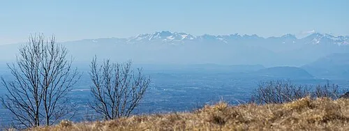 Monte Ioànaz Mountain, Torreano8.5 km E
-
Monte Spich Mountain, Faedis7.9 km E
-
Monte Caludranza Mountain, Torreano8 km E
-
Monte Piccat Mountain, Faedis8.3 km SE
-
Monte Forcis Mountain, Torreano10 km SE
-
Monte Lubia Mountain, Pulfero11 km E
Sources & licences
Data last updated: