- Population
- 74,660
- 74.7K
- Elevation
- 74 m
- above sea level
- Local time
- UTC+01:00
- Europe/Rome · UTC+01:00
- Places inside
- 34
- listed under Aprilia
- Airports
- CIA Ciampino–G. B. Pastine International Airport24 km
- FCO Rome–Fiumicino Leonardo da Vinci International Airport41 km
About Aprilia
Aprilia is a municipality. Location: Province of Latina, Lazio. Population: 74,660. Elevation: 74 m. The best months to visit are May–June, October. The nearest airport is Ciampino–G. B. Pastine International Airport (24 km). Nearby sights include Forte Sangallo and Monte Due Torri.
Climate of Aprilia
Best months for sightseeingBest months for sightseeing: May–June, October.
This month · November
A wet month
Day 17° · Night 8° · Rain 125 mm
- Hottest month
- August (day 30°)
- Coldest month
- January (night 4°)
- Wettest month
- November (125 mm)
- Driest month
- July (16 mm)
Bars: average monthly low and high temperature. Below: precipitation. Monthly averages for 1970–2000 at about 18 km resolution, adjusted for elevation. Highlighted months are mild and relatively dry. Source: WorldClim 2.1 (CC BY 4.0).
Show values as a table
| Month | Jan | Feb | Mar | Apr | May | Jun | Jul | Aug | Sep | Oct | Nov | Dec |
|---|---|---|---|---|---|---|---|---|---|---|---|---|
| Average high (°C) | 13° | 13° | 15° | 18° | 22° | 26° | 29° | 30° | 26° | 22° | 17° | 13° |
| Average low (°C) | 4° | 5° | 6° | 9° | 12° | 16° | 19° | 19° | 16° | 13° | 8° | 6° |
| Precipitation (mm) | 91 | 83 | 74 | 69 | 43 | 27 | 16 | 35 | 77 | 108 | 125 | 107 |
How to get to Aprilia
The nearest airport is Ciampino–G. B. Pastine International Airport (CIA), 24 km to the north as the crow flies. The nearest large city is Split, 377 km to the northeast.
Airports
- Ciampino–G. B. Pastine International Airport (CIA) Rome 24 kmnorth
- Rome–Fiumicino Leonardo da Vinci International Airport (FCO) Rome 41 kmnorthwest
- Abruzzo Airport (PSR) Pescara 158 kmnortheast
Nearby large cities
- Split Population: 149.8K 377 kmnortheast
Straight-line distances; road distances are longer. Airport data: OurAirports.
Day trips from Aprilia
Within 100 km: 97 historic and cultural sites, 147 natural sites, 46 lakes, rivers and coasts.
0–25 km25 places
- Spiaggia di Rio Torto Beach 14 kmW
- Spiaggia Torvaianica Beach 17 kmW
- Spiaggia Marina di Ardea Beach 11 kmW
- Zion Beach Beach 20 kmW
25–60 km112 places
- La Bussola Beach 54 kmSE
- Lido di Latino Beach 27 kmSE
- Spiaggia Saporetti Beach 50 kmSE
- Spiaggia Lilanda Beach 47 kmSE
60–100 km153 places
- Valle Cerrese Natural site 84 kmN
- Sombrero Beach 61 kmSE
- Spiaggia delle Bambole Beach 79 kmSE
- Spiaggia Dell'Agave Beach 85 kmSE
Straight-line distances.
Places in Aprilia
34 places- 1 Aprilia 75K
- 2 Genio Civile 4.3K
- 3 Campo di Carne 3.8K
- 4 Fossignano 3.7K
- 5 Casalazzara 1.5K
- 6 Campoleone 1.3K
- 7 Camilleri-Vallelata 1.1K
- 8 Campoverde 809
- 9 Apriliana 514
- 10 Pantanelle 448
- 11 Pozzo dell'Inferno 347
- 12 Lampione 322
- 13 Pontoni 290
- 14 Vallelata Nord 286
- 15 Riserva Nuova 267
- 16 Campo del Fico-Sele 213
- 17 Buon Riposo 184
- 18 Sassi Rossi 151
- 19 Apriliana Sud 146
- 20 Vallelata Centrale 140
- 21 Rutuli 136
- 22 Tre Colli 131
- 23 Giannottola 92
- 24 Torre del Padiglione 90
- 25 Torre Bruna 87
- 26 Cossira 78
- 27 Colli del Sole 77
- 28 Tufetto 74
- 29 Due Case 72
- 30 Carano 42
- 31 Colle Oliva 35
- 32 Il Rimessone 32
- 33 Giglio 30
- 34 Orfanotrofio 3
Bar: population relative to the most populous place in this list.
Nearby attractions & nature
Everything nearby-
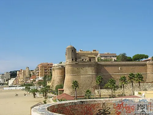 Forte Sangallo Historic site, Nettuno15 km S
-
Monte Due Torri Mountain, Genzano di Roma13 km N
-
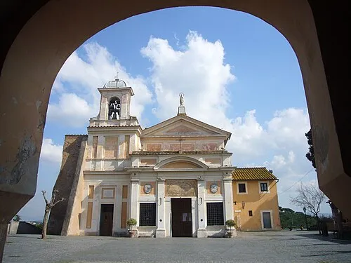 Santuario della Madonna del Divino Amore Attraction, Municipio Roma IX23 km NW
-
 Stadio Pio XII Landmark, Albano Laziale16 km N
-
Spiaggia Lavinio Beach, Italy11 km SW
-
Spiaggia Marina di Ardea Beach, Ardea11 km W
-
Maschio dell'Artemisio Mountain, Velletri16 km NE
-
 Stadio Domenico Francioni Landmark, Latina25 km SE
Sources & licences
Data last updated: