- Population
- 45,800
- 45.8K
- Elevation
- 6 m
- above sea level
- Local time
- UTC+01:00
- Europe/Rome · UTC+01:00
- Places inside
- 37
- listed under Terracina
- Airports
- CIA Ciampino–G. B. Pastine International Airport77 km
- FCO Rome–Fiumicino Leonardo da Vinci International Airport99 km
About Terracina
Terracina is a municipality. Location: Province of Latina, Lazio. Population: 45,800. Elevation: 6 m. The best months to visit are May–June, October. The nearest airport is Ciampino–G. B. Pastine International Airport (77 km). Nearby sights include Spiaggia di Porto Badino and Monte Circeo.
Climate of Terracina
Best months for sightseeingBest months for sightseeing: May–June, October.
This month · November
A wet month
Day 17° · Night 9° · Rain 145 mm
- Hottest month
- August (day 31°)
- Coldest month
- January (night 5°)
- Wettest month
- November (145 mm)
- Driest month
- July (21 mm)
Bars: average monthly low and high temperature. Below: precipitation. Monthly averages for 1970–2000 at about 18 km resolution, adjusted for elevation. Highlighted months are mild and relatively dry. Source: WorldClim 2.1 (CC BY 4.0).
Show values as a table
| Month | Jan | Feb | Mar | Apr | May | Jun | Jul | Aug | Sep | Oct | Nov | Dec |
|---|---|---|---|---|---|---|---|---|---|---|---|---|
| Average high (°C) | 13° | 13° | 16° | 18° | 23° | 27° | 30° | 31° | 27° | 22° | 17° | 13° |
| Average low (°C) | 5° | 5° | 7° | 9° | 13° | 17° | 19° | 20° | 17° | 13° | 9° | 6° |
| Precipitation (mm) | 95 | 91 | 78 | 77 | 47 | 24 | 21 | 42 | 82 | 118 | 145 | 127 |
How to get to Terracina
The nearest airport is Ciampino–G. B. Pastine International Airport (CIA), 77 km to the northwest as the crow flies. The nearest large city is Split, 362 km to the northeast.
Airports
- Ciampino–G. B. Pastine International Airport (CIA) Rome 77 kmnorthwest
- Rome–Fiumicino Leonardo da Vinci International Airport (FCO) Rome 99 kmnorthwest
- Naples International Airport (NAP) Napoli 100 kmsoutheast
Nearby large cities
- Split Population: 149.8K 362 kmnortheast
Straight-line distances; road distances are longer. Airport data: OurAirports.
Day trips from Terracina
Within 100 km: 129 historic and cultural sites, 145 natural sites, 54 lakes, rivers and coasts.
0–25 km18 places
- Sombrero Beach 2 kmE
- La Bussola Beach 11 kmSW
- Spiaggia delle Bambole Beach 22 kmE
- Spiaggia Saporetti Beach 16 kmW
25–60 km77 places
- Spiaggia Dell'Agave Beach 28 kmE
- Ultima spiaggia Beach 28 kmE
- Spiaggia dei Sassolini Beach 40 kmE
- Cala Nave Beach 57 kmS
60–100 km233 places
- S.L.O Rodolfo beach Beach 70 kmSE
- Lido di Liccola Beach 82 kmSE
- Marina di Varcaturo Beach 80 kmSE
- Spiaggia Miliscola Beach 90 kmSE
Straight-line distances.
Places in Terracina
37 places- 1 Terracina 31K
- 2 Borgo Hermada 3K
- 3 La Fiora 818
- 4 San Silviano 334
- 5 San Benedetto 313
- 6 Piazza Palatina 248
- 7 Colle la Guardia I 208
- 8 San Vito 187
- 9 Migliara 56 III 157
- 10 Casaletti 149
- 11 Strada delle Risaie 146
- 12 Lungo Sisto II 141
- 13 Machiarella 104
- 14 Circondariale 101
- 15 Pontina I 101
- 16 Guardiola II 95
- 17 Pontina 90
- 18 Gavotti 82
- 19 La Casina 82
- 20 Strada dei Confini 82
- 21 Ponte Maggiore 80
- 22 Guardiola III 77
- 23 Pontalto 75
- 24 Lungo Sisto I 74
- 25 Campolungo 72
- 26 Macchia di Piano II 71
- 27 Macchia di Piano I 68
- 28 Migliara 56 II 62
- 29 Campo Soriano 61
- 30 Cimitero 54
- 31 Migliara 57 49
- 32 Migliara 56 I 42
- 33 Guardiola I 37
- 34 Pietra Porci 35
Bar: population relative to the most populous place in this list.
Mountains & nature2
- Monte Giusto · Mountain
- Punta della Cucca · Mountain
Lakes, rivers & coasts1
- Sombrero · Beach
Nearby attractions & nature
Everything nearby-
Spiaggia di Porto Badino Beach, Italy1.9 km W
-
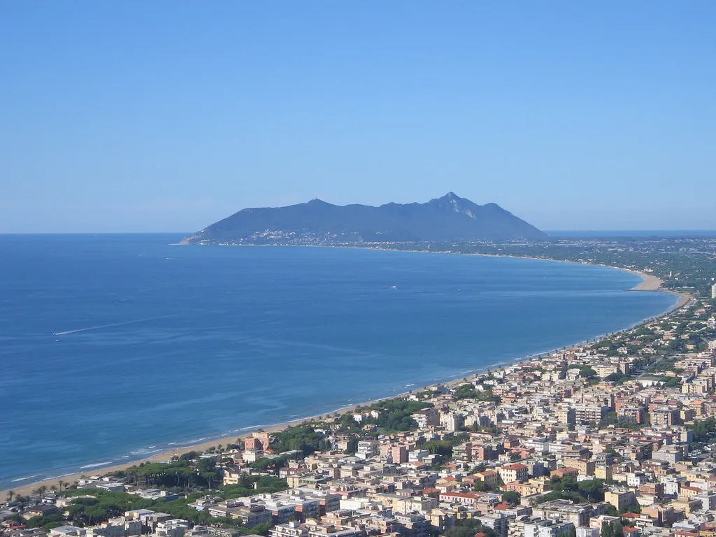 Monte Circeo Mountain, San Felice Circeo15 km SW
-
La Bussola Beach, Italy11 km SW
-
Monte Sparago Mountain, Sonnino15 km N
-
Valle Cereto Natural site, Lazio15 km N
-
Monte Alto Mountain, Prossedi20 km N
-
Spiaggia Saporetti Beach, Sabaudia16 km W
-
Monte Moneta Mountain, Itri24 km E
Sources & licences
Data last updated: