Carpasio
Located in Montalto Carpasio, Province of Imperia Coordinates: 43°57′37″ N 7°51′59″ E

- Population
- 135
- 135
- Elevation
- 720 m
- above sea level
- Local time
- UTC+01:00
- Europe/Rome · UTC+01:00
- Airports
- NCE Nice-Côte d'Azur Airport62 km
- CUF Cuneo International Airport68 km
About Carpasio
Carpasio is a village. Location: Montalto Carpasio, Province of Imperia. Population: 135. Elevation: 720 m.
Carpasio (Ligurian: Carpaxe) is a former comune (municipality) in the Province of Imperia in the Italian region Liguria, located about 100 kilometres (62 mi) southwest of Genoa and about 15 kilometres (9 mi) northwest of Imperia. As of 31 December 2004, it had a population of 180 and an area of 16.1 square kilometres (6.2 mi2). At the beginning of 2018 Caprasio was unified with Montalto Ligure in the new comune of Montalto Carpasio.
Source: Wikipedia · CC BY-SA 4.0
At a glance
- Area
- 16 km²
Source: Wikidata
Photos of Carpasio
-

Moleskine · CC BY 4.0 -

villlamania · CC BY 3.0 -

Davide Papalini · CC BY-SA 3.0 -

Davide Papalini · CC BY-SA 3.0 -
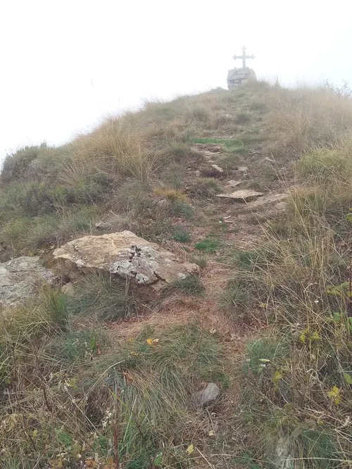
Carmo di Brocchi Pampuco · CC BY-SA 4.0


Climate of Carpasio
Best months for sightseeingBest months for sightseeing: June–August.
This month · November
A wet month
Day 11° · Night 6° · Rain 101 mm
- Hottest month
- August (day 24°)
- Coldest month
- January (night 2°)
- Wettest month
- October (117 mm)
- Driest month
- July (20 mm)
Bars: average monthly low and high temperature. Below: precipitation. Monthly averages for 1970–2000 at about 18 km resolution, adjusted for elevation. Highlighted months are mild and relatively dry. Source: WorldClim 2.1 (CC BY 4.0).
Show values as a table
| Month | Jan | Feb | Mar | Apr | May | Jun | Jul | Aug | Sep | Oct | Nov | Dec |
|---|---|---|---|---|---|---|---|---|---|---|---|---|
| Average high (°C) | 8° | 9° | 11° | 13° | 17° | 20° | 24° | 24° | 20° | 16° | 11° | 9° |
| Average low (°C) | 2° | 2° | 4° | 7° | 11° | 14° | 17° | 17° | 14° | 10° | 6° | 3° |
| Precipitation (mm) | 67 | 63 | 67 | 80 | 62 | 45 | 20 | 39 | 79 | 117 | 101 | 77 |
How to get to Carpasio
The nearest airport is Nice-Côte d'Azur Airport (NCE), 62 km to the southwest as the crow flies. The nearest large city is Nice, 56 km to the southwest.
Airports
- Nice-Côte d'Azur Airport (NCE) Nice, Alpes-Maritimes 62 kmsouthwest
- Cuneo International Airport (CUF) Levaldigi (CN) 68 kmnorth
- Genoa Cristoforo Colombo Airport (GOA) Genova (GE) 93 kmnortheast
Nearby large cities
- Nice Population: 342.7K 56 kmsouthwest
- Toulon Population: 168.7K 182 kmsouthwest
- Aix-en-Provence Population: 146.8K 200 kmwest
- Marseille Population: 877.2K 214 kmwest
- Grenoble Population: 158.6K 218 kmnorthwest
Straight-line distances; road distances are longer. Airport data: OurAirports.
Day trips from Carpasio
Within 100 km: 93 historic and cultural sites, 511 natural sites, 91 lakes, rivers and coasts.
0–25 km48 places
- Monte lega Mountain 16 kmW
- Cime de Campbel Mountain 23 kmW
- Mont Agu Mountain 25 kmW
- Monte Rotondo Mountain 24 kmN
25–60 km298 places
- Plage de Buse Beach 40 kmSW
- Plage Petite Afrique Beach 51 kmSW
- Plage des Fourmis Beach 52 kmSW
- Neptune Plage Beach 57 kmSW
60–100 km349 places
- Siagne River 88 kmSW
- Plage de Galets Beach 67 kmSW
- Plage de la Raguette Beach 89 kmSW
- Île Saint-Honorat Island 83 kmSW
Straight-line distances.
Nearby attractions & nature
Everything nearby-
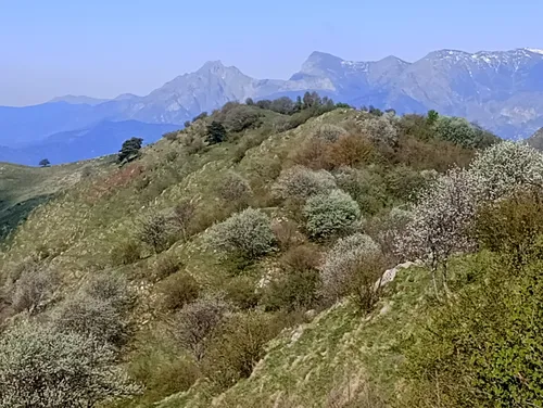 Monte Carpasina Mountain, Montalto Carpasio3 km N
-
Monte Moro Mountain, Prelà2.3 km SE
-
Monte Grande Mountain, Montalto Carpasio2.9 km N
-
Monte Fenáira Mountain, Molini di Triora4 km NW
-
Carmo di Brocchi Mountain, Rezzo6.7 km NW
-
Monte Faudo Mountain, Taggia5.8 km S
Sources & licences
Data last updated: · 2 independent sources