- Population
- 29
- 29
- Elevation
- 71 m
- above sea level
- Local time
- UTC+01:00
- Europe/Rome · UTC+01:00
- Airports
- VRN Verona Villafranca Valerio Catullo Airport20 km
- VBS Brescia Gabriele d'Annunzio Airport24 km
About Fossa Lojera
Fossa Lojera is a village. Location: Sirmione, Province of Brescia. Population: 29. Elevation: 71 m. The best months to visit are May–June, September. The nearest airport is Verona Villafranca Valerio Catullo Airport (20 km). Nearby sights include Monte Pizzocolo and Monte Castello di Gaino.
Climate of Fossa Lojera
Best months for sightseeingBest months for sightseeing: May–June, September.
This month · November
A cold month
Day 11° · Night 4° · Rain 62 mm
- Hottest month
- July (day 29°)
- Coldest month
- January (night -1°)
- Wettest month
- October (96 mm)
- Driest month
- February (39 mm)
Bars: average monthly low and high temperature. Below: precipitation. Monthly averages for 1970–2000 at about 18 km resolution, adjusted for elevation. Highlighted months are mild and relatively dry. Source: WorldClim 2.1 (CC BY 4.0).
Show values as a table
| Month | Jan | Feb | Mar | Apr | May | Jun | Jul | Aug | Sep | Oct | Nov | Dec |
|---|---|---|---|---|---|---|---|---|---|---|---|---|
| Average high (°C) | 6° | 8° | 13° | 17° | 22° | 26° | 29° | 28° | 24° | 18° | 11° | 6° |
| Average low (°C) | -1° | 0° | 4° | 7° | 12° | 16° | 18° | 18° | 14° | 9° | 4° | 0° |
| Precipitation (mm) | 56 | 39 | 51 | 61 | 75 | 76 | 64 | 77 | 75 | 96 | 62 | 54 |
How to get to Fossa Lojera
The nearest airport is Verona Villafranca Valerio Catullo Airport (VRN), 20 km to the east as the crow flies. The nearest large city is Innsbruck, 209 km to the north.
Airports
- Verona Villafranca Valerio Catullo Airport (VRN) Caselle (VR) 20 kmeast
- Brescia Gabriele d'Annunzio Airport (VBS) Montichiari (BS) 24 kmwest
- Parma Airport (PMF) Parma (PR) 75 kmsouth
Nearby large cities
- Innsbruck Population: 132.5K 209 kmnorth
- Zurich Population: 415.4K 267 kmnorthwest
- Winterthur Population: 111.8K 272 kmnorthwest
- Bern Population: 121.6K 297 kmnorthwest
- Rijeka Population: 108K 298 kmeast
Straight-line distances; road distances are longer. Airport data: OurAirports.
Day trips from Fossa Lojera
Within 100 km: 57 historic and cultural sites, 747 natural sites, 3 lakes, rivers and coasts.
0–25 km7 places
- Monte Pizzocolo Mountain 25 kmN
- Monte Rocchetta Mountain 19 kmSW
- Monte Nuvolo Mountain 12 kmW
- Monte Rosso Mountain 13 kmSW
25–60 km231 places
- Dosso Rotondo Mountain 46 kmNE
- Monte Bronzone Mountain 58 kmNW
- Lora Mountain 55 kmNE
- Selvata Mountain 50 kmNE
60–100 km569 places
- Spadalone Mountain 77 kmN
- Lagh dal Mat Lake 98 kmNW
- Lagh da la Regina Lake 97 kmNW
- Vetta Salarsa Mountain 96 kmNW
Straight-line distances.
Nearby attractions & nature
Everything nearby-
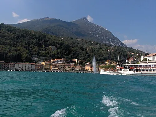 Monte Pizzocolo Mountain, Toscolano-Maderno25 km N
-
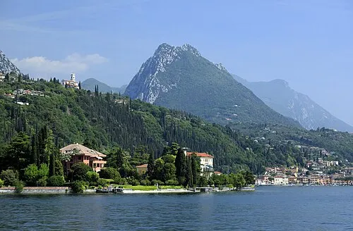 Monte Castello di Gaino Mountain, Toscolano-Maderno24 km N
-
Monte Nuvolo Mountain, Veneto12 km W
-
Monte Rosso Mountain, Veneto13 km SW
-
Monte Tre Cornelli Mountain, Gavardo24 km NW
-
Selvapiana Mountain, Villanuova sul Clisi24 km NW
Sources & licences
Data last updated: · 2 independent sources