- Population
- 548,722
- 548.7K
- Elevation
- 61 m
- above sea level
- Local time
- UTC+01:00
- Europe/Rome · UTC+01:00
- Places inside
- 185
- listed under Province of Pavia
- Airports
- LIN Milano Linate Airport38 km
- MXP Milan Malpensa International Airport65 km
About Province of Pavia
Province of Pavia is a district. Location: Lombardy, Italy. Population: 548,722. The best months to visit are May–June, September. The nearest airport is Milano Linate Airport (38 km).
Photos of Province of Pavia
-
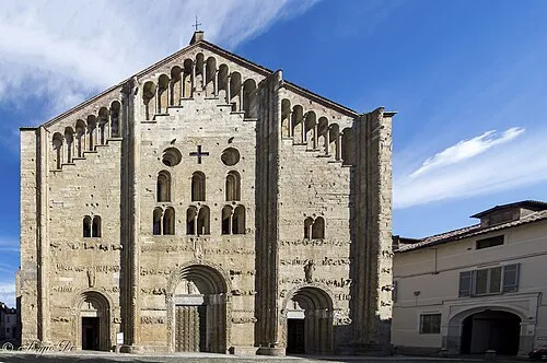
San Michele Maggiore Sergio Di · CC BY-SA 4.0 -
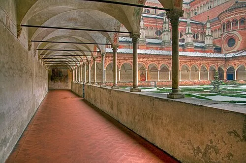
Certosa di Pavia Roberto Ferrari · CC BY-SA 2.0 -
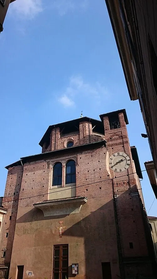
Santa Maria di Canepanova Treehill · CC BY-SA 4.0 -
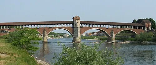
Ponte Coperto Luigi Chiesa · CC BY-SA 3.0


Climate of Province of Pavia
Best months for sightseeingBest months for sightseeing: May–June, September.
This month · November
A cold month
Day 10° · Night 3° · Rain 71 mm
- Hottest month
- July (day 29°)
- Coldest month
- January (night -2°)
- Wettest month
- October (103 mm)
- Driest month
- July (36 mm)
Bars: average monthly low and high temperature. Below: precipitation. Monthly averages for 1970–2000 at about 18 km resolution, adjusted for elevation. Highlighted months are mild and relatively dry. Source: WorldClim 2.1 (CC BY 4.0).
Show values as a table
| Month | Jan | Feb | Mar | Apr | May | Jun | Jul | Aug | Sep | Oct | Nov | Dec |
|---|---|---|---|---|---|---|---|---|---|---|---|---|
| Average high (°C) | 5° | 8° | 14° | 17° | 22° | 26° | 29° | 28° | 24° | 17° | 10° | 6° |
| Average low (°C) | -2° | -1° | 3° | 7° | 11° | 15° | 17° | 17° | 14° | 9° | 3° | -1° |
| Precipitation (mm) | 57 | 41 | 55 | 64 | 68 | 56 | 36 | 61 | 69 | 103 | 71 | 52 |
How to get to Province of Pavia
The nearest airport is Milano Linate Airport (LIN), 38 km to the north as the crow flies. The nearest large city is Nice, 216 km to the southwest.
Airports
- Milano Linate Airport (LIN) Segrate (MI) 38 kmnorth
- Milan Malpensa International Airport (MXP) Ferno (VA) 65 kmnorthwest
- Il Caravaggio International Airport (BGY) Orio al Serio (BG) 76 kmnortheast
Nearby large cities
- Nice Population: 342.7K 216 kmsouthwest
- Bern Population: 121.6K 242 kmnorthwest
- Lausanne Population: 139.1K 249 kmnorthwest
- Zurich Population: 415.4K 254 kmnorth
- Geneva Population: 201.7K 262 kmnorthwest
Straight-line distances; road distances are longer. Airport data: OurAirports.
Day trips from Province of Pavia
Within 100 km: 75 historic and cultural sites, 227 natural sites, 24 lakes, rivers and coasts.
0–25 km6 places
- Fiume Ticino River 9 kmNE
- San Pietro in Ciel d'Oro Attraction 8 kmN
- San Michele Maggiore Attraction 8 kmN
- Certosa di Pavia Attraction 16 kmN
25–60 km65 places
- Monte Penice Mountain 40 kmS
- Monte Lesima Mountain 50 kmS
- Monte Carmo Mountain 56 kmS
- Monte Aserei Mountain 53 kmSE
60–100 km255 places
- Rotteri Mountain 63 kmS
- Laghetto di Muzzano Lake 99 kmN
- Lake Lugano Lake 98 kmN
- San Salvatore Mountain 97 kmN
Straight-line distances.
Places in Province of Pavia
185 places- 61 Zerbolò 1.8K
- 62 Bascapè 1.7K
- 63 Magherno 1.7K
- 64 Zeccone 1.7K
- 65 Pinarolo Po 1.7K
- 66 Copiano 1.7K
- 67 Marzano 1.7K
- 68 Montù Beccaria 1.6K
- 69 Torrazza Coste 1.6K
- 70 Santa Giuletta 1.6K
- 71 Confienza 1.6K
- 72 Sartirana Lomellina 1.6K
- 73 Montebello della Battaglia 1.6K
- 74 Retorbido 1.6K
- 75 Roncaro 1.6K
- 76 Arena Po 1.6K
- 77 Candia Lomellina 1.6K
- 78 Vistarino 1.5K
- 79 Valle Salimbene 1.5K
- 80 Inverno e Monteleone 1.5K
- 81 Portalbera 1.5K
- 82 Carbonara al Ticino 1.5K
- 83 Borgo Priolo 1.5K
- 84 Gerenzago 1.4K
- 85 Canneto Pavese 1.4K
- 86 Mezzanino 1.4K
- 87 Campospinoso Albaredo 1.3K
- 88 Cigognola 1.3K
- 89 Verrua Po 1.3K
- 90 Cervesina 1.2K
- 91 Frascarolo 1.2K
- 92 Sommo 1.2K
- 93 Castello d'Agogna 1.1K
- 94 Lardirago 1.1K
- 95 Ferrera Erbognone 1.1K
- 96 Ottobiano 1.1K
- 97 Colli Verdi 1.1K
- 98 Mezzana Bigli 1.1K
- 99 Castelletto di Branduzzo 1.1K
- 100 San Giorgio di Lomellina 1.1K
- 101 Redavalle 1.1K
- 102 Corvino San Quirico 1K
- 103 Trovo 1K
- 104 Zeme 1K
- 105 Zavattarello 999
- 106 Bastida Pancarana 993
- 107 Codevilla 979
- 108 Borgo San Siro 975
- 109 Sant'Alessio con Vialone 970
- 110 Torre d'Arese 944
- 111 Scaldasole 909
- 112 Montalto Pavese 896
- 113 Rovescala 883
- 114 Casatisma 881
- 115 Pieve Albignola 860
- 116 Cornale e Bastida 848
- 117 Barbianello 847
- 118 Alagna 836
- 119 Pietra de' Giorgi 835
- 120 Torricella Verzate 833
Bar: population relative to the most populous place in this list.
Nature and heritage in Province of Pavia
Sources & licences
Data last updated: