- Population
- 7
- 7
- Elevation
- 1,437 m
- above sea level
- Local time
- UTC+01:00
- Europe/Rome · UTC+01:00
- Airports
- BGY Il Caravaggio International Airport47 km
- LUG Lugano Airport62 km
About Sant'Antonio
Sant'Antonio is a village. Location: Tartano, Province of Sondrio. Population: 7. Elevation: 1,437 m. The best months to visit are June–August. The nearest airport is Il Caravaggio International Airport (47 km). Nearby sights include Monte Moro and Monte Seleron.
Photos of Sant'Antonio
-
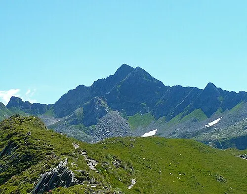
Monte Cadelle MatthewGhera · CC BY 3.0 -
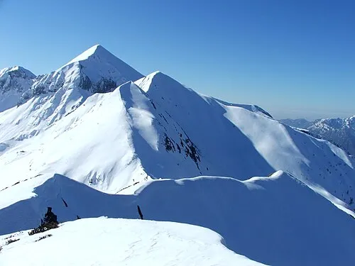
Monte Cavallo Orobicon, uploaded by Giorces · CC BY 2.5


Climate of Sant'Antonio
Best months for sightseeingBest months for sightseeing: June–August.
This month · November
A cold month
Day 5° · Night -4° · Rain 63 mm
- Hottest month
- July (day 19°)
- Coldest month
- January (night -8°)
- Wettest month
- June (97 mm)
- Driest month
- February (32 mm)
Bars: average monthly low and high temperature. Below: precipitation. Monthly averages for 1970–2000 at about 18 km resolution, adjusted for elevation. Highlighted months are mild and relatively dry. Source: WorldClim 2.1 (CC BY 4.0).
Show values as a table
| Month | Jan | Feb | Mar | Apr | May | Jun | Jul | Aug | Sep | Oct | Nov | Dec |
|---|---|---|---|---|---|---|---|---|---|---|---|---|
| Average high (°C) | 1° | 2° | 5° | 8° | 13° | 16° | 19° | 19° | 15° | 11° | 5° | 2° |
| Average low (°C) | -8° | -8° | -4° | -1° | 4° | 7° | 9° | 9° | 6° | 2° | -4° | -7° |
| Precipitation (mm) | 47 | 32 | 48 | 68 | 93 | 97 | 88 | 96 | 97 | 92 | 63 | 44 |
How to get to Sant'Antonio
The nearest airport is Il Caravaggio International Airport (BGY), 47 km to the south as the crow flies. The nearest large city is Zurich, 167 km to the northwest.
Airports
- Il Caravaggio International Airport (BGY) Orio al Serio (BG) 47 kmsouth
- Lugano Airport (LUG) Agno 62 kmwest
- Milano Linate Airport (LIN) Segrate (MI) 79 kmsouthwest
Nearby large cities
- Zurich Population: 415.4K 167 kmnorthwest
- Winterthur Population: 111.8K 174 kmnorthwest
- Innsbruck Population: 132.5K 183 kmnortheast
- Bern Population: 121.6K 198 kmnorthwest
- Basel Population: 177.6K 231 kmnorthwest
Straight-line distances; road distances are longer. Airport data: OurAirports.
Day trips from Sant'Antonio
Within 100 km: 97 historic and cultural sites, 3,830 natural sites, 471 lakes, rivers and coasts.
0–25 km122 places
- Pizzo Cengalo Mountain 24 kmN
- Sciora Dadent Mountain 24 kmN
- Ago di Sciora Mountain 24 kmN
- Punta Pioda Mountain 24 kmN
25–60 km1,285 places
- Chaviolas Island 37 kmN
- Lajets Lake 46 kmN
- Silvaplanersee Lake 41 kmN
- Lake Sils Lake 37 kmN
60–100 km2,991 places
- Spadalone Mountain 78 kmE
- Lago Nero Lake 99 kmNW
- Isole di Brissago Island 75 kmW
- Sant' Apollinare Island 75 kmW
Straight-line distances.
Nearby attractions & nature
Everything nearby-
Monte Moro Mountain, Tartano2.2 km SW
-
Monte Seleron Mountain, Fusine1.9 km NE
-
Pizzo Scala Mountain, Tartano2.5 km S
-
Cima di Lemma Mountain, Tartano3.1 km S
-
Monte Cadelle Mountain, Foppolo4.2 km SE
-
Monte Valegino Mountain, Foppolo4.1 km SE
Sources & licences
Data last updated: