- Population
- 7
- 7
- Elevation
- 1,199 m
- above sea level
- Local time
- UTC+01:00
- Europe/Rome · UTC+01:00
- Airports
- TRN Turin Airport68 km
- CUF Cuneo International Airport82 km
About Amazas
Amazas is a village. Location: Oulx, Province of Turin. Population: 7. Elevation: 1,199 m. The best months to visit are July–August. The nearest airport is Turin Airport (68 km). Nearby sights include Mont Fraitève and Punta di Chalanche Ronde.
Photos of Amazas
-
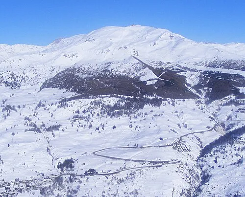
Mont Fraitève F Ceragioli · CC BY-SA 3.0

Climate of Amazas
Best months for sightseeingBest months for sightseeing: July–August.
This month · November
A wet month
Day 8° · Night 2° · Rain 138 mm
- Hottest month
- August (day 23°)
- Coldest month
- February (night -2°)
- Wettest month
- November (138 mm)
- Driest month
- July (68 mm)
Bars: average monthly low and high temperature. Below: precipitation. Monthly averages for 1970–2000 at about 18 km resolution, adjusted for elevation. Highlighted months are mild and relatively dry. Source: WorldClim 2.1 (CC BY 4.0).
Show values as a table
| Month | Jan | Feb | Mar | Apr | May | Jun | Jul | Aug | Sep | Oct | Nov | Dec |
|---|---|---|---|---|---|---|---|---|---|---|---|---|
| Average high (°C) | 5° | 5° | 7° | 9° | 14° | 18° | 22° | 23° | 19° | 14° | 8° | 6° |
| Average low (°C) | -2° | -2° | 0° | 2° | 6° | 9° | 13° | 13° | 10° | 7° | 2° | 0° |
| Precipitation (mm) | 123 | 112 | 109 | 113 | 113 | 91 | 68 | 82 | 92 | 128 | 138 | 128 |
How to get to Amazas
The nearest airport is Turin Airport (TRN), 68 km to the east as the crow flies. The nearest large city is Grenoble, 89 km to the west.
Airports
- Turin Airport (TRN) Caselle Torinese (TO) 68 kmeast
- Cuneo International Airport (CUF) Levaldigi (CN) 82 kmsoutheast
- Chambéry Aix les Bains airport (CMF) Chambéry 102 kmnorthwest
Nearby large cities
- Grenoble Population: 158.6K 89 kmwest
- Geneva Population: 201.7K 143 kmnorth
- Nice Population: 342.7K 149 kmsouth
- Lausanne Population: 139.1K 168 kmnorth
- Villeurbanne Population: 131.4K 174 kmnorthwest
Straight-line distances; road distances are longer. Airport data: OurAirports.
Day trips from Amazas
Within 100 km: 85 historic and cultural sites, 1,398 natural sites, 243 lakes, rivers and coasts.
0–25 km86 places
- Grand Lac du Laus Lake 22 kmS
- Lac de Souliers Lake 23 kmS
- Lac des Sarailles Lake 15 kmSW
- Montagne du Vallon Mountain 24 kmW
25–60 km710 places
- Lac Premier Lake 53 kmS
- Lac Vert Lake 47 kmS
- Lac des Vaches Lake 43 kmN
- Lac Sainte-Anne Lake 44 kmS
60–100 km930 places
- Lac Mort Lake 81 kmW
- Lac du Gd. St. Bernard Lake 99 kmN
- Grand Golliat Mountain 97 kmN
- Tête de Fonteinte Mountain 100 kmN
Straight-line distances.
Nearby attractions & nature
Everything nearby-
Mont Fraitève Mountain, Sestriere4.8 km SE
-
Punta di Chalanche Ronde Mountain, Névache7.1 km W
-
Mont Chaberton Mountain, Montgenèvre7.7 km SW
-
Pic du Lausin Mountain, Névache9.1 km SW
-
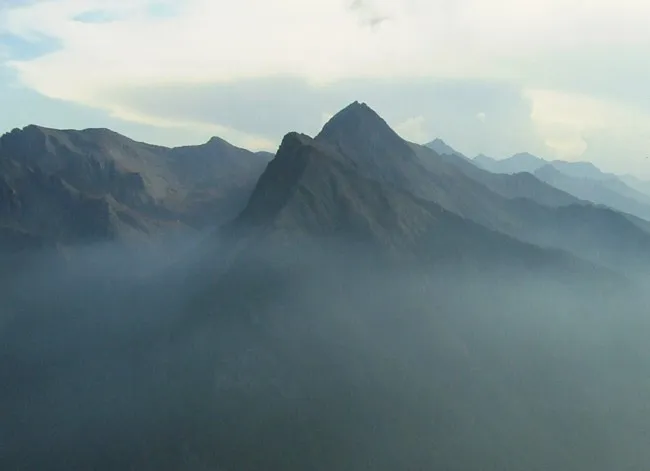 Monte Albergian Mountain, Massello13 km E
-
Rocher des Prés Mountain, Névache8.4 km W
Other cities and towns in Oulx

Sources & licences
Data last updated: · 2 independent sources