- Population
- 23
- 23
- Elevation
- 6 m
- above sea level
- Local time
- UTC+01:00
- Europe/Rome · UTC+01:00
- Airports
- CAG Cagliari Elmas Airport29 km
- AHO Alghero-Fertilia Airport192 km
About Su Guventeddu
Su Guventeddu is a village. Location: Pula, Province of Cagliari. Population: 23. Elevation: 6 m. The best months to visit are May, October. The nearest airport is Cagliari Elmas Airport (29 km). Nearby sights include Spiaggia dei Fichi and Spiaggia di Su Guventeddu.
Photos of Su Guventeddu
-
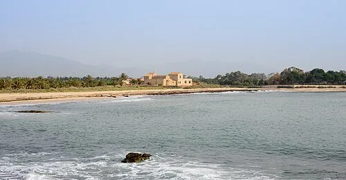
Spiaggia di Nora Norbert Nagel · CC BY-SA 3.0 -
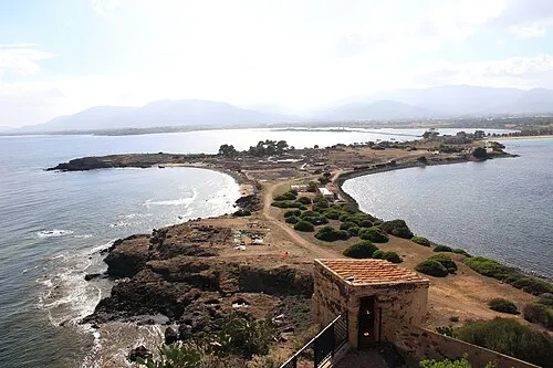
Nora Gianni Careddu · CC BY-SA 3.0


Climate of Su Guventeddu
Best months for sightseeingBest months for sightseeing: May, October.
This month · November
Outside the best season
Day 19° · Night 10° · Rain 60 mm
- Hottest month
- August (day 31°)
- Coldest month
- January (night 6°)
- Wettest month
- October (60 mm)
- Driest month
- July (4 mm)
Bars: average monthly low and high temperature. Below: precipitation. Monthly averages for 1970–2000 at about 18 km resolution, adjusted for elevation. Highlighted months are mild and relatively dry. Source: WorldClim 2.1 (CC BY 4.0).
Show values as a table
| Month | Jan | Feb | Mar | Apr | May | Jun | Jul | Aug | Sep | Oct | Nov | Dec |
|---|---|---|---|---|---|---|---|---|---|---|---|---|
| Average high (°C) | 15° | 15° | 17° | 19° | 23° | 28° | 31° | 31° | 28° | 24° | 19° | 16° |
| Average low (°C) | 6° | 6° | 7° | 9° | 13° | 16° | 19° | 20° | 17° | 14° | 10° | 7° |
| Precipitation (mm) | 52 | 59 | 44 | 42 | 25 | 11 | 4 | 8 | 38 | 60 | 60 | 54 |
How to get to Su Guventeddu
The nearest airport is Cagliari Elmas Airport (CAG), 29 km to the north as the crow flies.
Airports
- Cagliari Elmas Airport (CAG) Cagliari 29 kmnorth
- Alghero-Fertilia Airport (AHO) Alghero 192 kmnorth
- Olbia Costa Smeralda Airport (OLB) Olbia (SS) 216 kmnorth
Straight-line distances; road distances are longer. Airport data: OurAirports.
Day trips from Su Guventeddu
Within 100 km: 5 historic and cultural sites, 63 natural sites, 85 lakes, rivers and coasts.
0–25 km42 places
- Spiaggia di Tuerredda Beach 21 kmSW
- Spiaggia di Campana Dune Beach 17 kmSW
- Spiaggia del Pinus Village Beach 12 kmSW
- Spiaggia Riva dei Pini Beach 12 kmSW
25–60 km82 places
- Poetto Beach 26 kmNE
- Cape Teulada Natural site 36 kmSW
- Spiaggia di Genn'e Mari Beach 38 kmNE
- Spiaggia di Punta Molentis Beach 49 kmE
60–100 km29 places
- Spiaggia di Foxi Murdegu Beach 92 kmNE
- Spiaggia di Cala Luas Beach 100 kmNE
- Spiaggia di Cala Fico Beach 70 kmW
- Spiaggia di Isola Piana Beach 64 kmW
Straight-line distances.
Nearby attractions & nature
Everything nearby-
Spiaggia dei Fichi Beach, Pula0.1 km SE
-
Spiaggia di Su Guventeddu Beach, Pula0.2 km NE
-
Spiaggia di Nora Beach, Pula0.7 km S
-
Nora Historic site, Pula1.2 km S
-
Su Casteddu Mountain, Pula2.5 km NW
-
Monte Mereu Mountain, Villa San Pietro3.8 km N
Sources & licences
Data last updated: · 2 independent sources